Previous state
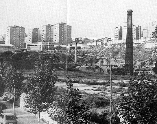
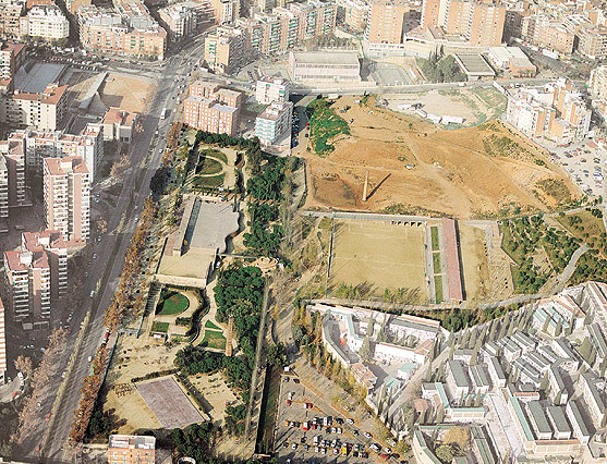
The territory of Samuntà (the mountain), on the north side of the town of L´Hospitalet, was occupied, until the mid-eighteenth century, by a number of farmhouses dotted over farmland. The growth in the population, after the nineteenth century, together with important changes in agriculture and the establishment of industries, led to a series of changes in the zone which included the building of the La Infanta canal and the railway line. The development of Samuntà took place in the twentieth century, particularly during the sixties and seventies, and the fields of Pubilla Casas, Can Serra, La Florida and Les Planes disappeared beneath the tide of blocks and estates.The site of the park is located in this part of Samuntà next to the L´Hospitalet cemetery and was previously occupied by tile factories and a chemical plant. The two chimneys, which now stand out between the pines, remind us of this recent industrial past.
Aim of the intervention
A shortage of amenities was one of the most serious consequences of land speculation and the lack of planning in the sixties. The 1976 General Metropolitan Plan tried to curb indiscriminate growth and earmarked the industrial site next to the cemetery for amenities and a green area.The creation of the park sought to homogenize the land and make it into a large green space, into a true central park which would be the "lung", the space for communication and a meeting point for the densely populated districts around it: Can Serra, Pubilla Casas, La Florida, Les Planes and Sant Josep (together they have a total of 111,113 inhabitants).
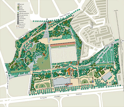
Description
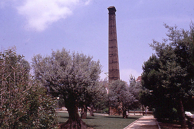
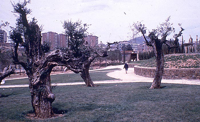
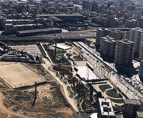
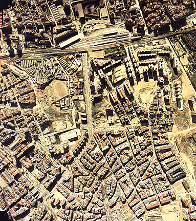
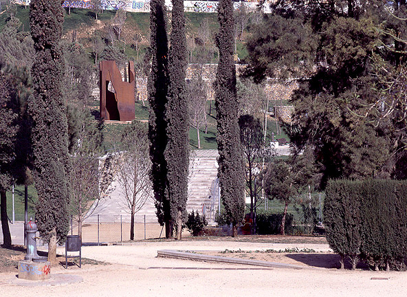
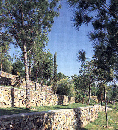
The Parc de les Planes lies on an uneven terrain on the southern edge of Samuntà. It consists of a series of hillocks separated by streams and torrents originating mainly from Sant Pere Màrtir and Collserola. The stream in the cemetery cut through the hills of Can Serra and Les Planes and ran through what is today the central walkway of the park. The park´s main boundaries are: Carrer de Sant Rafael in the north; the cemetery and railway line in the south; the cemetery, Carrer del Teide and Carrer de la Maragda in the east; and the Avinguda d´Isabel la Catòlica in the west. The main entrance to the park is located on this avenue, across the big public square which is dominated by a modern clock tower. There is an esplanade-viewing point at the end of the square. There are landscaped areas and pergolas on either side and a children´s play area on the southern side.The area between the stream in the cemetery and Carrer del Teide has the steepest slopes which go up to the Les Planes hill. The flattest area includes the La Florida football ground and an area of spaces which are more open and feature a series of unusual elements such as the old chimney, the plane tree with three branches and the modern sculpture. The park then continues to climb between small platforms populated with pines and ilexes, built in the style of the terraces once used for cultivation. A network of steps, paths and pedestrian walkways allows us to enter these spaces or go round the edge of them, until we get to the highest point in the park.
Assessment
In the middle of the dense, disorganised urban weave of its surroundings, the park has become an important green area, which not only benefits the residents of L´Hospitalet, but the population of almost 500,000 people in the metropolitan area within the subsystem of the eastern Llobregat delta. As well as being a nature reserve, the new space also fulfils other functions such as providing a recreational zone and a receptacle for a variety of uses.Albert García Espuche, architect
[Last update: 02/05/2018]