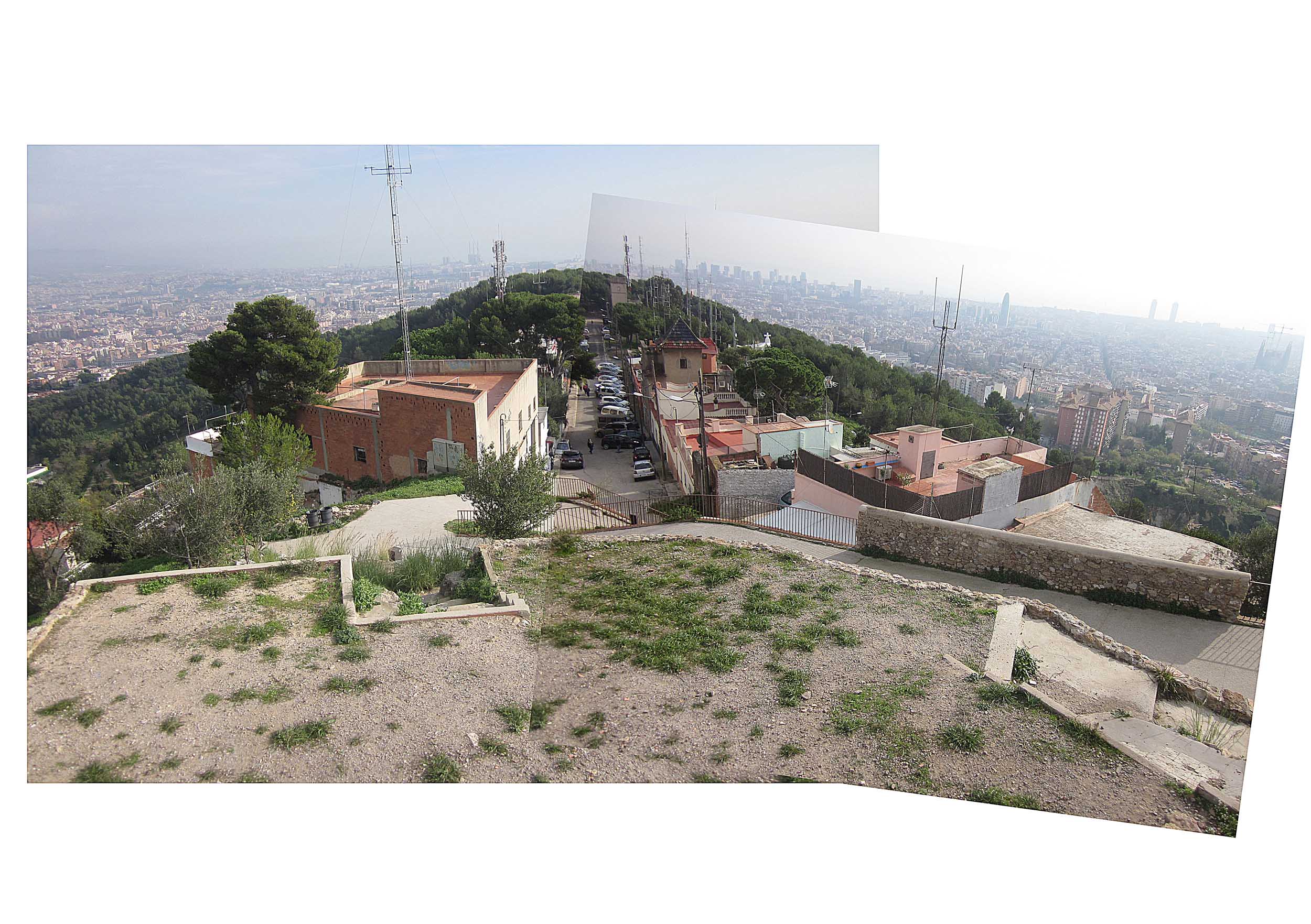
Previous state
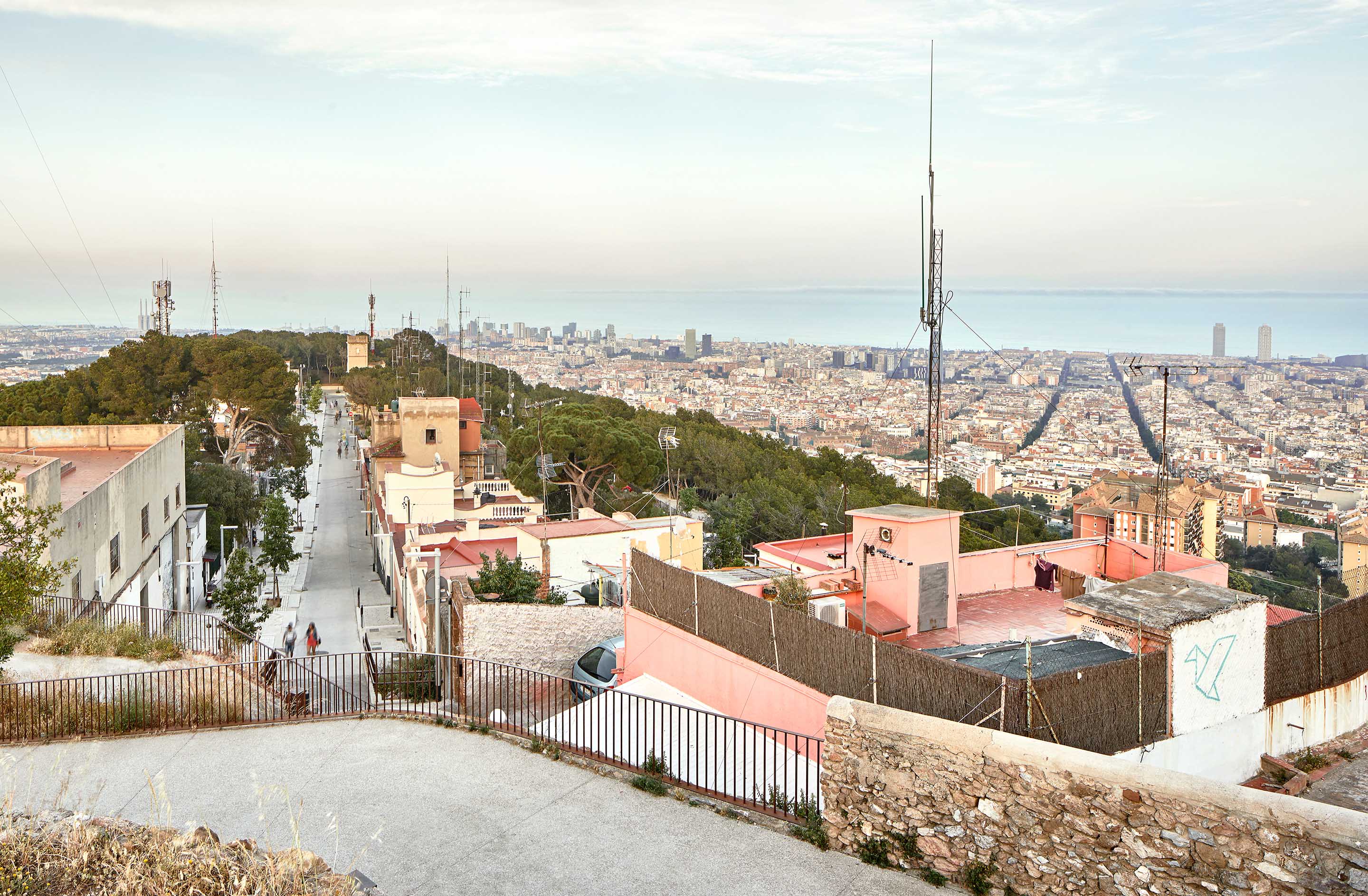
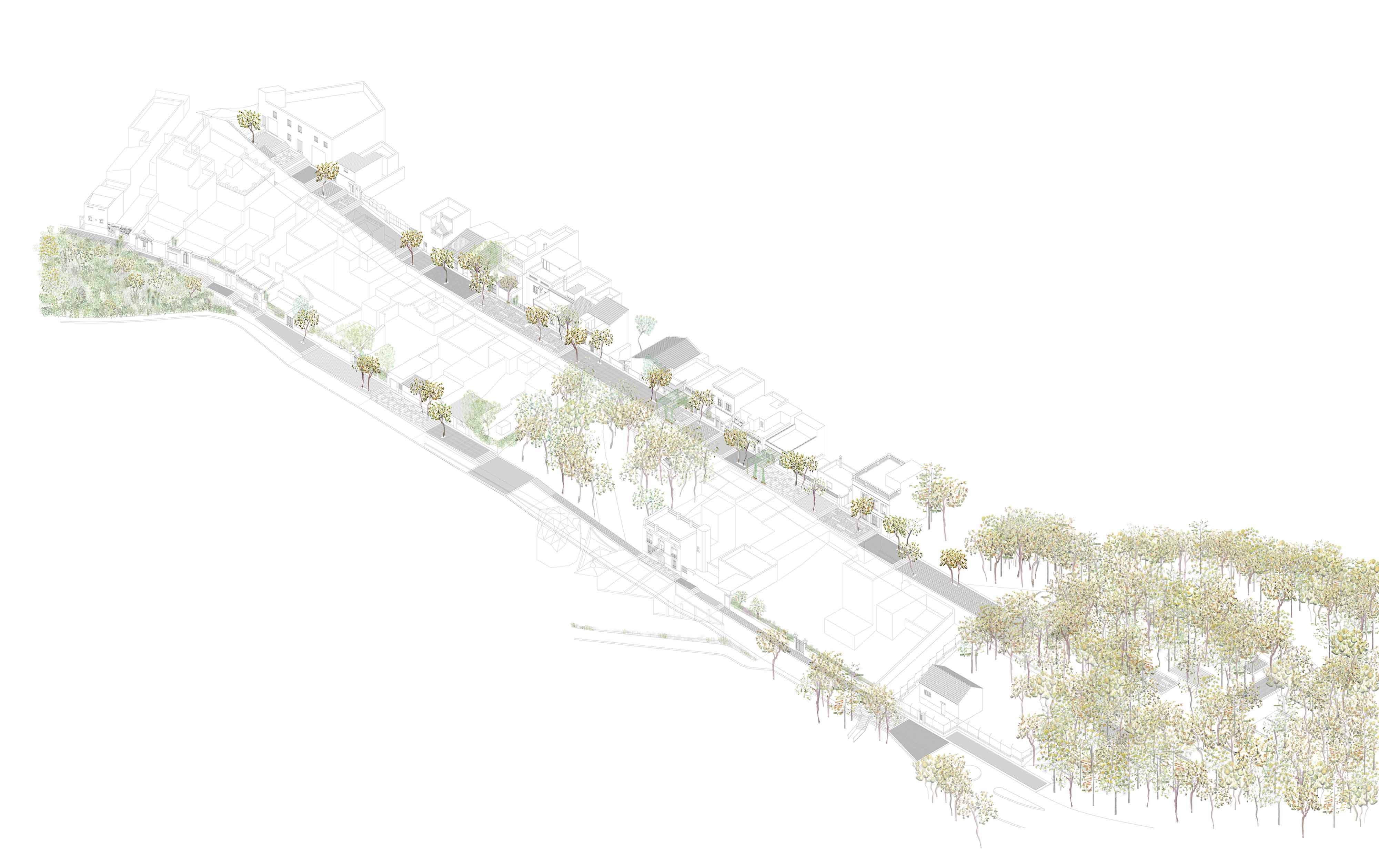
The Turó de la Rovira is one of the last of the hills of the Catalan Coastal Range before its slopes lose height and flatten out into the plain of Barcelona. It is one of the hills of the Collserola massif which, ranging from between 180 and 260 metres above sea level, rise above the built-up area to offer excellent vantage points for viewing the city. It is likely that this geographic situation favoured the first Iberian settlements in the fourth century BCE. More specifically, since the end of the nineteenth century the Turó de la Rovira, the site of this project, has seen several phases of urbanisation, starting with the installation of the city’s water supply and the construction of the first summer residences. During the Spanish Civil War anti-aircraft gun emplacements, installed on the hill because of its strategic location overlooking the city, were essential for the defence of Barcelona. In the post-war years, large numbers of immigrants came to Barcelona from other parts of Spain and many built shacks in a settlement on the Turó de la Rovira which lasted until the 1990s. It was not until 2010 that the zone was recuperated for collective use, thanks to a project—joint winner of the 2012 European Prize for Urban Public Space—which, revealing all the different layers, drew attention to the dense history of the place. However, two streets of the small settlement of Marià Lavèrnia which, at the top of the hill, give access to the site of the project were not included in the intervention. Neglected for years, these houses from different times and of different quality had no public facilities. There was no paving, or lighting, or trees, or sanitation services. Over the years, the spaces that should have been streets became open-air parking areas for cars and motorcycles.Aim of the intervention
In recent years, the municipality of Barcelona has been working to create a connection between the Turó de la Rovira and the rest of the urban fabric while also imagining new walkers’ itineraries linking the hilltop with some of the city’s most significant features like Parc Güell, Hospital de Sant Pau, and the Sagrada Família basilica. These possible routes needed an intervention to improve the access tracks and roads leading from the settlement of Marià Lavèrnia—which is inside a wooded area—to the lookout and site of the old anti-aircraft gun emplacements. The project was part of a larger “Microbarcelones” programme designed by the Urban Habitat Office of the City Hall with the idea that any fragment of the city can be recovered despite the historic difficulties entailed. The aim of the “Microbarcelones” project is to carry out urban renewal operations in areas of the urban fabric which, although they have been neglected, contribute richness and diversity to the city. In the case of the Turó de la Rovira, the aim was to change its peripheral nature while still conserving the urban-fringe character of a semirural area with a domestic feel. This meant achieving a high-quality public space for the residents by means of a plan that would combine harmonious coexistence between visitors and residents in order to achieve the dual aim of a place for people living together there and for people who are passing through.Description
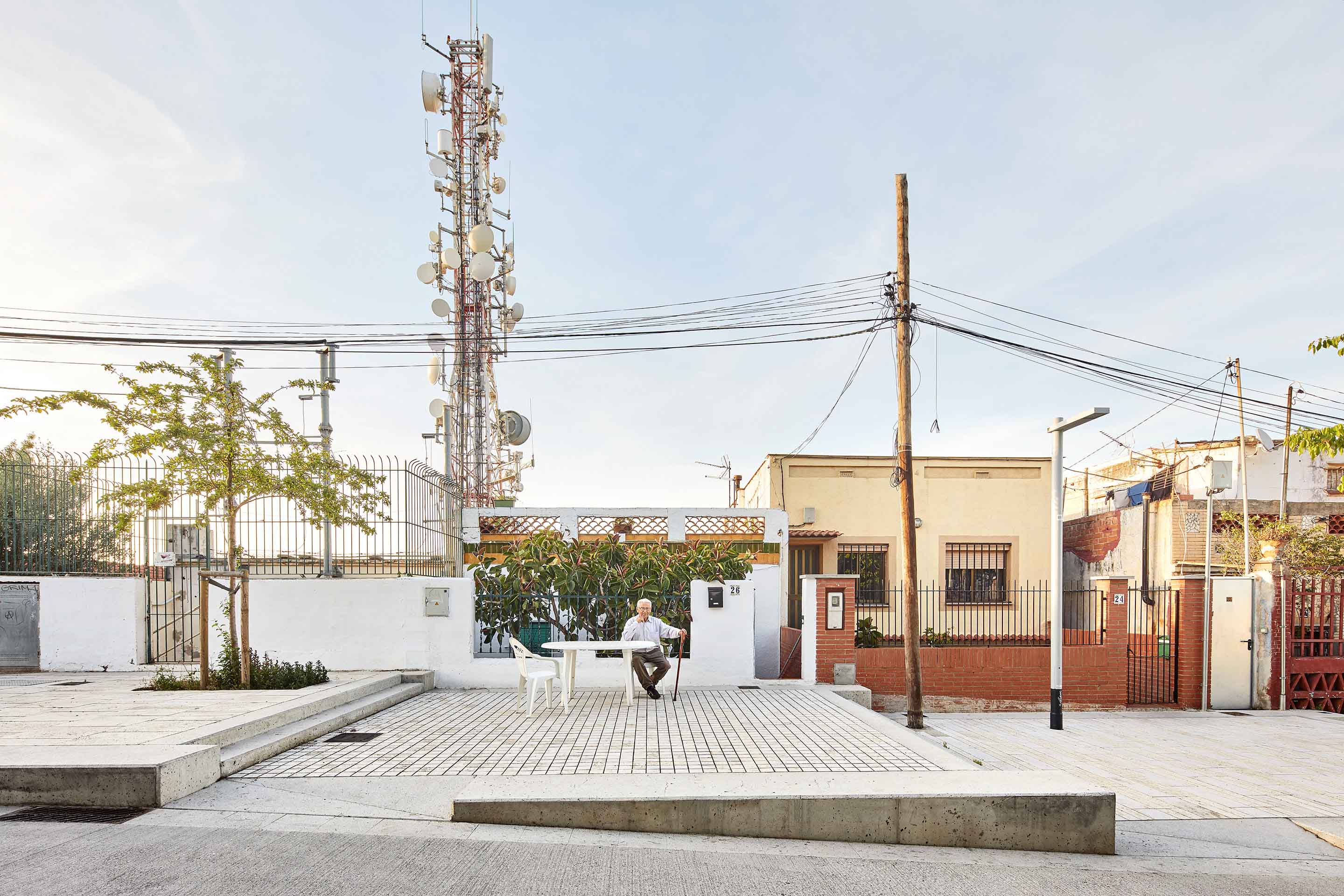
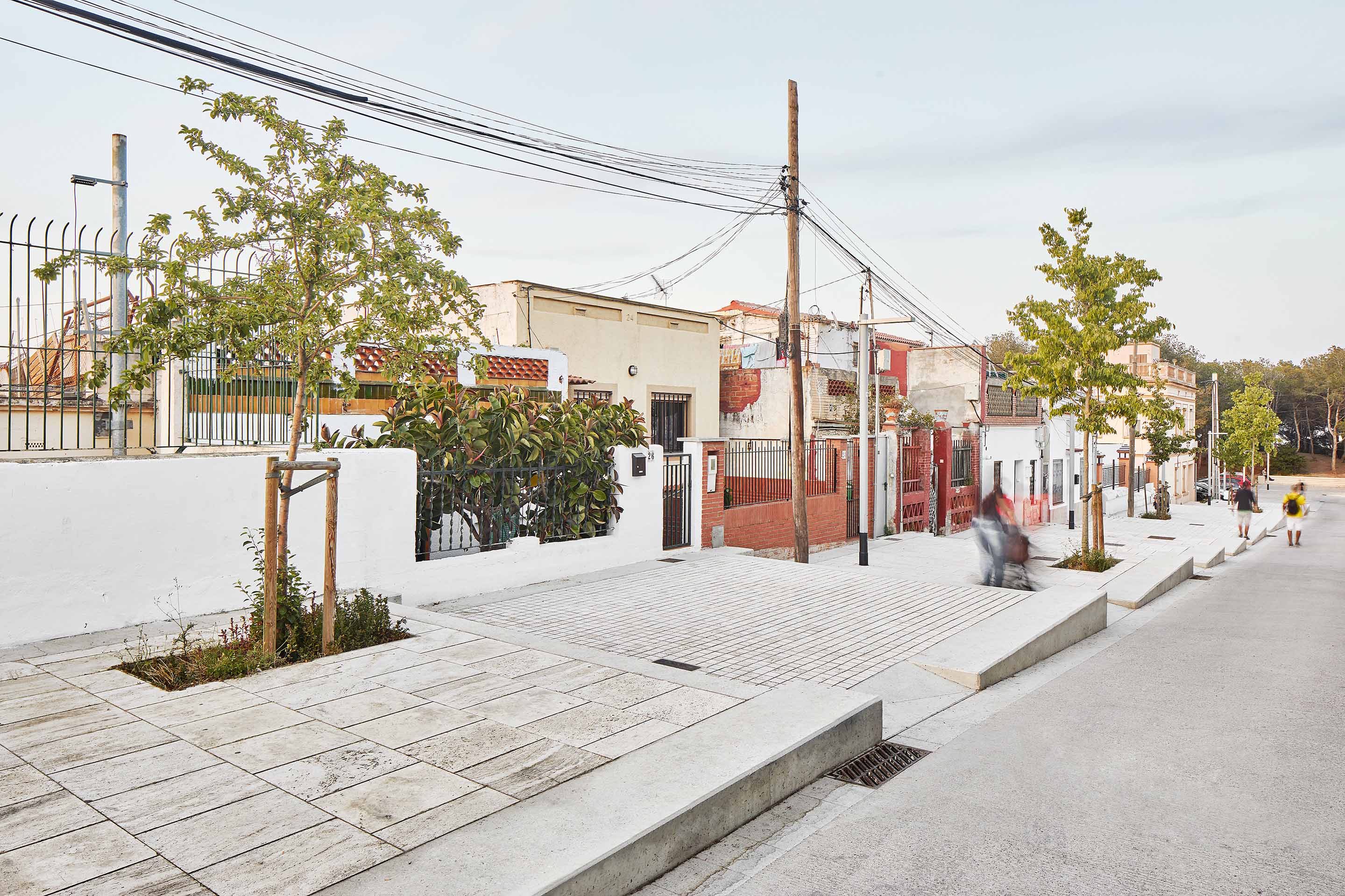
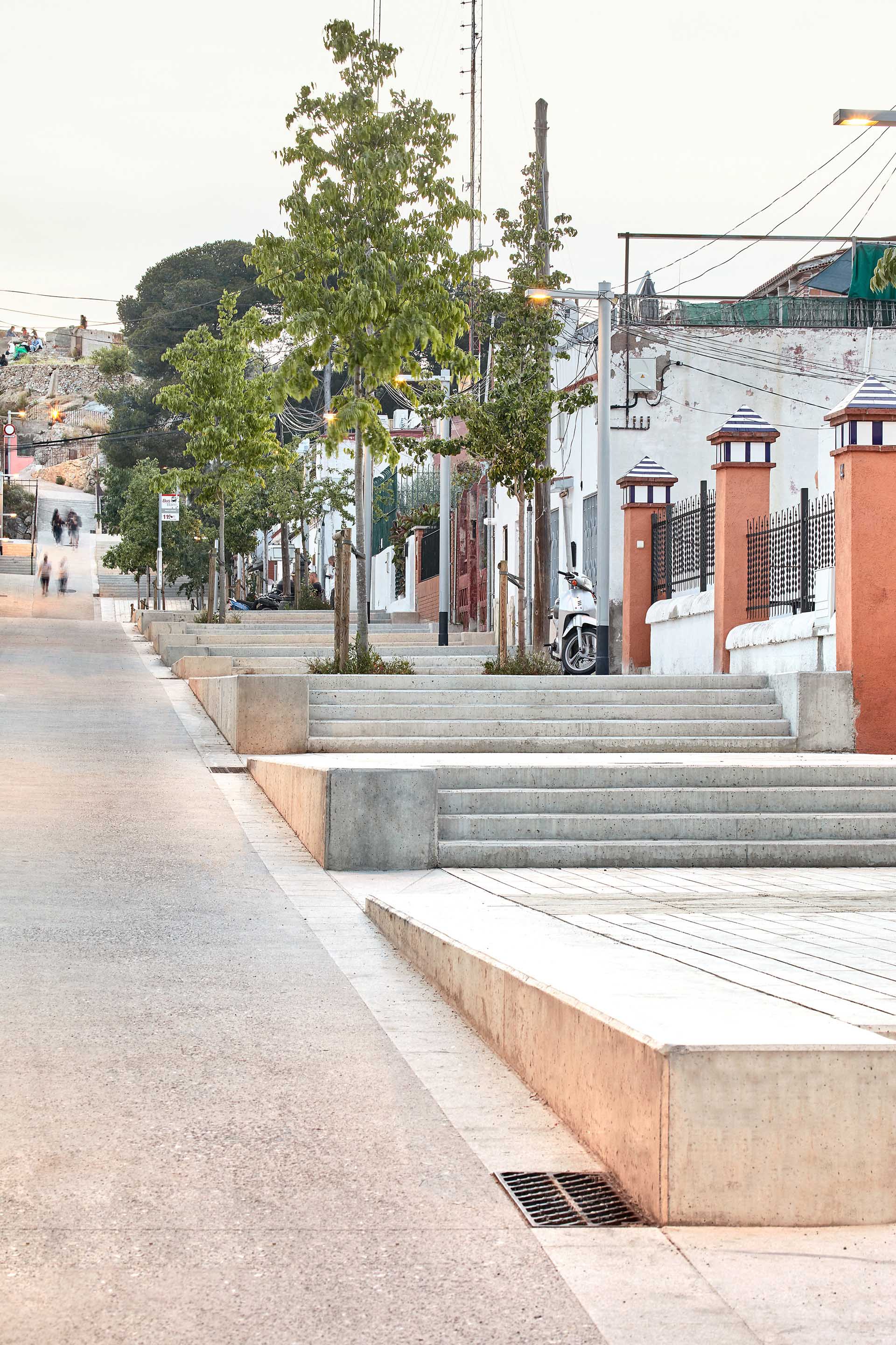
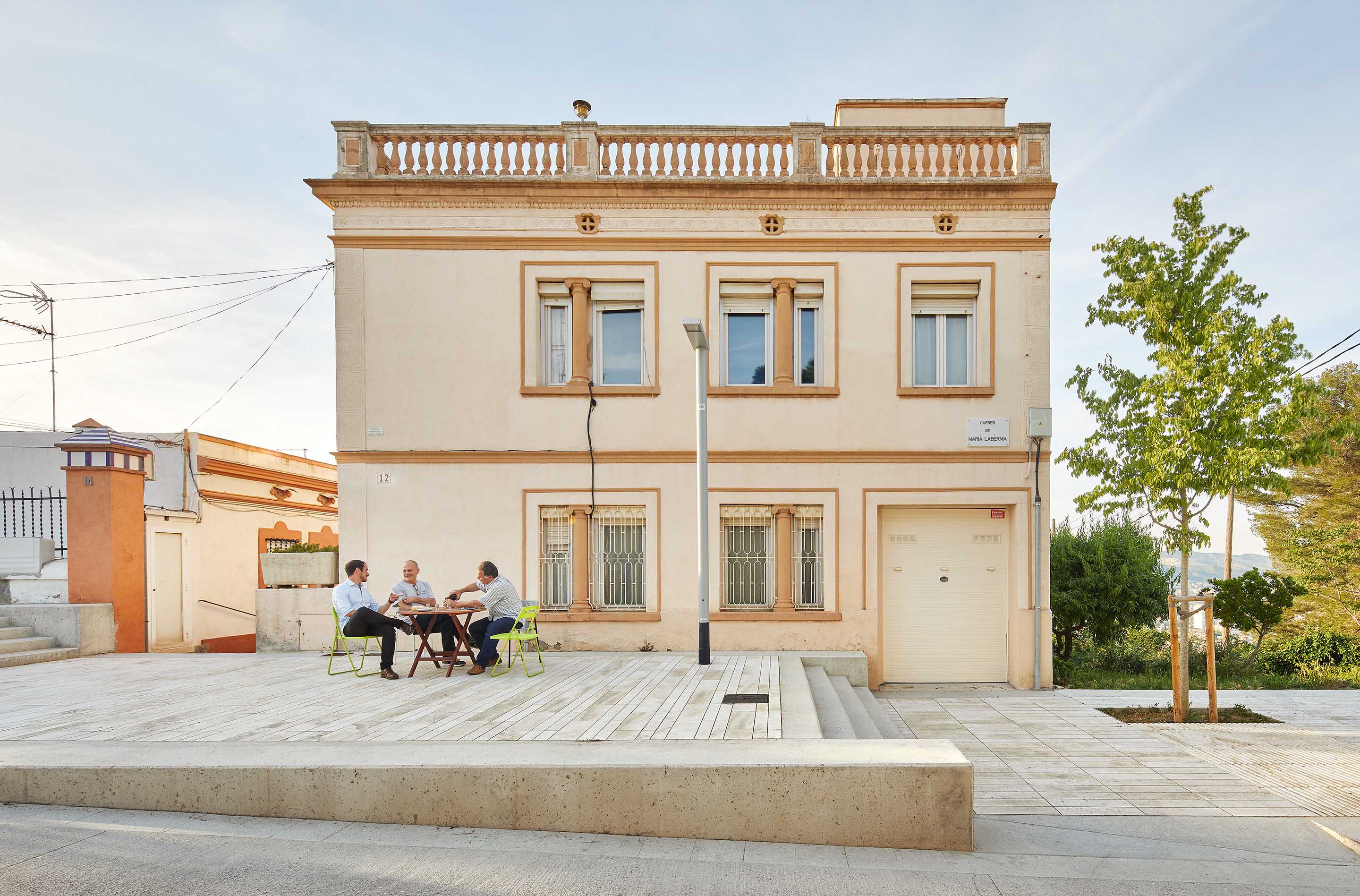
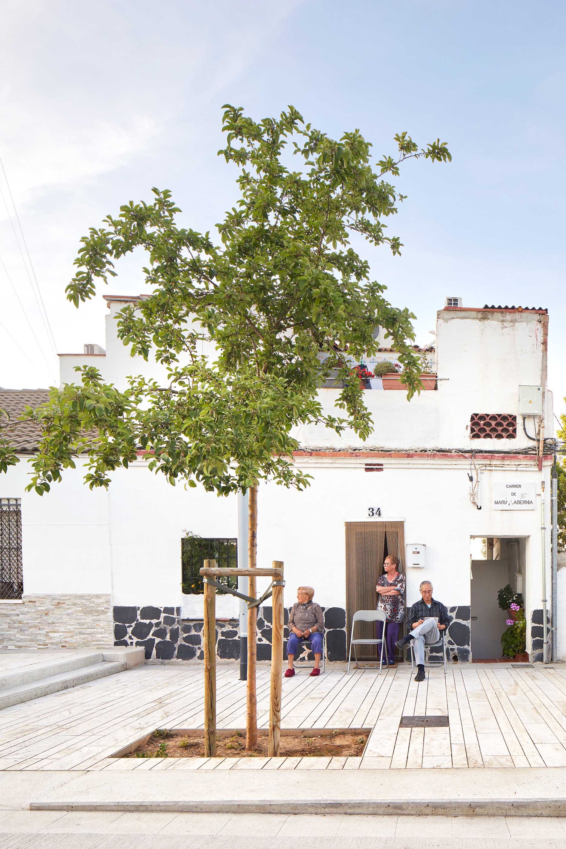
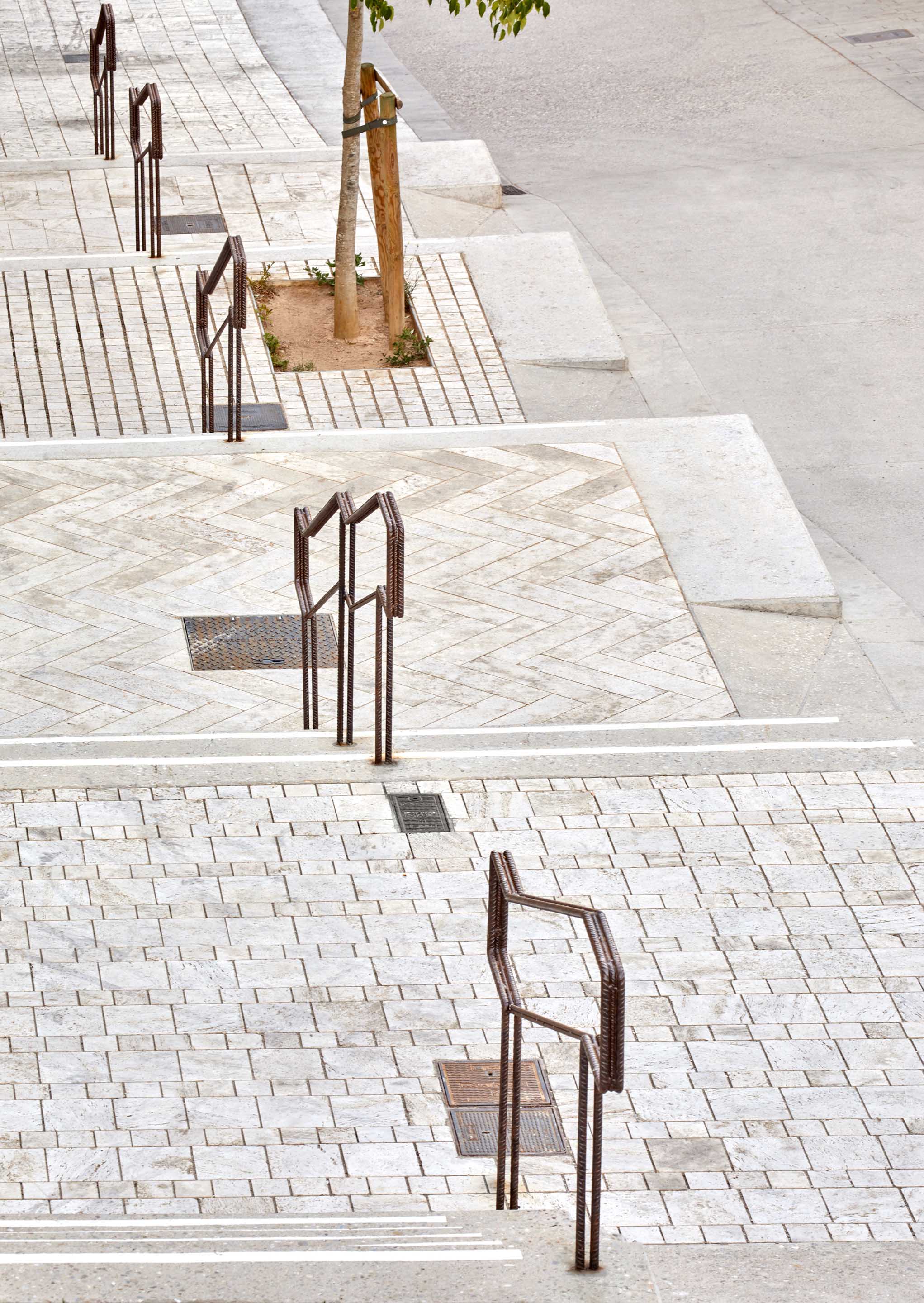
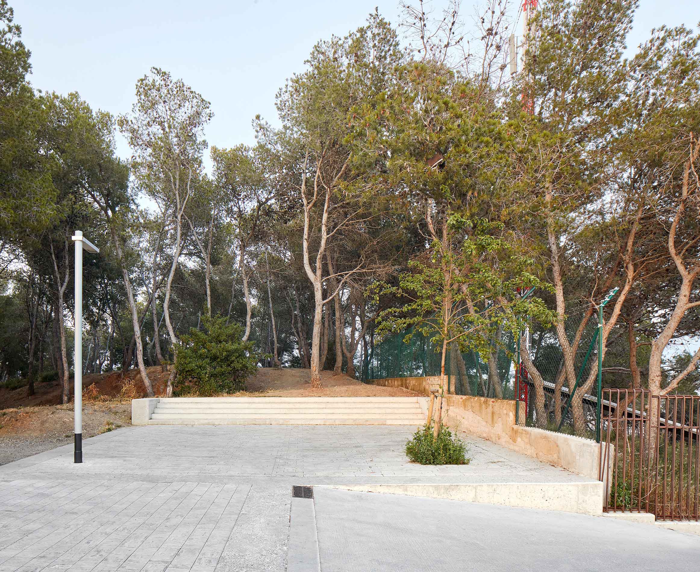
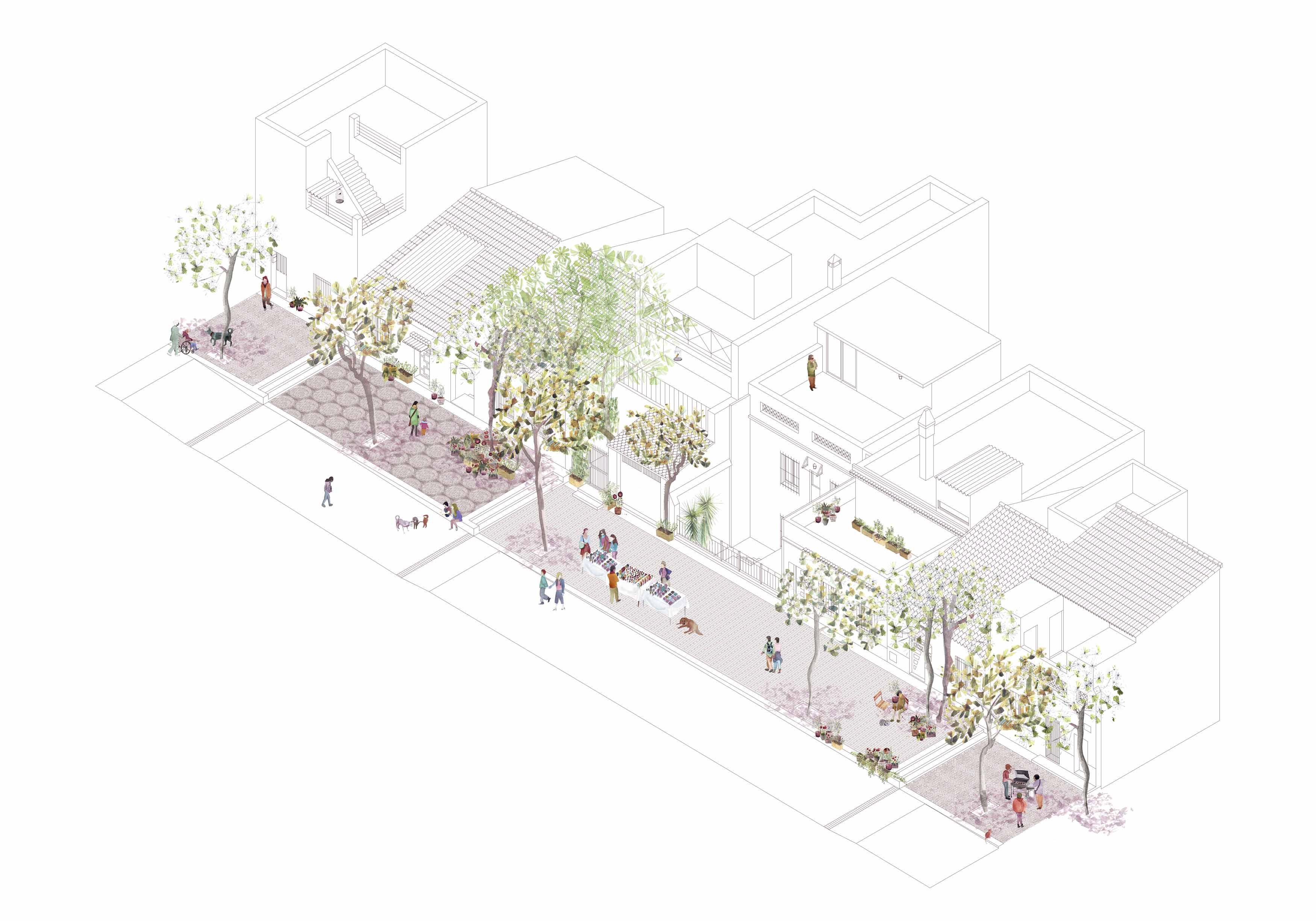
The project began by working on the topography of the site with an earth-moving operation. The need to have vehicular access was one of the objectives and this had to fit with the requirement of having small squares consisting of a series of flat areas the same width as the smallholdings and located at different levels down the slope to create a stepped series of horizontal spaces for relaxing lingering and encouraging new open-air activities. Each one of these level areas can be understood as public space on the domestic scale, a space outside the houses to be used by their inhabitants. The project thereby resolves a twofold geometrical challenge, namely giving access at the level of every entrance to the houses, and gradually adapting the natural slope of the land to the project. The roads have been covered with scraped concrete to prevent slippage of vehicles and the small squares are paved in travertine because of its pale colour and irregular texture resulting from its ecological history. Different rug-like patterns were chosen in order to highlight the fact that the place has been inhabited since ancient times. Trees and other plants will play an essential role in the coming years by giving the area the heat and light control necessary to favour outdoor life, and the new trees will help to re-establish continuity between the adjacent green spaces, the street and the peak of the Turó de la Rovira.Assessment
The project has greatly improved the street and dignified the life of the local residents after many years of neglect. Now they enjoy all the services offered by the city, including better access despite the complex topography of the hill. For the first time, they have horizontal spaces to extend the limits of their small houses and enjoy outdoor living. However, the new situation has also given rise to new problems owing to a sharp rise in the number of visitors to the Turó de la Rovira lookout, which has affected the quiet, self-contained life of the small neighbourhood. Yet, even faced with the risk of a massive influx of tourists, the project, based on the addition of the small-scale squares, helps to conserve the domestic feel of the place and allows local residents to take over the street as their own space.
In any case, the main conflict lies in the fact that, because of changes in municipal government norms, the idea of demolishing the original constructions and turning the area into a green zone has now reappeared and this would mean obliterating evidence of the settlement’s existence. Countering this threat, the project has contributed by showing that the neighbourhood could be a place where residents can enjoy a very good life.
Teresa Navas
[Last update: 27/08/2019]