
Previous state
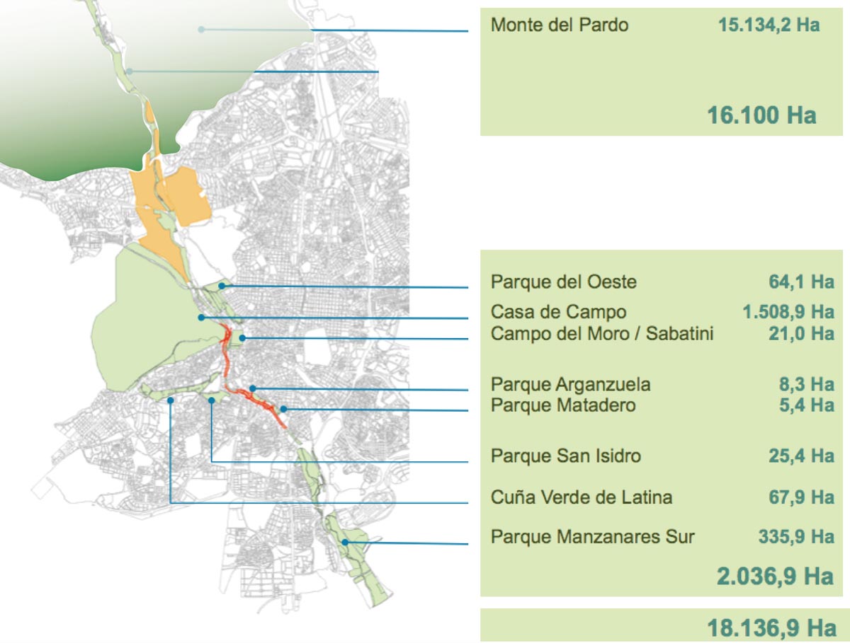
Despite its scant geographical relevance, the Manzanares River has played a determining role in the urban development of the city of Madrid, which has respected, along its bank, extensive green zones that have been left as open spaces. Immediately before penetrating the city’s urban fabric, it runs through the Monte del Pardo, a Mediterranean forest that occupies over one thousand five hundred hectares, thus constituting the city’s biggest public park today. Finally, the river leaves Madrid by way of the Parque Lineal del Manzanares, a natural reserve of more than three hundred hectares.The natural value of these green lungs became exceptional after 1926 when the urban section of the river was channelled and both banks lost their character of a bucolic rural space where the inhabitants of Madrid came to swim, fish or do their laundry. Since then, the city’s relationship with the river has been sporadic through a series of public parks on a more reduced scale. The oldest of these are the nineteenth-century gardens of the Campo del Moro, which bridge the difference in height between the Palacio Real and the river, and the Parque del Oeste which, until the beginning of the twentieth century, had been the city’s main rubbish dump.
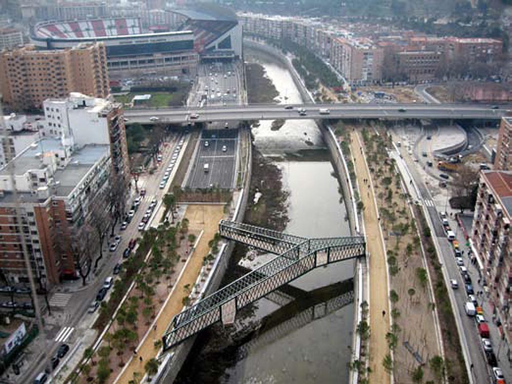
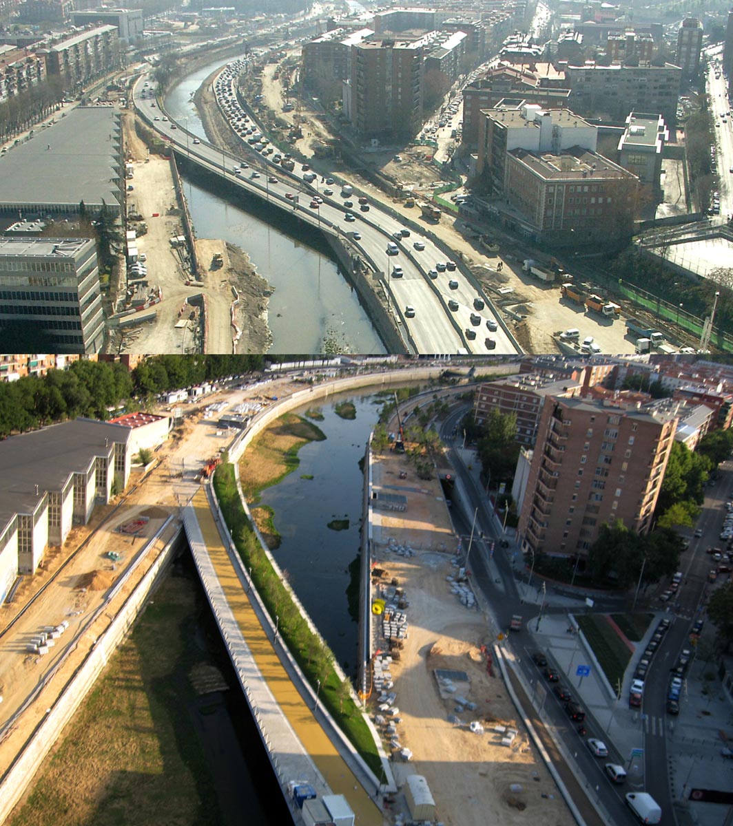
Although, during the second half of last century, some public spaces were opened along the banks of the Manzanares, for example the Arganzuela, the San Isidro, the Cuña Verde and the Matadero parks, Madrid’s exponential growth meant that the greater part of the riverfront ended up facing away from the river so that it was practically relegated to the status of being a sewer. This relationship was definitively broken in the 1970s, when the fissure created by the fluvial flow within the urban space was taken advantage of in order to construct the western arm of the M-30, a motorway ring route used by over two hundred thousand vehicles every day.
Aim of the intervention
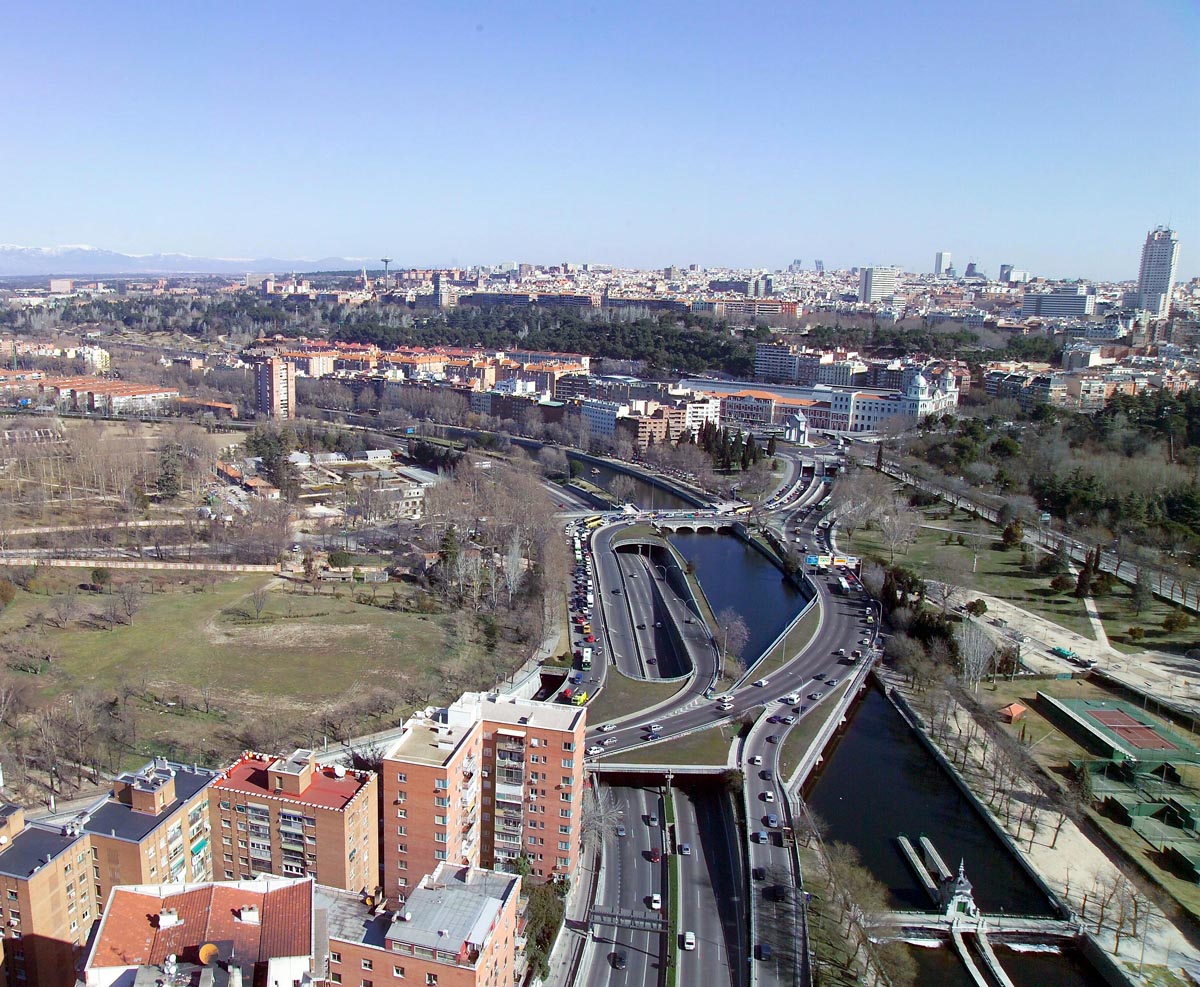
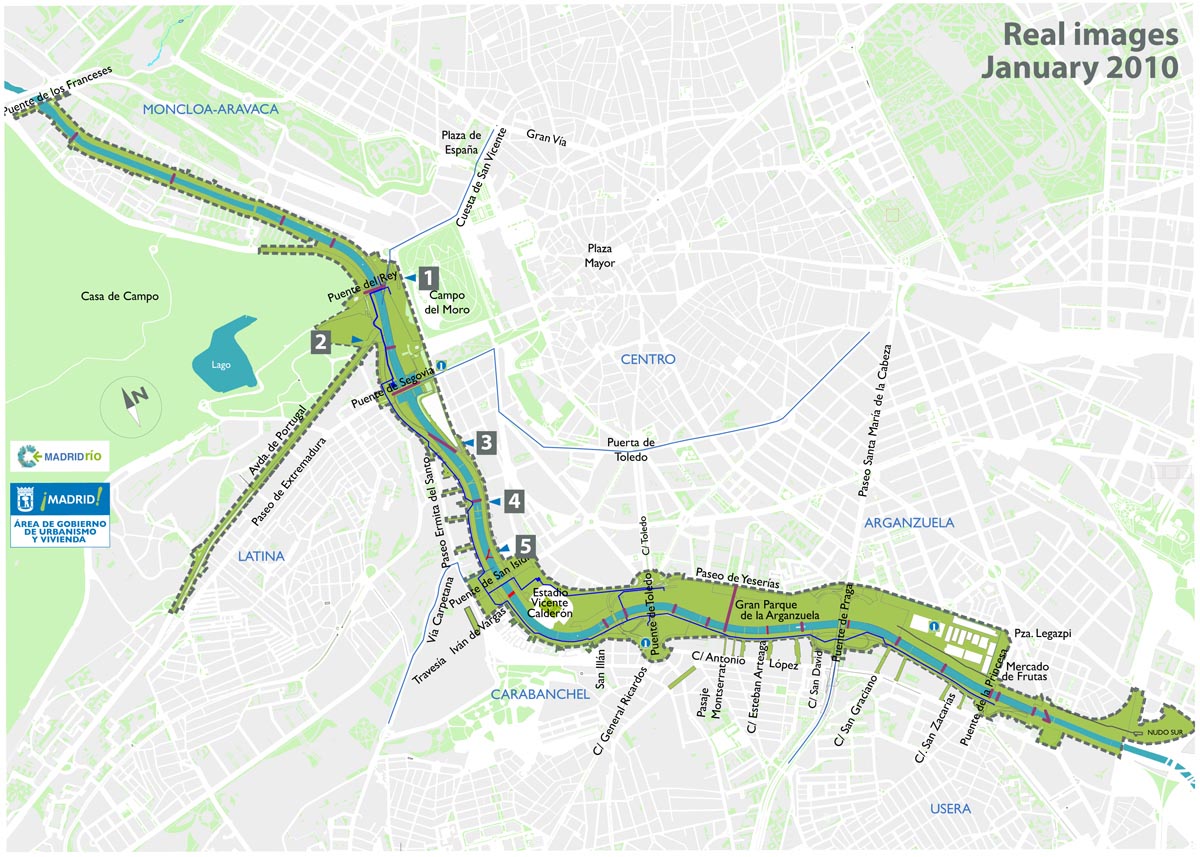
In 2004, the Madrid City Council decided to take underground, by means of a tunnel of more than five kilometres long, the section of the motorway that ran along the riverbanks from the Puente de los Franceses to the Puente del Rey. This massive-scale project gave Madrid the unwonted experience of disposing of a large free surface area, on the metropolitan scale, in a central position and with lineal structure, offering the possibility of connecting all the green zones along the Manzanares River.Description
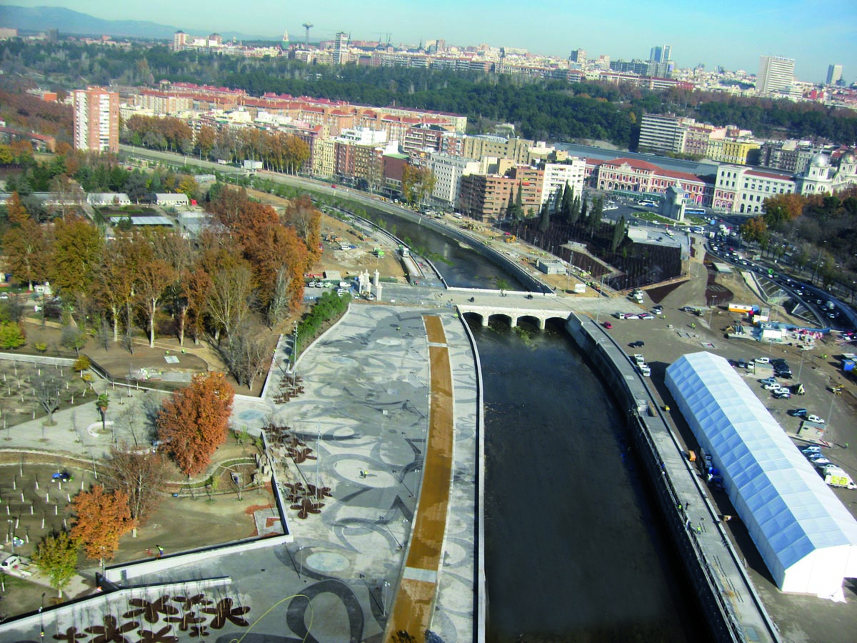
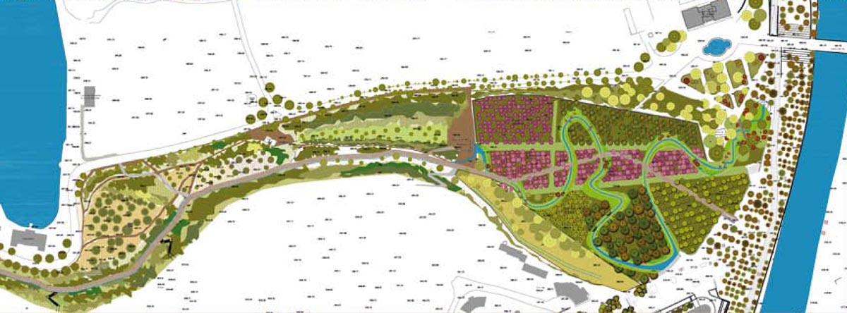
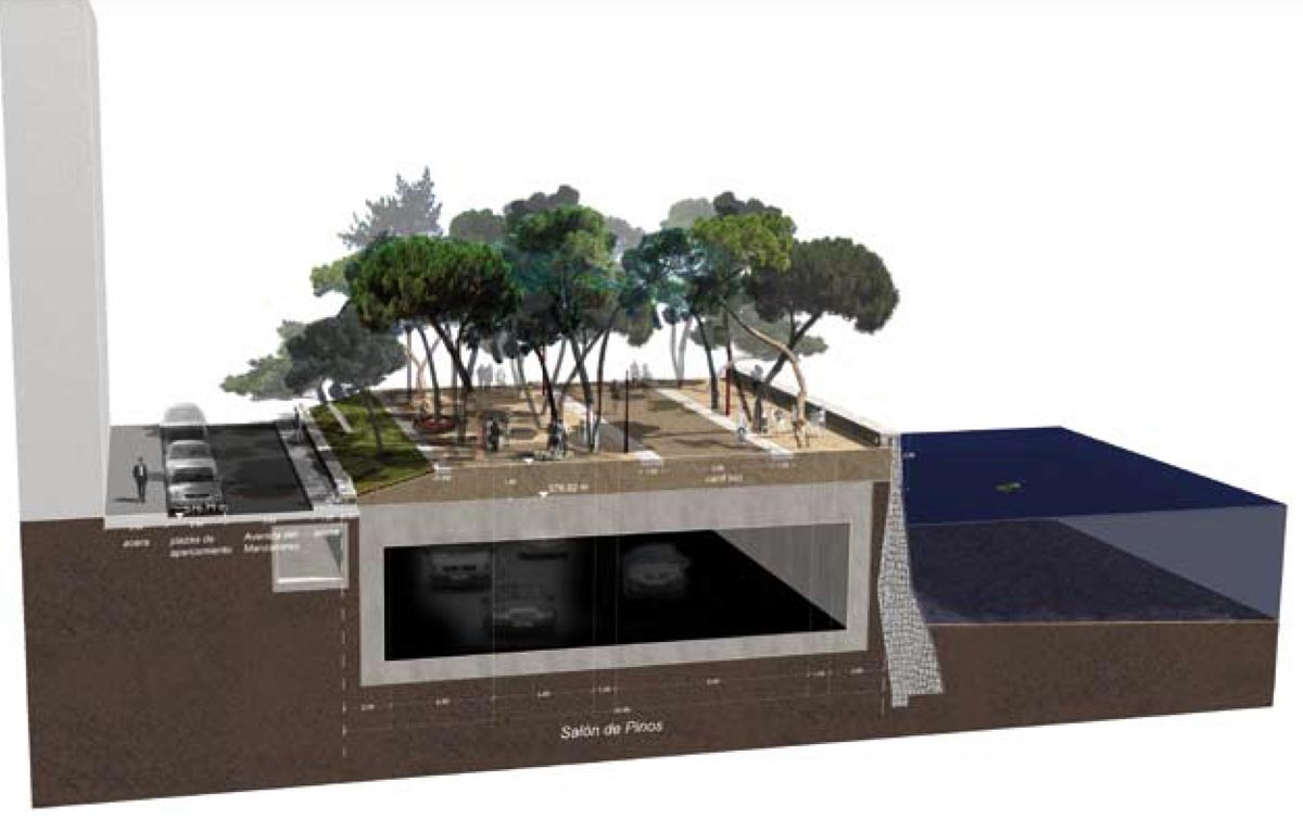
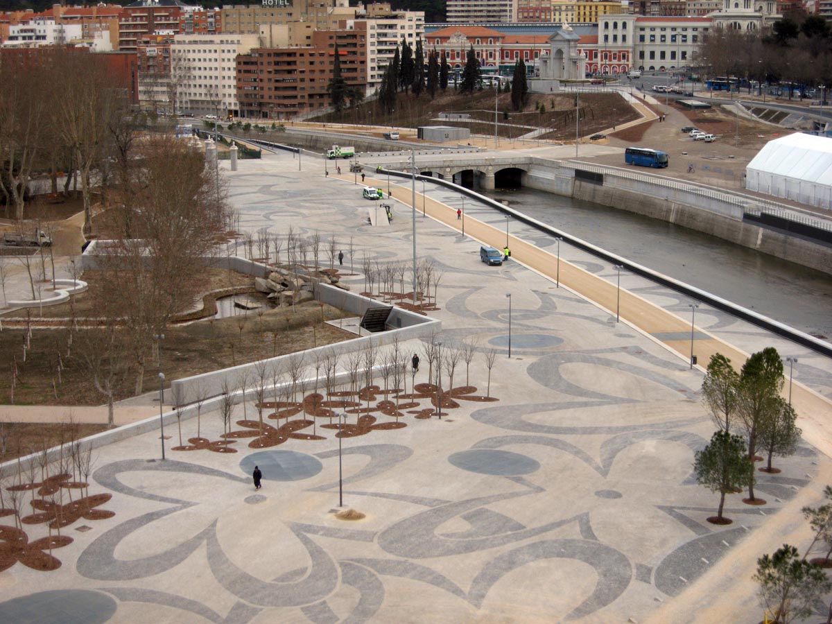
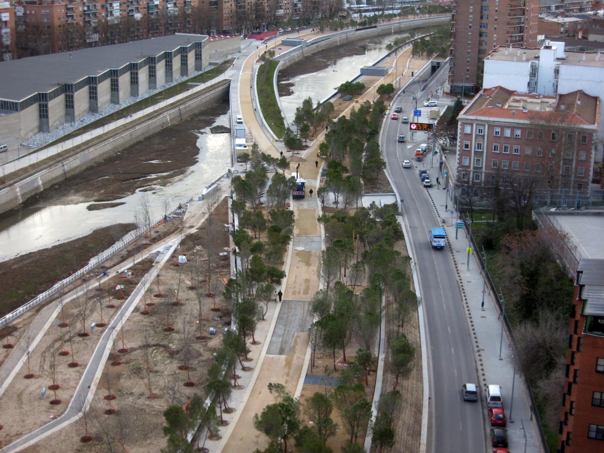
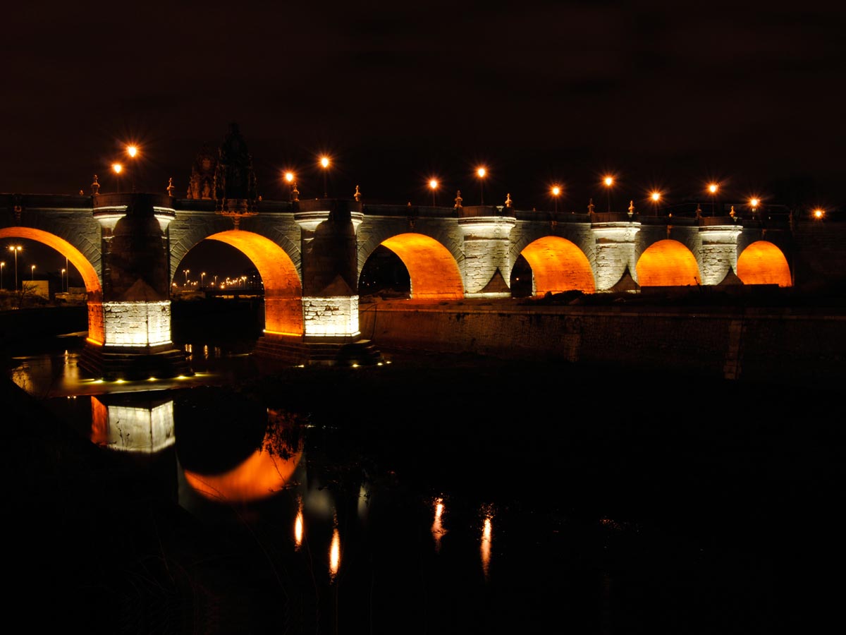
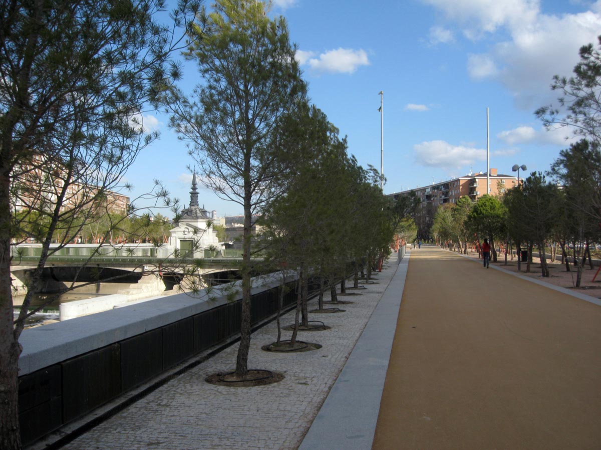
The 750,000 square metres of land freed by taking the M-30 underground now accommodate a green corridor connecting all the river parks along the urban section of the river, from the Monte del Pardo, in the north of the city to the Parque Lineal del Manzanares, in the south. A new riverside walk called Salón de Pinos runs for six kilometres next to the river. More than 250,000 new trees have been planted and a network of over seventy kilometres of paths is offered for the exclusive use of cyclists and walkers.Within the precinct of the Casa de Campo, on the right-hand bank, the Manzanares once again waters the Huerta de la Partida, an old royal garden planted with over 800 fruit trees and endowed with a paved esplanade especially equipped as a venue for large-scale cultural events. The demolition of the bulky road junction that covered the river has removed obstacles to views of this orchard from the monumental cornice formed by the Palacio Real, the Catedral de la Almudena and the Real Basílica de San Francisco el Grande. The Puente del Rey, which had been trapped among the lanes of the road junction is now a pedestrians-only bridge after having been restored along with the other historic bridges, for example the Puente de Segovia and the Puente de Toledo.
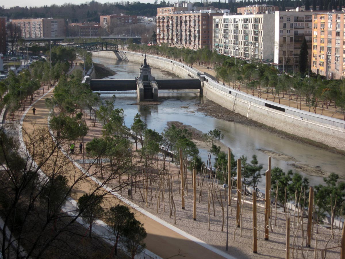
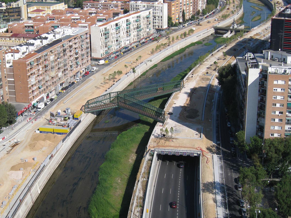
Three hundred metres downriver, a branch of the M-30 that obliquely crossed the river is now a landscaped walkway and, just before the Vicente Calderón stadium, a new footbridge has been constructed, this time consisting of three branches converging over the river to form a Y. The upgrading and extension of the already-existing bulkhead dams, renovation of the drainage system, introduction of twenty-seven rainwater tanks to accumulate torrential rains and overhaul of the sewage treatment plants have considerably raised the water level and improved its quality, as a result of which a river beach is soon to be opened in its El Matadero reach.
Assessment
In the second half of the twentieth century, European cities made huge efforts to construct large-scale infrastructure which, like the M-30, gave greater priority to the flow of private vehicular traffic than to the integrity and continuity of the urban fabric. Time has shown that the easing of traffic achieved by these fast lanes is short-lived since, in the medium term, their opening up is always followed by a pull effect that brings about an increase in traffic volume and the resulting saturation. Much less ephemeral, however, are the insurmountable barriers they bring with them, and the deep wounds they inflict on the urban fabric.Interventions like that of MadridRío represent an overcoming of this erroneous model. The Manzanares River has ceased to be a barrier to become a seam transversally pulling together the urban fabric and green corridor that longitudinally links the different parks that join up with the riverbank.
David Bravo Bordas, architect
[Last update: 02/05/2018]