Previous state
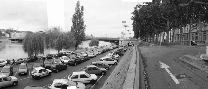
Lyon was built at the confluence of the River Rhône and its tributary the Saône River on the Presqu'île Peninsula, which is now occupied by the old city centre. As with many other fluvial cities, its relationship with the river started to deteriorate with the Industrial Revolution. Even if Haussmann-style dictates issued during the Third Republic ensured that its banks were satisfactorily tidied up, dignifying them and preventing them from being populated by factories, after the middle of the twentieth century they were not able to withstand the assault of the massively expanding presence of the private vehicle. The free space along its banks was occupied by high-speed roads and open-air car parks that intermittently interrupted access to the river and fragmented its longitudinal course.Aim of the intervention
In 2003, the City Council and the Greater Lyon Urban Community, an organism of metropolitan scope, called for entries in a competition with the idea that recovering the left bank would bring about reconciliation between the city and its river. The new public space was to be a meeting place, a leisure area and a zone where people could relate with nature. The specific requirements of the project were established by means of a participative process that included a public exhibition with 85,000 visitors as well as organising fifteen workshops with a total of 600 participants, these focusing on discussing details of specific areas, for example sustainable transport, aquatic activities and fishing.Description
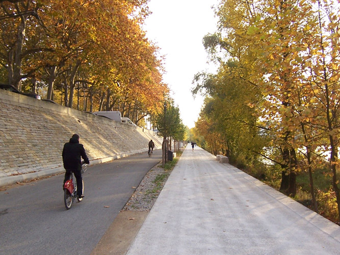
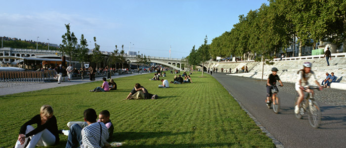
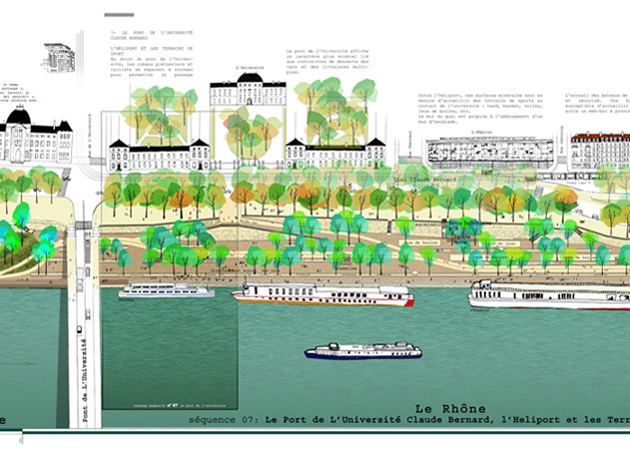
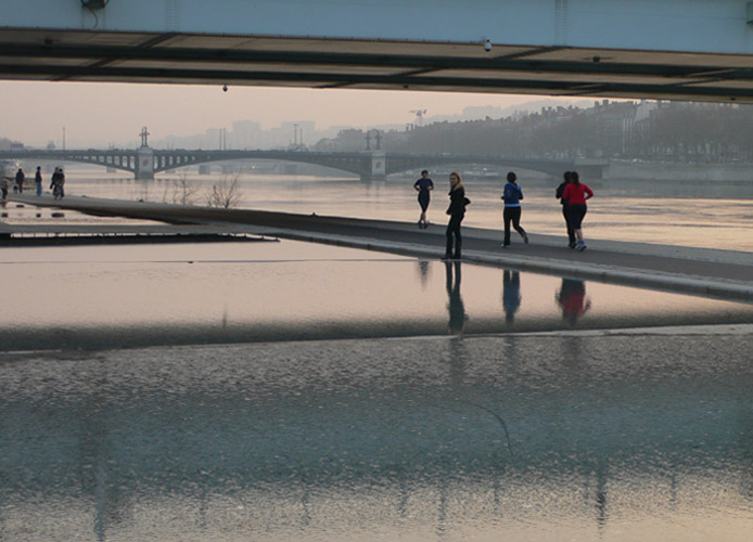
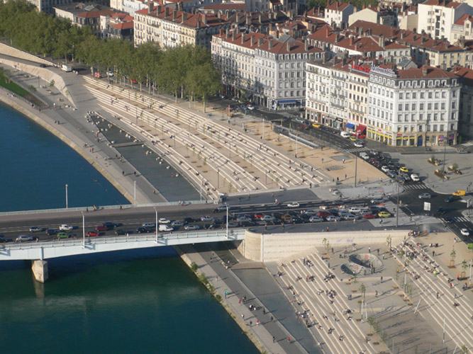
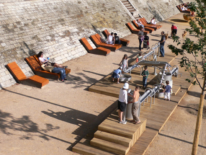
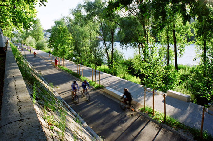
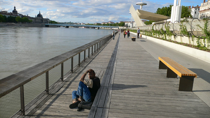
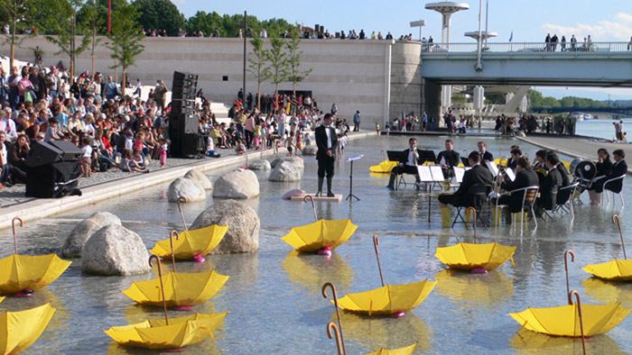
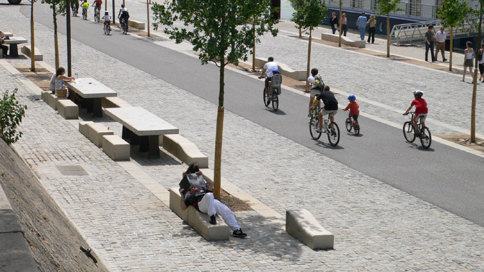
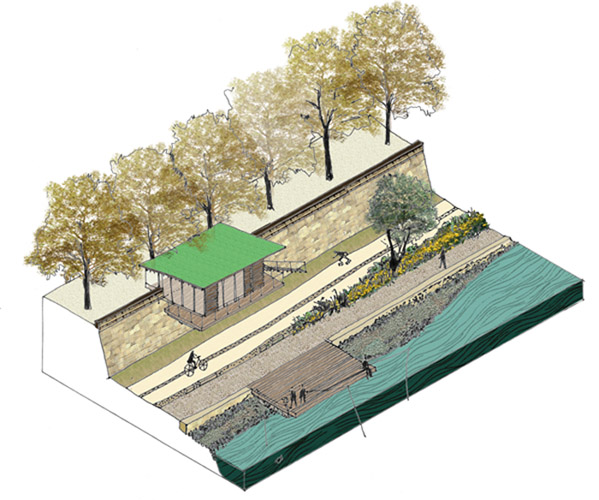
The project occupies an extension of approximately ten hectares over a front of over five kilometres running along the left bank of the Rhône. It starts upstream beneath the Winston Churchill bridge and, after passing beneath nine more bridges as it moves downstream, it ends at the tip of the Presqu'île Peninsula, beyond the railway bridge. The form is almost symmetrical, with two ends that are in a more natural setting and a centre, marked by the Guillotière Bridge, which is markedly urbanised. Throughout its length, the new riverside frontage has a tiered section of variable width with two main levels separated by a pre-existing sloping retaining wall in exposed stone. The upper level, in contact with the urban fabric, has a path running along its edge, separating vehicular traffic next to the buildings from the circulation of pedestrians on the side next to the wall and the river. The lower level is almost exclusively for pedestrians, with a succession of riverside woods, fields planted with different grasses and paved areas of tiered seating that are repeatedly crossed through by the longitudinal, uninterrupted tracks for strolling, skating or cycling. The cycling track is part of the Léman-Mer circuit, which follows the course of the Rhône from Lake Geneva to the Mediterranean coast. The connection between both levels, previously achieved by way of tangential ramps integrated into the retaining wall, is now enhanced by means of introducing ten homogeneously-distributed vertical nuclei. These points, called “lookout boxes”, contain lifts, stairs, health services, drinking-water fountains, information points, bicycle- and skate-rental establishments, ice cream and drink stalls and nurseries.The Guillotière Bridge, which directly connects with the busy Place Bellecour, signals the most central and representative point of the intervention. This zone is occupied by more than 300 metres of tiered seating, which replaces a former inaccessible area that was ironically known as the “bear pit”. This grandstand is a site of major significance. Facing the cupolas of the Hôtel Dieu it is a civic space which, with the river as its backdrop, is now the venue for such multitudinous events as concerts, parades, screenings, fireworks and even the passing of the Tour de France.
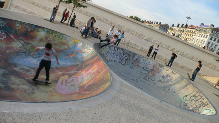
Downstream from here, on either side of the Université Bridge, there is a zone of sports facilities. The Centre Nautique du Rhône, a former complex of swimming pools and public baths has now been revamped with the addition of a series of zones for playing handball, basketball, volleyball and petanque.
In the northern zone of the intervention, known as Le Bretillod de la Lône, traffic constituted by vehicles coming from the Quai Charles de Gaulle has now been blocked, opening up a valuable natural riverside space, a wetland environment consisting of islets of alluvial sediment and riparian woods. This natural space constitutes a vestibule leading into the Tête d’Or Park which, with an extension of 116 hectares, is the green lung of the metropolitan area. Similarly, the southern sector has lost built-up ground and gained in vegetal cover, opening into the Berges and Gerland parks. Both north and south, the two ends of the route, are intimately linked with the water through wooden pontoons used for fishing and other aquatic activities. Moving closer towards the centre, the riverside zones are populated with large inhabited barges that have been duly connected to public facility networks. The boats in the more central area have restaurants and night-time bars that enliven the scene of the lower wharf areas.
Assessment
After the intervention, the left bank of the Rhône, effectively acts as a mediator in the senseless dispute between the city and its river. The reconciliation strategy consists of generously satisfying the demands of both parties. In the longitudinal sense, the intervention bows to the demands of the river, adopting a coherent and unitary form in order to flow into its majestic presence. This achieves a restitution of circulatory continuity on the territorial scale while bringing out the river’s major role in the genesis of the city. In the transversal sense, the new riverfront unconditionally obeys the requirements dictated by the city. It becomes permeable in order to respond to the different urban situations it flows through, in such a way that the intensity of the equipment and the degree of built-up intensity diminishes with distance from the urban centre.David Bravo Bordas, architect
[Last update: 02/05/2018]