Previous state
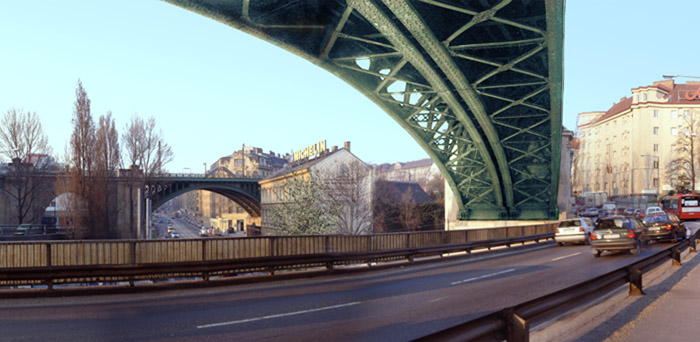
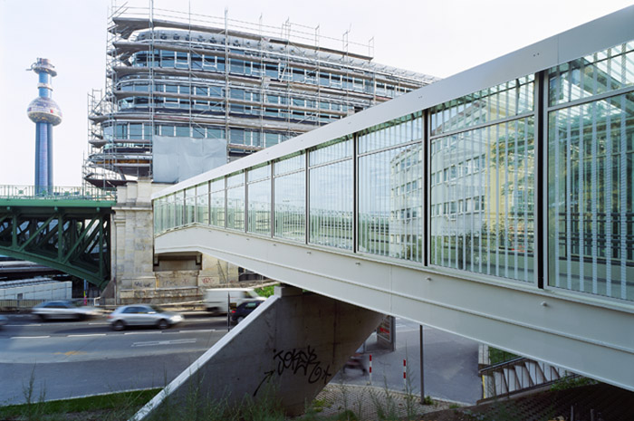
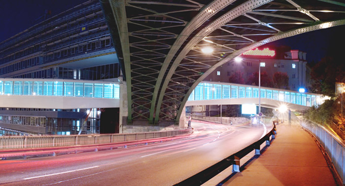
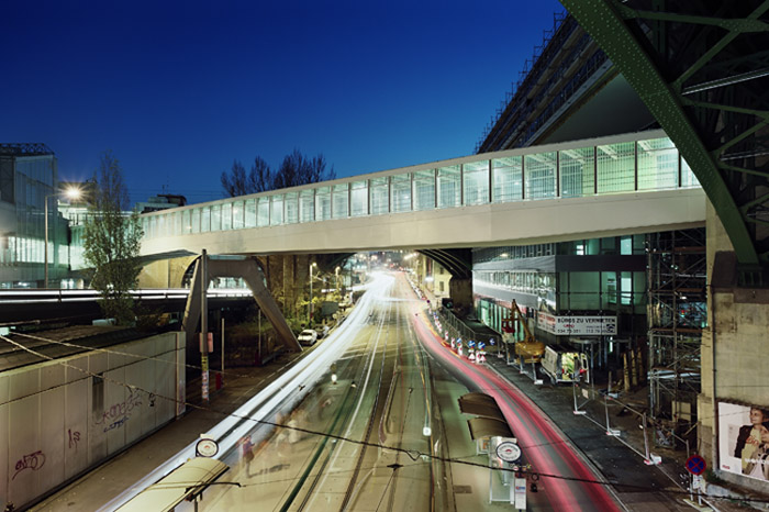
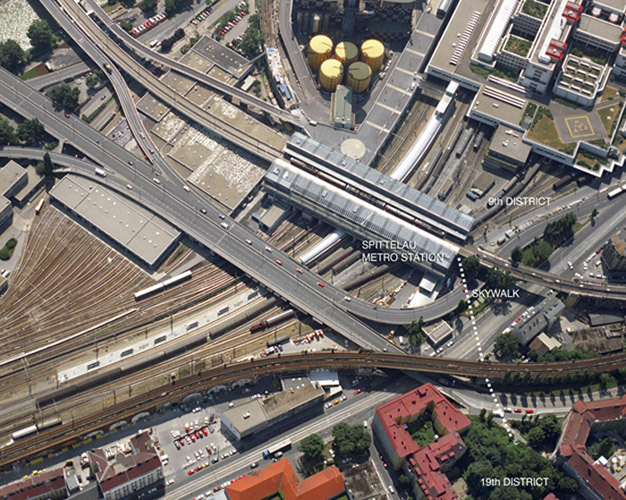
Vienna’s most complex road junction is to be found in the north of the city, straddling the districts of Alsergrund and Döbling, some three hundred metres east of the Danube Canal. With four bridges crossing at different levels, two of the main roads coming from the north also meet here along with several streets, two branches of the historic railway line planned by Otto Wagner, two tramlines and the Spittelau underground station. This complex node of infrastructure took shape over several decades on land freed by a station that had fallen into disuse and ended up constituting an unbreachable barrier for pedestrians and cyclists.Aim of the intervention
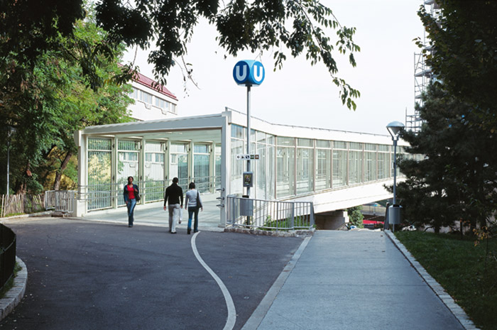
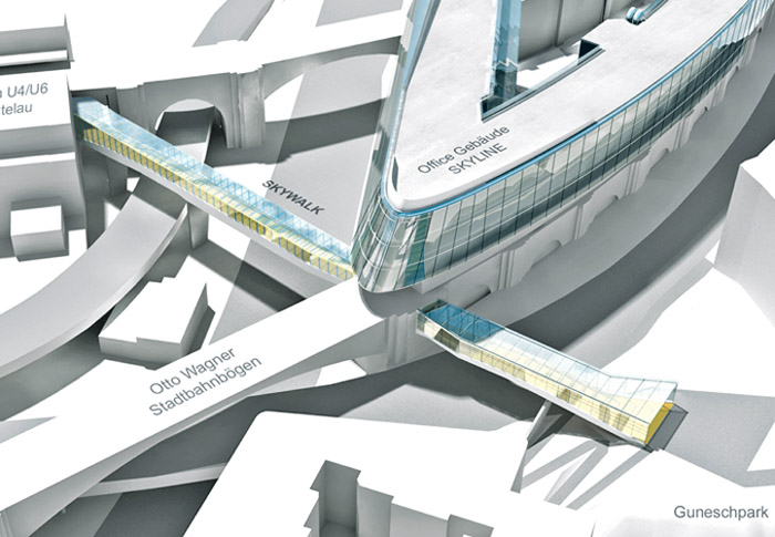
The Vienna City Council is undertaking a series of measures to re-establish contact between the two districts and to improve the quality of life for pedestrians and cyclists. One such measure was constructing a walkway, the so-called Skywalk, which connects the Spittelau underground station with a residential area of the 19th District.Description
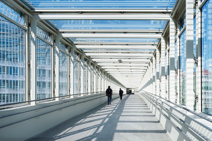
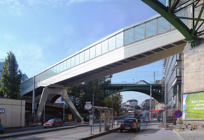
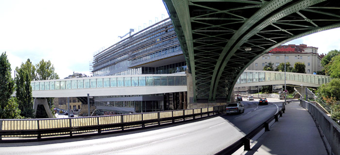
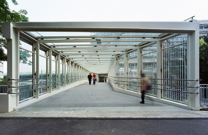
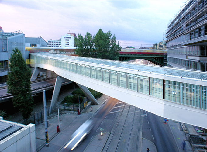
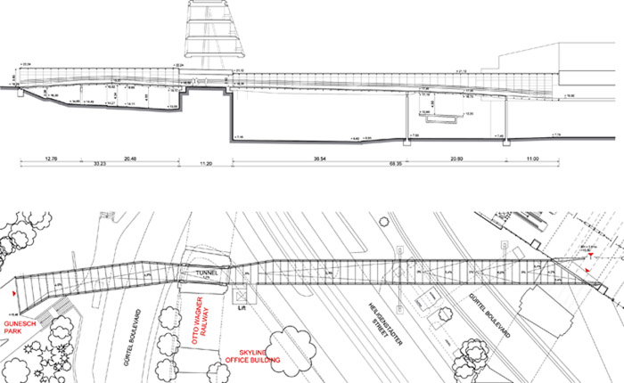
The Skywalk is a covered bridge with a total length of 112 metres and three intermediate supports along its length. Beyond its response to the merely structural requirements, the form and dimensions of the Skywalk were conditioned by the complex urban area it crosses. The width and level of its floor and its angle vary with each point where it has to pass among the different obstacles in its way.After its starting point in the underground station, the passageway crosses two avenues and is then mounted into a large pillar of the upper railway bridge built by Otto Wagner, forming a tunnel. This obliges a considerable narrowing of its width, which is recovered once the obstacle is passed. Then it slightly changes direction to pass over another avenue, thence to open out in the Gunesch Park. Throughout its length its level changes by over three metres and this is managed by different sections of ramps with gentle slopes that are practicable for both wheelchairs and bicycles. In fact, this new bridge also constitutes the extension of a cycling route that runs alongside the Danube Channel. Both its vertical faces and its cover are in glass to protect users from bad weather. The interior space has ducts that guarantee proper ventilation.
Assessment
If it is true that the new walkway contributes towards making the tangled space of this crisscrossing of bridges and ground-level thoroughfares even more complex, it is equally true that it permits pedestrians to participate in the circulatory system. Proof of this are the 500 people every hour who are able to cross a major physical barrier by means of a passageway that is enlivened by the spatial deformations it has to deal with all along its length. Far from being capricious and fortuitous, these deformations are the direct result of the immediate surroundings, so that the optimisation of its structural design is justifiably subordinated to the limits set by the urban context.David Bravo Bordas, architect
[Last update: 02/05/2018]