Previous state
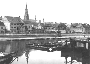
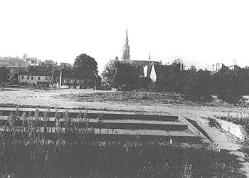
Osijek is the fourth largest city in the Croatian Republic, despite the fact that it is only medium-sized (105,000 inhabitants). It is the capital of the region of Slavonia which has 900,000 inhabitants within its catchment area. The city's strategic location (it shares a border with Hungary) has led it to absorb a number of historical influences, which have endowed it with a remarkable architectural heritage. The city's historic weave consists of three kinds of urban settlement: the upper city (Gornji grad); the historic nucleus of Trvda (the ancient Roman colony of Mursa, the medieval fort dating from the beginning of the 11th century and, subsequently, the citadel built by the Austrians at the beginning of the 18th century); and the lower city (Donji grad). These three nuclei were to link up, as part of a continuous process, until they eventually absorbed the new peripheral and industrial spaces. The Drava River (an affluent of the Danube) cuts its swath through the city which has experienced most growth on its right bank. Until the end of the Second World War, the layout of the two river banks had not been subject to regulation. The requirements of the river harbour brought about large-scale economic development with the construction of many industrial facilities: wharves, terminals, warehouses, etc. From the sixties, the first serious undertaking to redevelop the zone was considered, hinging on a series of projects which could also solve the problem of the frequent flooding of the river. In 1973, the study and implementation of the Osijek General Plan was approved. The plan came about during a period of intense growth in industry and building, when the expectations of economic and demographic growth in the country gave cause for optimism. During this time, the university was founded (1975), new factories were built, the employment market was growing, housing and new municipal infrastructures were built, streets and squares were renewed, and urban culture was given a major boost. Over this period, the city experienced a major change with regard to its river and its quality of life, and the population reached 150,000 inhabitants.Aim of the intervention
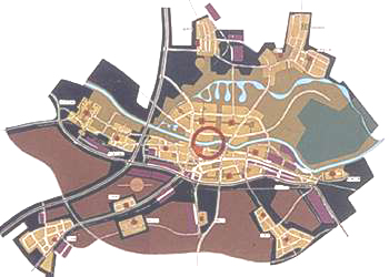
The Osijek 2000 Plan should be considered as a general or strategic plan for an overall intervention in the city from which different partial plans have been drawn up. The main aims focus on regulating and creating new public spaces, as well as preserving and boosting the region's ecological and landscape potential. From the outset, the need for a logical and rational ordering of the existing urban weave was mooted, as well as the future expansion of the city towards the left bank of the river, approached from sustainable-development criteria. The Drava and its banks became a compositional axis of great appeal which provided a focus for the leisure and recreational activities of the inhabitants. Thus, the proposed intervention takes its name from the models of "river in the city" and "city on the river".Description
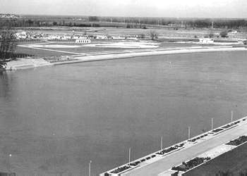
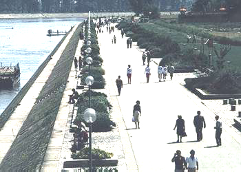
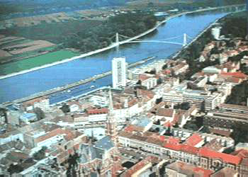
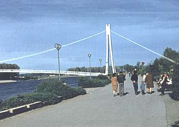
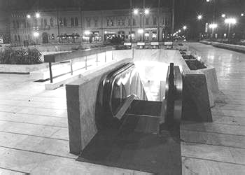
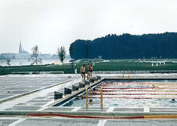
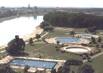
The plan seeks to boost different areas of the city, and to zone it according to particular activities. Interventions have also been carried out in the western city centre, connecting it directly with the river, and with the new districts and railway and bus stations in the south. The area is the focus of a number of recreational and sporting facilities: the racecourse and riding club, the sports centre, the central park with its tennis club, the "Iktus" rowing club and the children's play area. A number of unique spaces have been pedestrianised in this same area: from 1976 to 1979 "Ante Starcevic" Square (previously used as a haphazard parking zone) where cafés, shops and other commercial services have been built. The square has been enriched by the sculpture "People" (a work by the Croatian sculptor B. Ruzic) and a fountain. It also has an underground area "Zimski trg" or "Winter Square" which includes a post office and a major shopping area. Initially, an underground car park was planned, but this proposal went against the ideas of the project planner who, at the time, defended the preservation of the centre as a pedestrianised space. Adjacent to the main pedestrian thoroughfare ("Kapucinska") we find the zone known as the "Blok centar" built between 1971 and 1974. A pedestrianised and tertiary area has been built around it which has injected life into a part of the city where there used to be abandoned gardens, warehouses and shacks. A large building, over twelve storeys high was built in this space, and is also used as a hotel. It was envisaged that it would be built at the lowest spot height in order to avoid, to as great an extent as possible, a visual impact which would be too strong.The intervention on the left bank of the river included a zoological gardens, a natural wooded area and a new public leisure centre -built from 1979 to 1985 - known popularly as Kopika (Copacabana). It is equipped with swimming pools, a riverside beach, football pitches, basketball and volleyball courts (the latter on the sand). This recreational space covers a site of 10 hectares, where there were previously fields with army barrack huts and warehouses. Further to the west, we find the Kronenwerk zone ("Krunska tvrdava", the city of the Crown built in 1714 to provide additional defence for Trvda) which has been architecturally refurbished with the aim of providing a major cultural facility with restaurants and other services. The two zones developed on either side of the river -6 km of length- have long pedestrianised avenues (2,6 km long on the right and 2 km long on the left) which meet a constant desire to bring the river nearer to the inhabitants. A pedestrian bridge built between 1977 and 1978 spans the river - which is 250 m wide and navigable - thus connecting both zones. Before this bridge was built, there was only a complementary ferry service to the other two bridges which are situated further to the west: one for vehicles and pedestrians and another for the railway.
Assessment
The Osijek 2000 project, which has been underway since 1973, has still not been fully completed. In 1991, the Balkans War halted the renewal process and the project is currently at a standstill, because most investment is mainly given over to rebuilding public infrastructures (roads, bridges, etc.) damaged in the war. The new-housing zone for 50,000 inhabitants, which was to be located on the left bank of the river between the zoological gardens and the woods, remains unbuilt. A series of studies were carried out into the quality of land and underground water supplies, but the war put a stop to following them up. At present, work is being carried out on the adaptation of the urban-planning project, which will now be carried out at a later date. Non-regulated housing and a number of restaurants are still found on this site. We also need to complete the definition of uses for the Kronenwerk cultural facility, and two bridges, which will ease the transportation and flow of inhabitants between the two banks of the river, have to be built. One will be located between the harbour and the future city expansion zone, and the other, further to the west, will be used for vehicles and the railway.Apart from these shortcomings, the plan has more than accomplished its original aims. It is estimated that approximately 20,000 to 30,000 people use the long pedestrianised avenues running parallel to the river, and the vast leisure zone on the left bank. We must also assess, from a present-day perspective, the efforts made during the period at the beginning of the project, in order to form a pedestrian centre which will harmonize the recovery of spaces for inhabitants' use with the commercial and economic impetus of the city. To sum up, the plan has many followers, and today we can talk about a working methodology which has been applied to other Croatian cities.
Albert García Espuche, architect
[Last update: 02/05/2018]


