Previous state
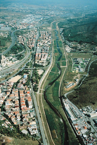
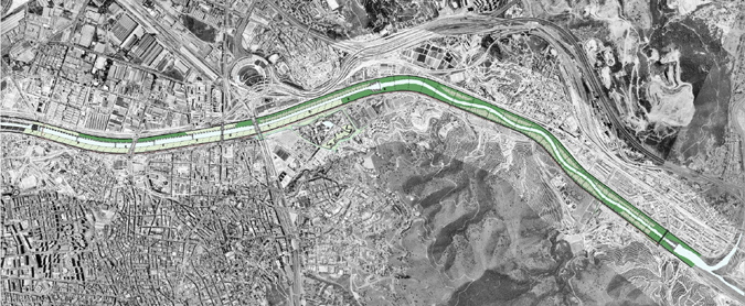
The River Besós is one of the territorial features that give shape to the Metropolitan Area of Barcelona. This river has been greatly changed by human activities and its basin has a population of over two million inhabitants. Almost all its water has been diverted from other rivers and, in its lower reaches, this water is mainly consumed for industrial and urban needs. The final section of the river was channelled in 1962 after catastrophic flooding that led to a subsequent construction of a central shallow-water canal with a bed 130 metres wide confined between two four-metre concrete walls. The isolated nature of the flow of this deprived river, so greatly in need of external inputs and with a markedly Mediterranean character of occasional dramatic torrents alternating with a scant flow for most of the year, has simply meant the progressive urbanisation of its surroundings and the resulting existence of numerous thwarted contacts with the city on both banks of its lower reaches. These factors have caused a progressive reduction of the riverbed with the consequent loss of the river's hydraulic capacity and endangering of its ecosystem, which was already frail and vulnerable.Aim of the intervention
This situation of environmental degradation of the area with all its negative effects for the population, led to the residents repeatedly demanding solutions from different branches of the administration and this eventually resulted in a 1995 agreement between several municipalities. The municipal councils of Barcelona, Santa Coloma de Gramanet, Sant Adrià del Besós and Montcada i Reixac decided to undertake a set of programmes and activities within the framework of a single project, managed by the Consortium in Defence of the River Besós, to recover the river basin.This project of the environmental regeneration of the final section of the river, forming part of the general plan, along with a series of interventions specifically applied to this section – nine km upstream from the mouth of the river – aimed not merely at improving environmental and landscape quality, and increasing the hydraulic capacity of the river, but also at an overall enhancement of the riverbed and its surroundings that would make several river areas apt for leisure activities, so that residents would once again be in contact with the watercourse. In 1996, financial support was obtained from the Infrastructure Fund for Environmental Regeneration from European Union Cohesion Funds, this providing the definitive impulse for the economic viability of the project and representing the start of a long and complex process.
Description
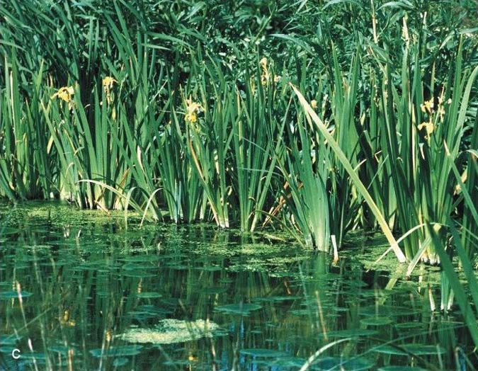
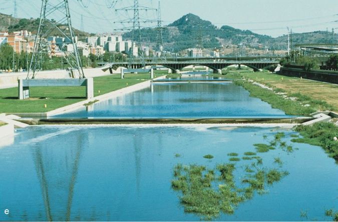
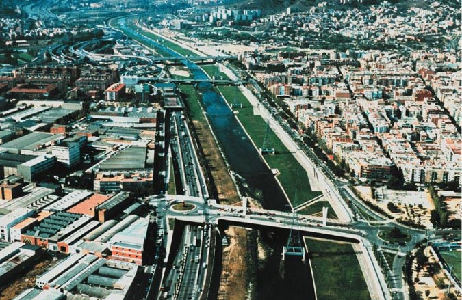
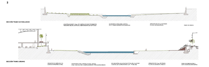
The first phase of the project, which is now completely finished, involved a strip of 6.2 km, from the confluence with the River Ripoll to the Molinet Bridge. The second phase, still to be completed, will result in the final recovery and naturalisation of the area around the mouth of the river. The first-phase intervention was adjusted according to the specific characteristics of each river zone, so that it was modelled in sub-sections. However, generally speaking, it might be broken down into two main areas of activity, the first pertaining to the section of the river going upstream from its mouth, an area that is not very built-up, and a second section that is notably more urbanised.In the first section, in order to bring about the environmental regeneration of the riverbed, it was decided to naturalise the course of the river, creating a central and sinuous shallow-water canal, thanks to which the permanent water can circulate over a meandering riverbed that encourages the diversity of river habitats and favours the stability of the area as a whole. The aim of recovering the river's ecosystem, which had completely disappeared in this area, was put into practice by means of designating ten hectares of marshland on both sides of the river, for third-level treatment of sewage water from the Montcada water purifying plant so that these waters can be reincorporated as part of the main flow after this natural treatment that greatly reduces problems of bad smells while minimising the presence of insects.
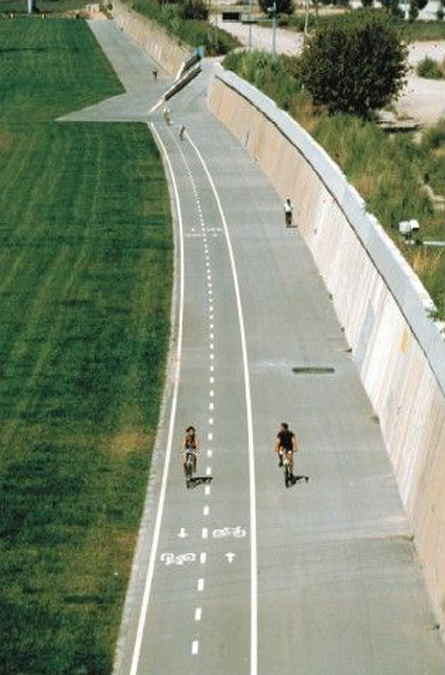
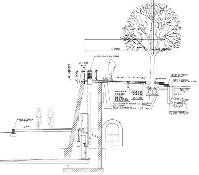
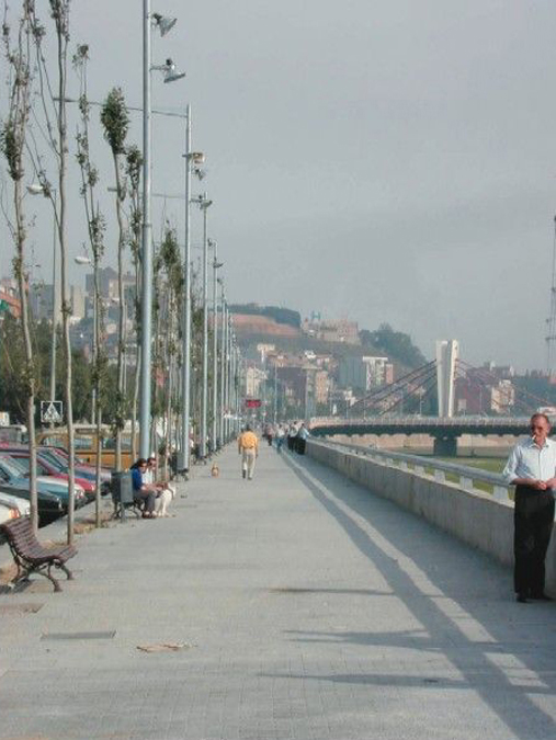
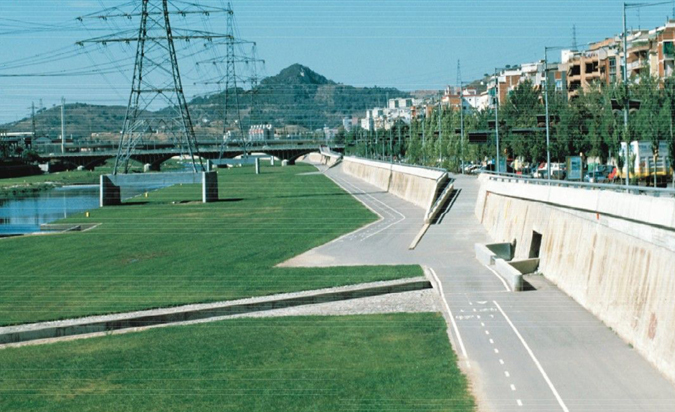
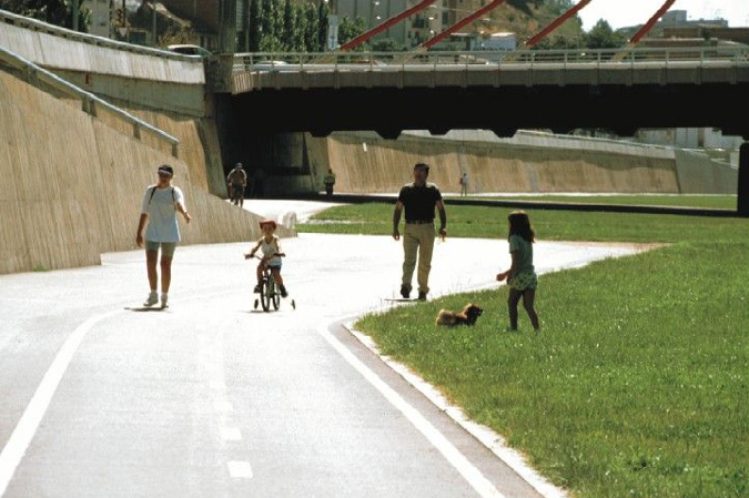
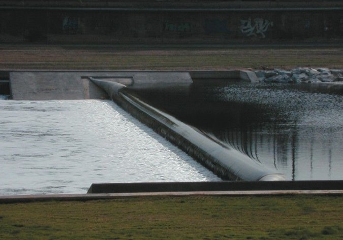
In the second section, this water treatment, also introduced on the right-hand bank, which is inaccessible from the edge of the urban area owing to the barrier effect created by the presence of different types of metropolitan transport infrastructure that provide access to the city centre, while thirteen hectares of green fields have been created on the left-hand bank, these being reached by means of ramps tangentially affixed to the pre-existing high concrete wall. These ramps, of varying sections and higher or lower with respect to the river, favour the sensation of being near its waters from the upper urban vantage point, where a new river walk is being constructed parallel to the river, integrating the park access points and inaugurating a new relation between the city and the river waters, which is highlighted in the perforations, occasioned by the ramps, in the lateral retaining wall. In the park zone, in order to maintain the presence of the water in the summer period, and also to increase the river’s hydraulic capacity, the central shallow-water canal has been widened to between twenty and fifty metres, while five inflatable dams have been installed in case of flooding. Apart from improving the natural appearance of the watercourse, these dams represent a natural lake formation that favours the water purifying process. The project incorporates monitoring mechanisms and the necessary warning systems to effect a rapid evacuation of the public from the park in case of high water and/or risk of flooding. Different signposting devices and warning notices have also been installed, along with indication of prohibited activities in accordance with the use and emergency plans that were drawn up before the new River Besós Fluvial Park was opened to the public.
Assessment
This project, a product of residents' concerns, and with a high degree of their participation in the early phases, represents the collaboration achieved between different branches of local administration and the successful implementation of environmental and hydraulic solutions that are pioneering in their application to fluvial systems. The end result of numerous multidisciplinary preliminary studies and pilot schemes, representing a high degree of cooperation between different professional spheres, is that a natural habitat of regional interest has been recovered – its present state affecting the whole metropolitan region – and a new park has now returned to local residents the river, now recovering its natural habitats, from which they had once turned away.The improvement of the environmental quality of the water and its correspondingly increased biodiversity – the necessary condition for the fluvial space to have any value – also means an enhanced quality of life for residents in the neighbourhoods on both sides of the river and a minimising of its barrier effect thanks to improvements in general accessibility to the area, which has gained a green zone for leisure and social activities.
Mònica Oliveres i Guixer, architect
[Last update: 02/05/2018]