

Previous state
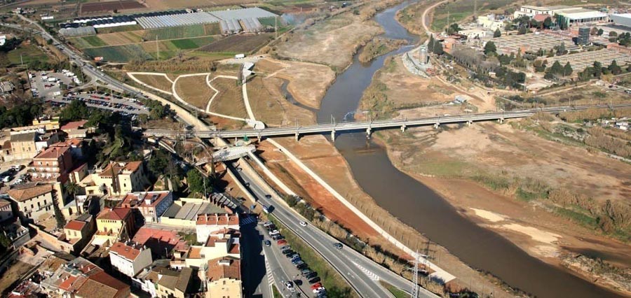
In the twentieth century the growth of the conurbation consisting of Barcelona and its surrounding municipalities faced away from the River Llobregat. To all intents and purposes a sewer, the river lost a considerable amount of its flow while a large number of elements of the metropolitan infrastructure broke up the continuity of its banks, which ended up being almost inaccessible. If, for example, a resident of Sant Boi de Llobregat wished to walk to the watercourse, he or she would be blocked by a main road, a railway line and an irrigation canal.Aim of the intervention
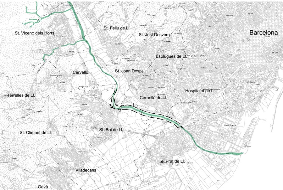
In 2007 the Mancomunitat de Municipis de l’Àrea Metropolitana de Barcelona (Association of Municipalities in the Metropolitan Area of Barcelona) decided to destine eight and a half million euros to finance a project of environmental and landscape recovery with the aim of remedying this situation. The operation involved a reach of the river extending over six kilometres running from the municipality of Sant Boi de Llobregat through to the coastal municipality of El Prat de Llobregat. From the very start, the River Llobregat was the object of two complementary conceptions. One saw it as a natural space, a changing system that was full of life, with its own dynamics that should not be contradicted. The other considered it as public space, a leisure area where people could walk along the riverbanks and that was accessible from the adjacent towns.Description
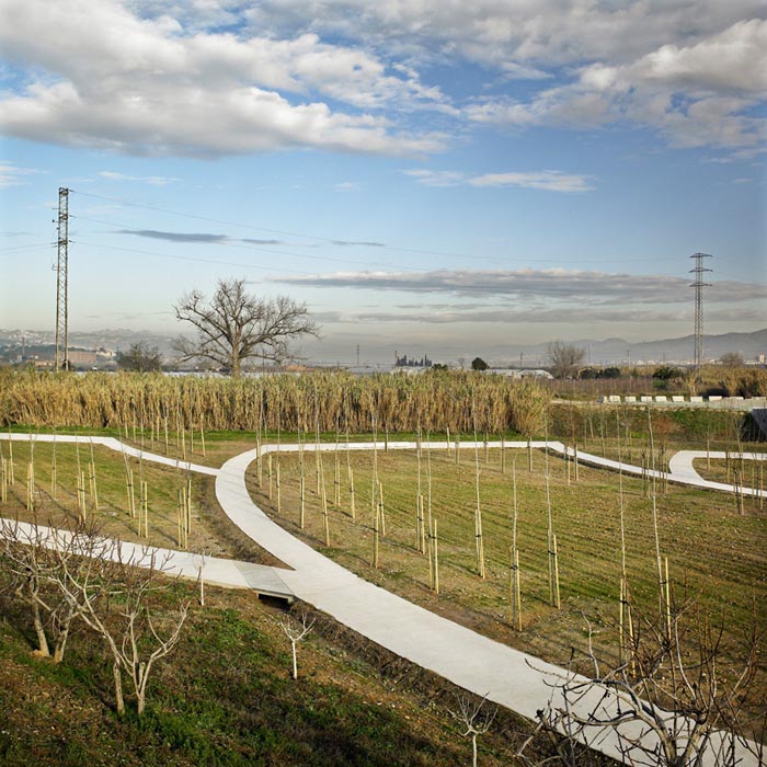
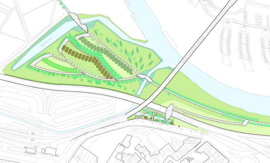
The intervention was carried out on a strip of almost one hundred and fifty-four hectares taking in the municipalities of El Prat de Llobregat, L’Hospitalet de Llobregat, Cornellà de Llobregat, Sant Joan Despí and Sant Boi de Llobregat. For the moment, the focus has been on the river bed since the left bank has been reserved for a second phase that was scheduled to begin in 2010.The work aiming at recovering the natural character of the river has been concentrated on a number of strategic points in the belief that its effects will gradually spread through the entire river system. Some of it consists in installing course deflectors that will reactivate the river from the hydraulic point of view. Besides bringing about a rise in the level of its waters, the deflectors slightly reorient its course and reshape its bends. Other tasks have involved revitalising the flora of the riverside zone, understanding that this is a natural process, independent of human intervention and that its results will not be fully visible until the medium or long term. In some cases, it has been necessary to eliminate alien species and replace them with autocthonous vegetation that will gradually colonise the whole bank.
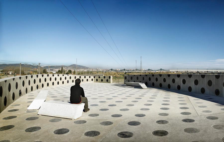
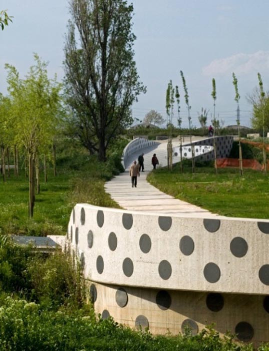
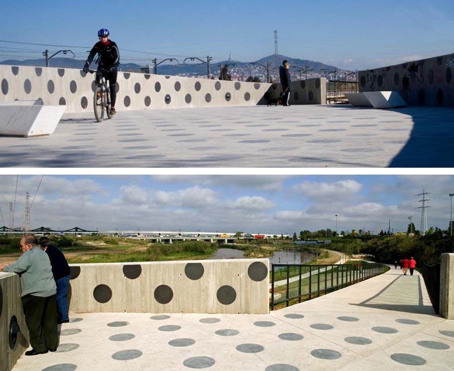
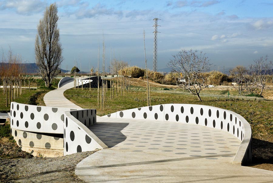
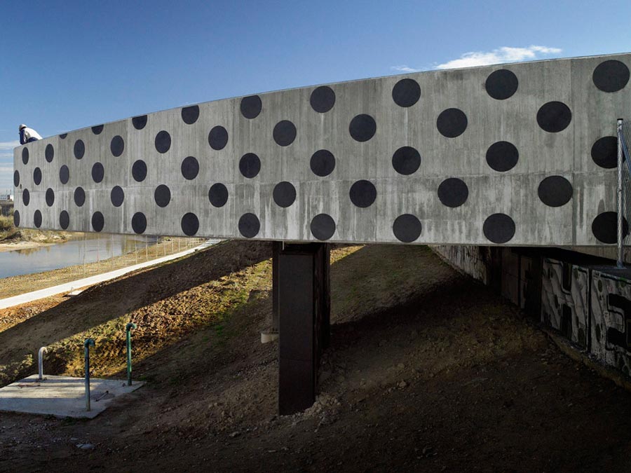
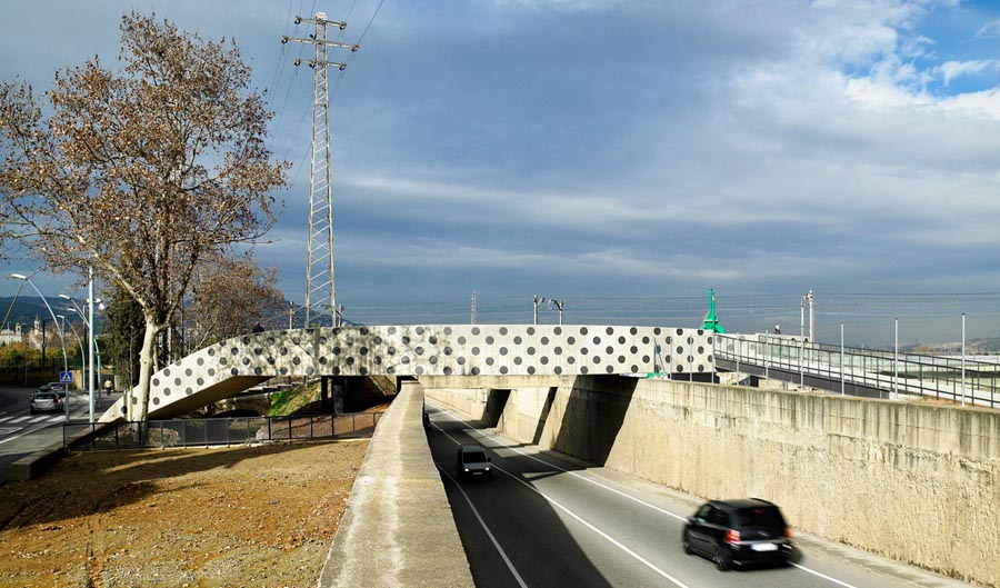
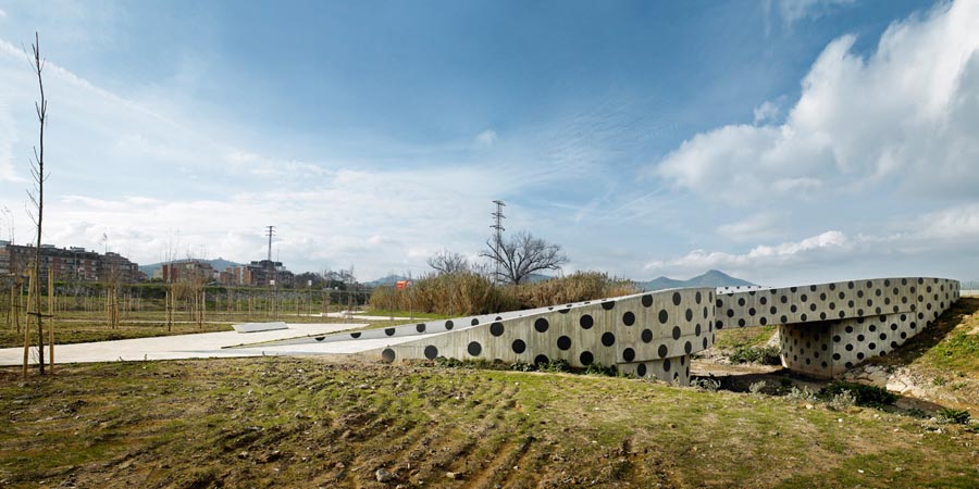
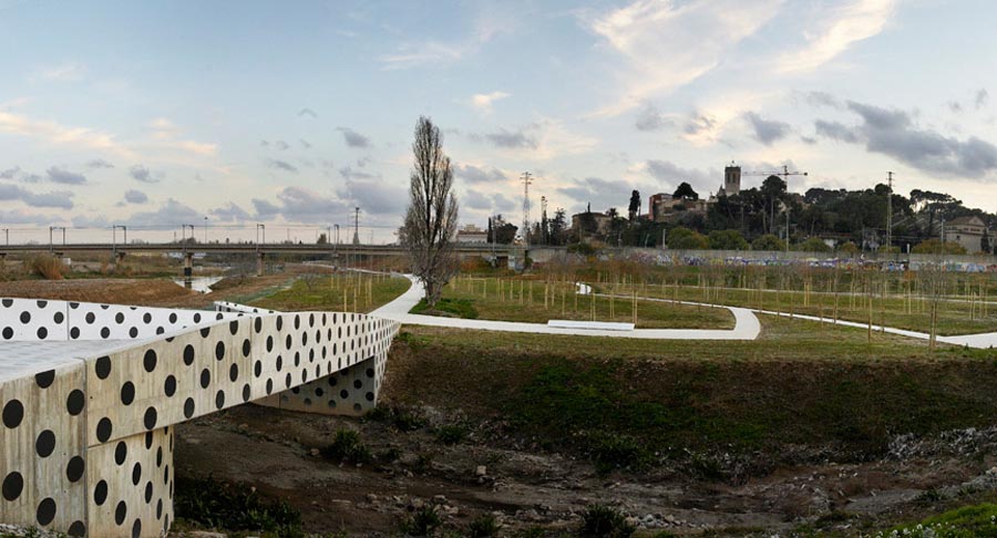
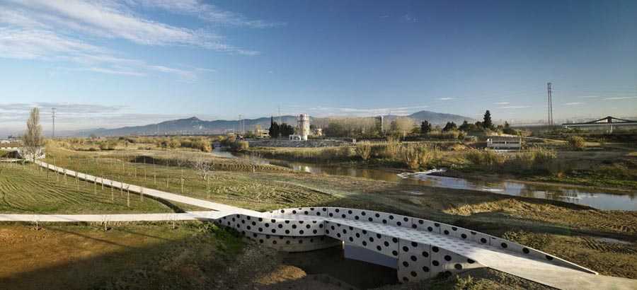
Again, the activities aiming at conquering the river as public space have concentrated on providing access and mobility along its bank. It has been necessary to intervene with the service road that ran along the top of the river’s retention dyke and that was interrupted at many points by the presence of different superimposed elements of infrastructure. Continuity has been given to the route by means of the introduction of bridges and sections of alternative routes. Painted with eye-catching patterns of dots, the new concrete bridges constitute visual landmarks that punctuate the landscape, giving it unity and coherence. There are also more points of access to the riverside walk. At the level of El Prat de Llobregat, a car park has been built so that visitors can leave their cars and enjoy the space as pedestrians, while at Sant Boi de Llobregat a bridge over the motorway connects the old centre of the town with the bank, while also being a privileged vantage point for good views over the river.
Assessment
When the second phase is completed, the network of riverbank routes will connect all the municipalities adjoining the river in an uninterrupted path of some thirty kilometres running from El Prat de Llobregat through to Martorell. Meanwhile, a good part of the River Llobregat has been turned into a park on the metropolitan scale, a public space of huge extension connecting a number of towns and bringing their inhabitants into relation with nature.David Bravo Bordas, architect
[Last update: 02/05/2018]