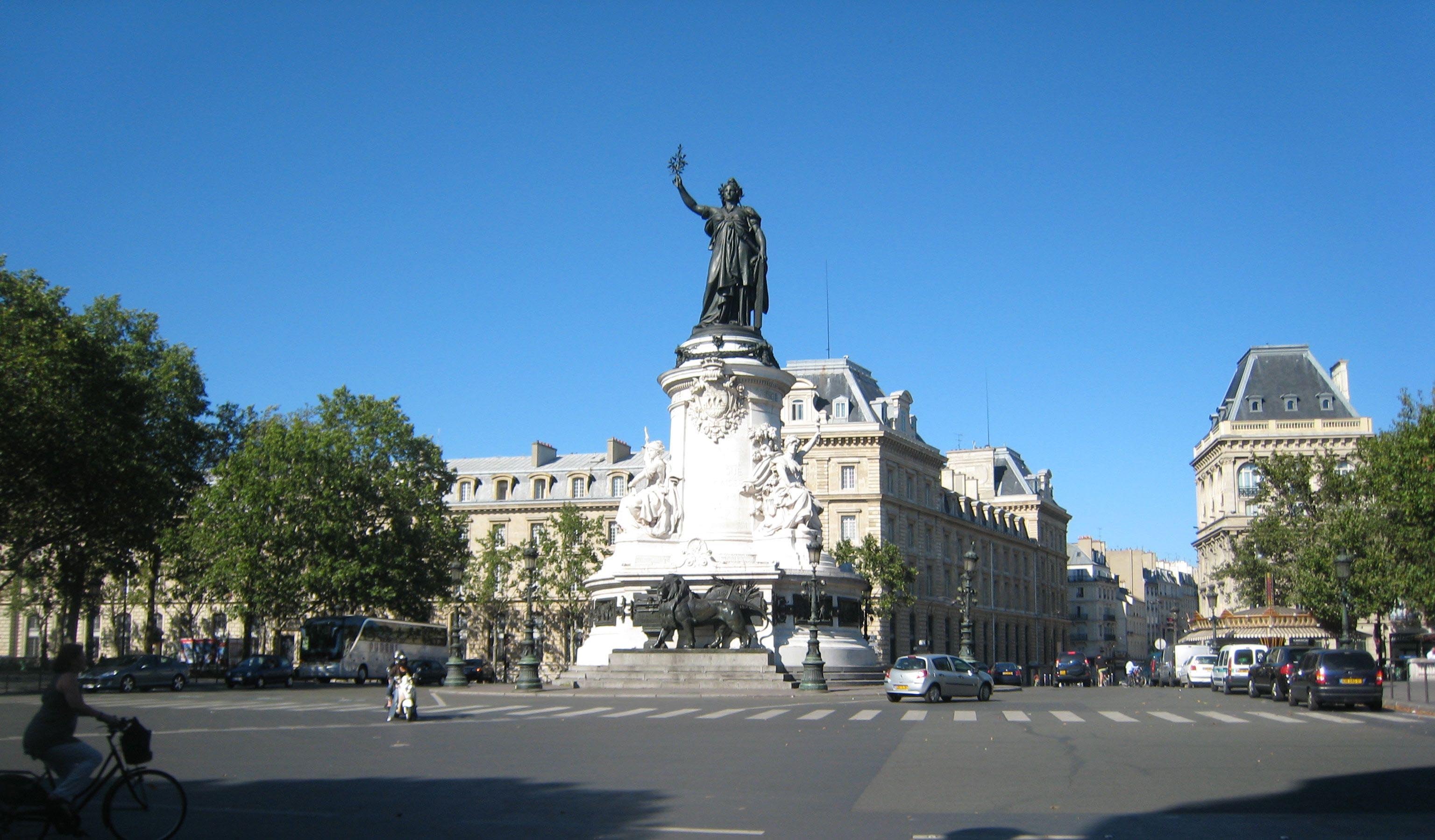
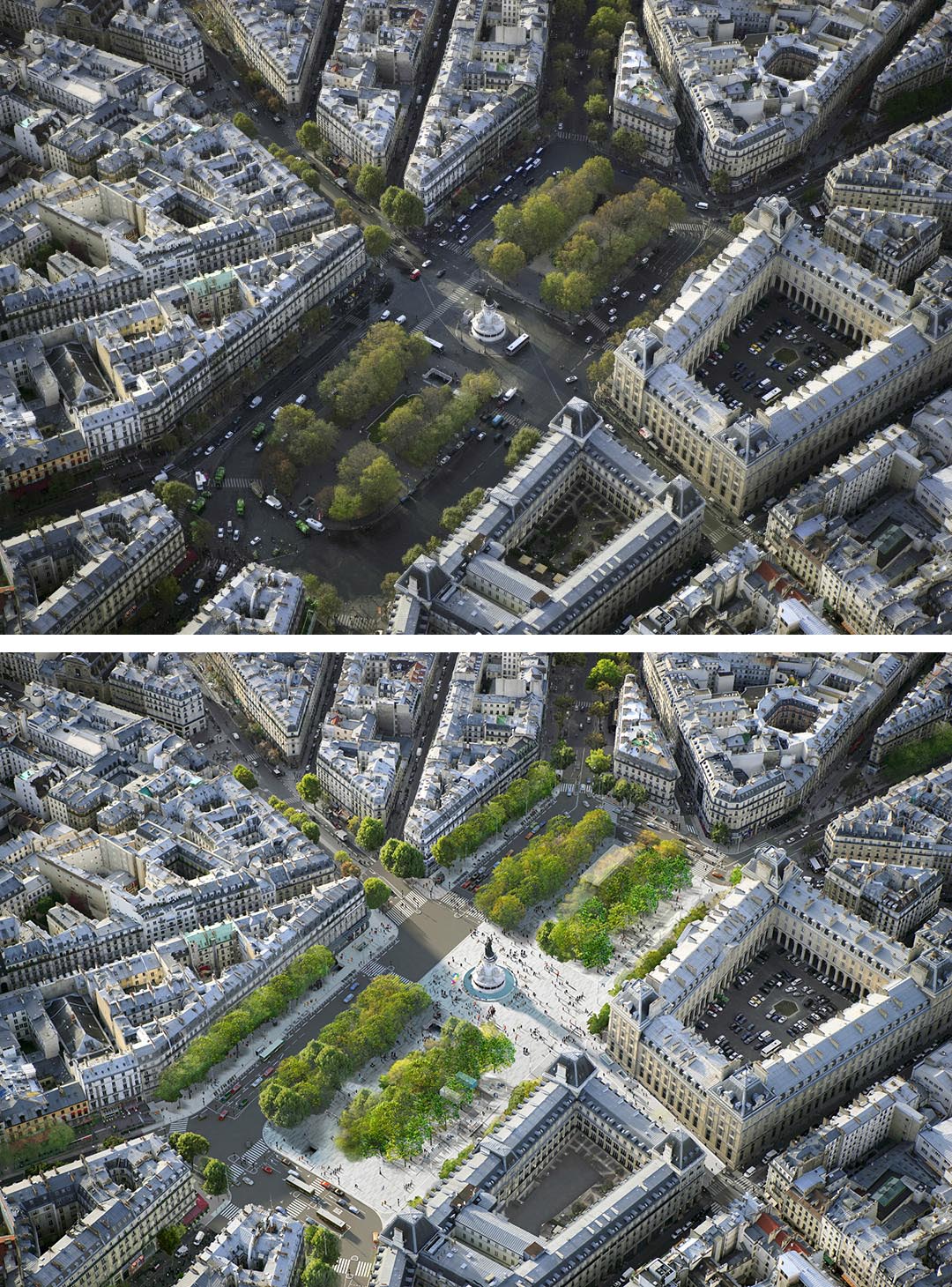

Previous state
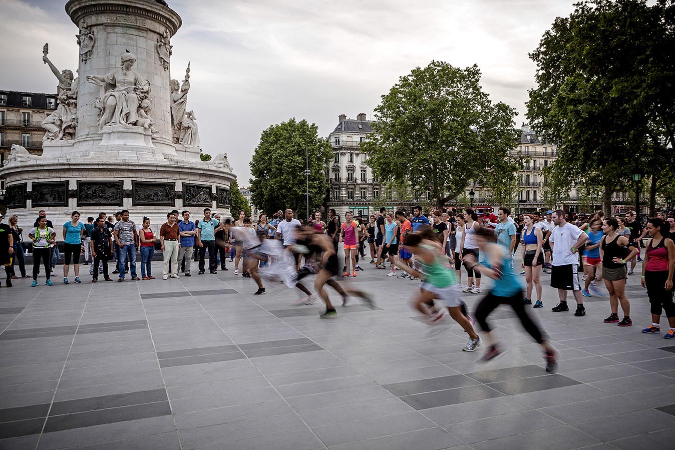
The Place de la République, a result of Georges-Eugène Haussmann’s vast nineteenth-century transformation of Paris, is one of the city’s main squares and not only because of its name, which means that it is the symbolic epicentre of trade union and left-wing demonstrations, or because of the fact that its dimensions ensure that it occupies a prominent place in the Parisian collective imaginary. It is also one of the nerve centres of the city’s transport system, where three districts meet, together with five Metro lines and several main roads, for example the Voltaire, Temple, Magenta and Saint-Martin boulevards.
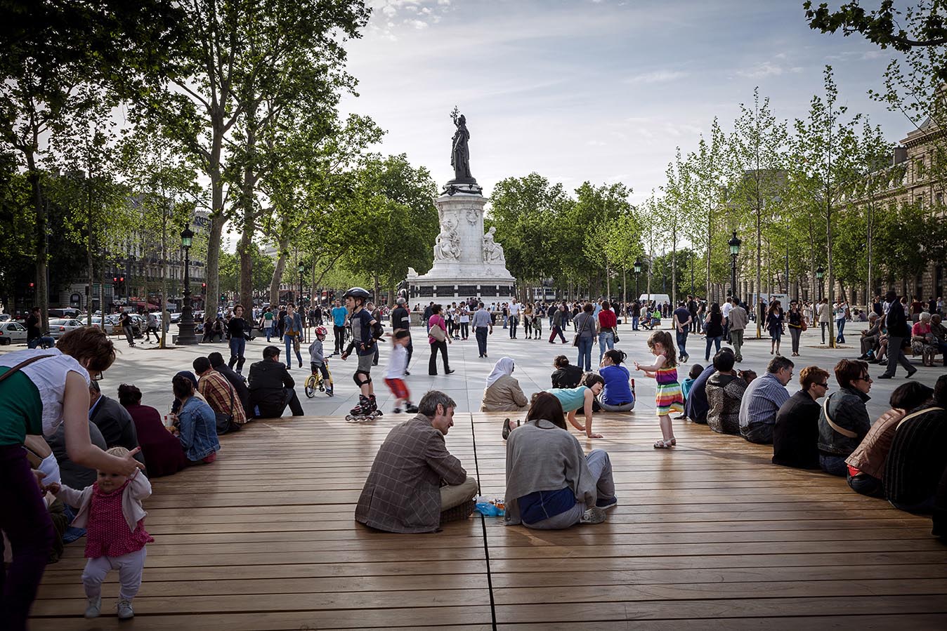
Nevertheless, in the twentieth century, as also happened with the Étoile, La Concorde, La Bastille and La Nation squares, the Place de la République ended up becoming a big traffic roundabout. Two thirds of its rectangular surface, which is more than two hundred and eighty metres long by almost one hundred and twenty wide, were used for vehicular traffic. Pedestrians hardly dared to walk along its edges, while the twenty-five-metre high Château-d'Eau fountain presiding over the square was diminished in this setting to become a mere decoration in the centre of the roundabout.
Aim of the intervention
In 2010, the Paris City Council earmarked twelve million euros for renovating the square. The chief aim of the intervention was to make its metropolitan significance fit with the quality of life in the four neighbourhoods opening onto it, Arts-et-Métiers, Enfants-Rouges, Porte-Saint-Martin and Folie-Méricourt. The plan included rationalisation of the traffic flow in order to take into account other kinds of mobility apart from the private vehicle, and particularly emphasised the goal of inverting the pre-existing proportion of the space used by traffic and pedestrians. A large area was to be made available for a great variety of citizens’ activities, while also highlighting the republican symbolism of the square. The decision-making in the project took the form of a consultative process which, through public events and thematic workshops organised by the City Council, took into account the demands of residents and local businesspeople.
Description
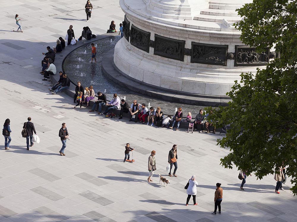
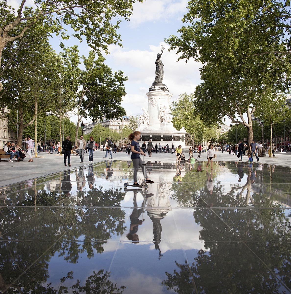
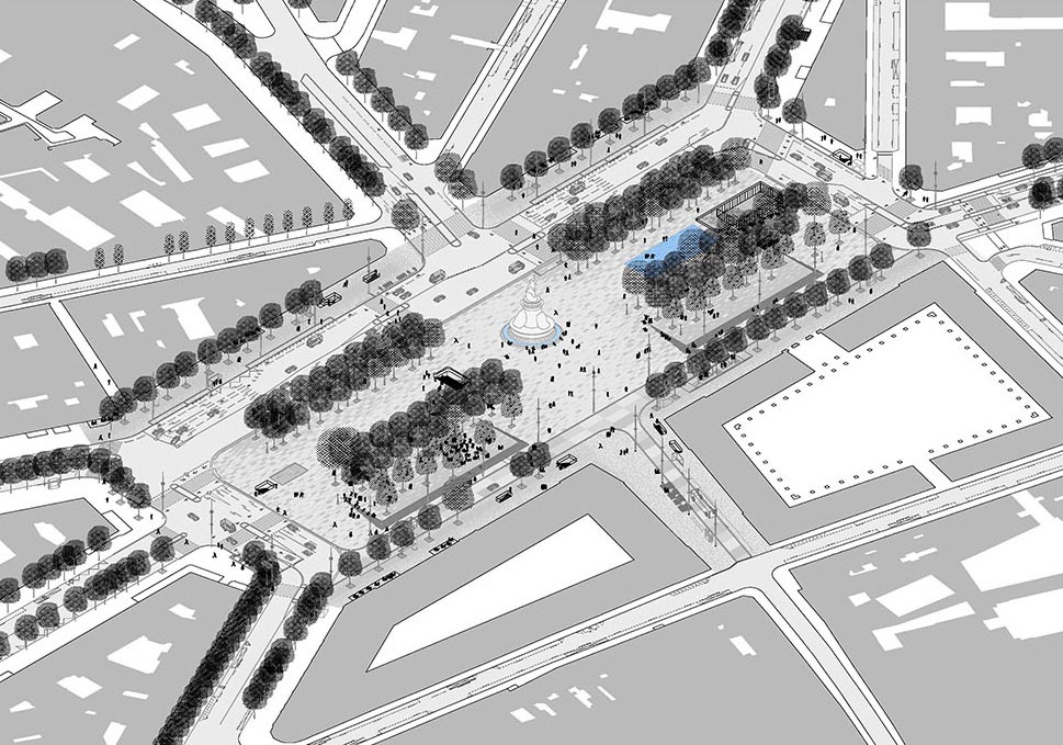
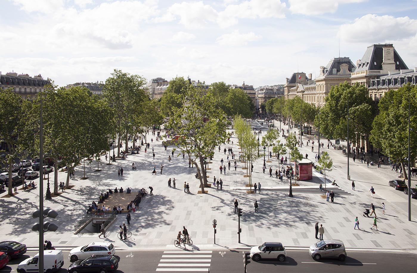
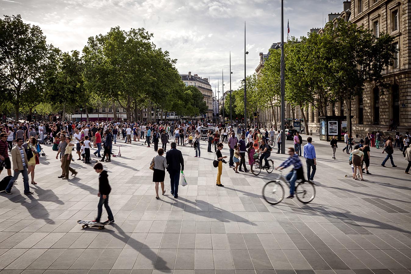
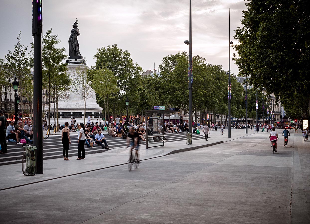
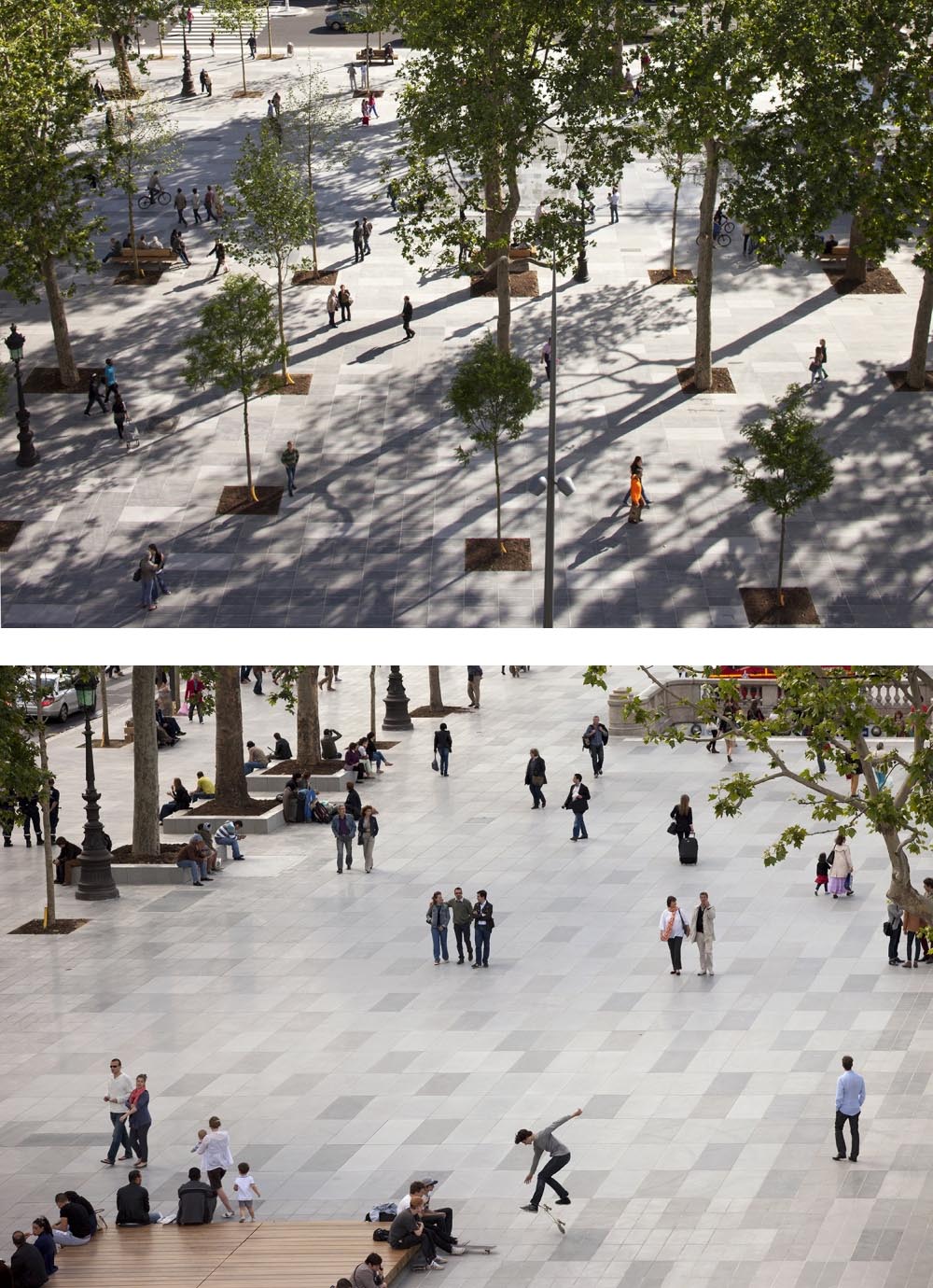
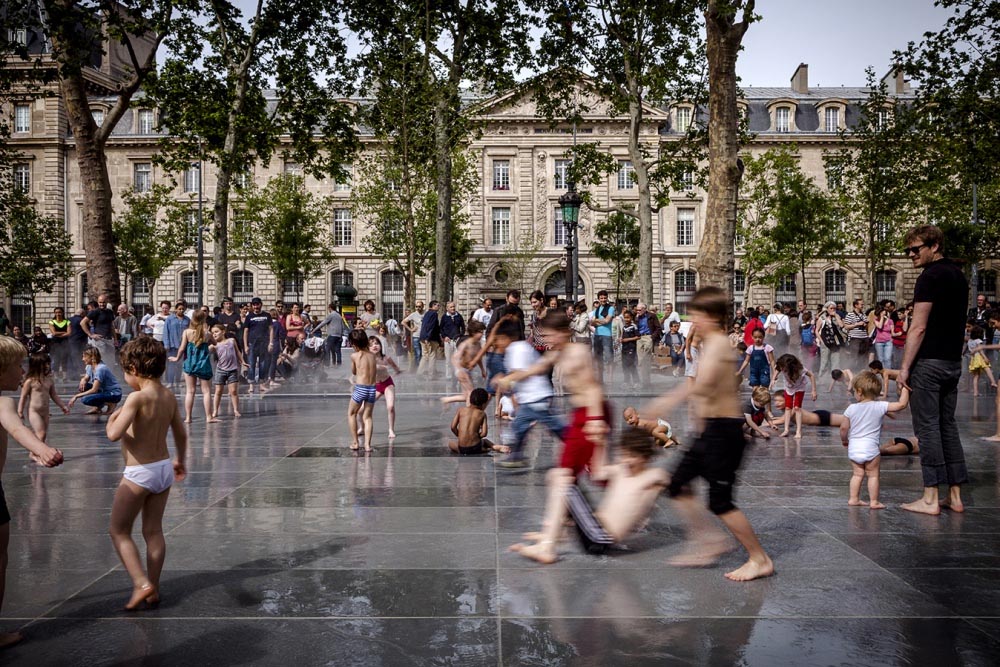
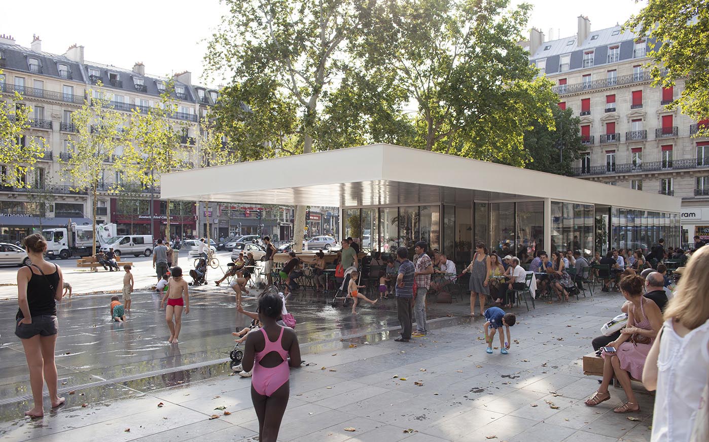
The renovation work has expanded the pedestrian area to almost two thirds of the surface of the square, now occupying some two hectares in the sunniest part on the north-eastern side. The other third, to be used by vehicular traffic, is the shadier part on the south-western side. Hence Temple and Saint-Martin boulevards maintain their continuity through a two-way road, while the rest of the roads flowing into the square have to skirt the central zone which is now for pedestrian use. The neighbourhoods of Porte-Saint-Martin and Folie-Méricourt open directly onto the pedestrian area, and residents of the more central Arts-et-Métiers and Enfants-Rouges neighbourhoods have to cross the road used by cars.
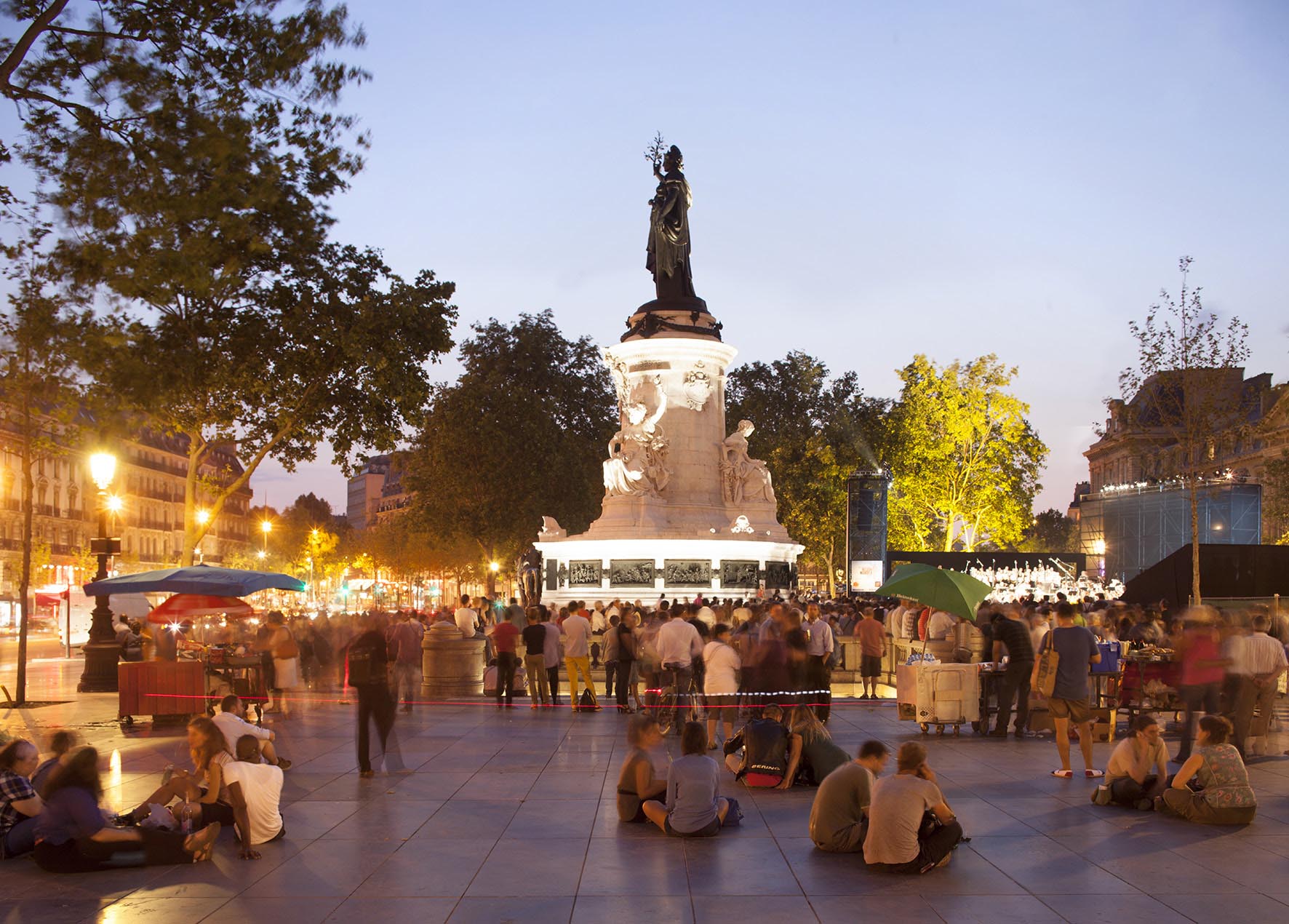
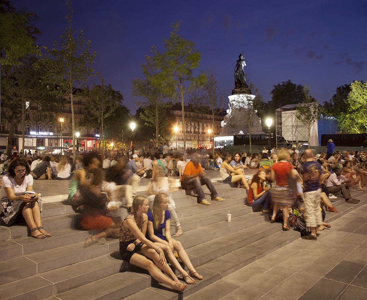
The Château-d'Eau fountain now presides over a large, open and versatile area paved in pale prefabricated concrete slabs which reflect the sun’s rays and are thus cooler in summer. With the same aim of improving the square’s climatic conditions, trees have been planted to offer shady zones and thicker vegetation has been introduced on the northern side to protect it from the icy blasts of winter winds. Sheets of water have also been introduced to cool summer breezes. A kiosk and cafeteria, where meetings and conferences are periodically organised, have also been installed at the northern end of the square.
Assessment
Despite its scale and the centrality of its position, the relevance of this intervention might not seem equally evident to everyone. Over the last decades the cities of Europe have been giving emphasis to public transport, freeing historic squares of the private vehicle and reconstituting them as settings for civic life. In fact, when it was first announced that the Place de la République was to be renovated and traffic restricted so as to make the space available to the citizens there was a great outcry in the media with more than a few apocalyptic voices predicting imminent traffic collapse in Paris. Yet, once the renovation was completed, the traffic continued to flow and, not only that, but the city has made a clear step forward in a commitment to more sustainable and just mobility. It is to be hoped that this example will be followed in other equally symbolic and central squares of the city, for example Place de l’Étoile, Place de la Concorde, Place de la Bastille and Place de la Nation.
David Bravo │ Translation by Julie Wark
[Last update: 21/01/2022]