

Previous state
Kalvebod Brygge (Kalvebod Wharf) is an old port area on the northern side of the canal in the Vesterbro district of Copenhagen and very near the old city centre. For almost a century, a strip of the wharf consisting of land reclaimed from the sea was trapped between the canal and the railway lines coming into the central station. In the 1990s, the area underwent a large-scale process of urban transformation that aimed to save it from marginality and to make the most of its central location. This entailed ceasing its commercial and industrial activities and giving it a more civic character and opening it to the city. However, the urban plan designed with this project in mind ended up being slapdash and ill-conceived. Office blocks, a convention centre with a capacity of 4,000 people, several hotels with hundreds of rooms, and a big shopping centre facing away from the port came together in a messy amalgam of free-standing buildings that had not taken advantage of this chance to create high-quality public spaces.
At the turn of the century, the complex was completed with an artificial island separated from the wharf by a narrow canal. The new addition included a series of residential buildings, which brought to the zone a mixture of uses and more local activity outside working and trading hours. Moreover, a bicycle and pedestrian bridge was constructed in order to connect the island with the harbourfront area of Islands Brygge (Iceland Wharf) with the other side of the canal and Amager, Copenhagen’s most populated island. Yet the complex was still badly connected with the rest of the city’s urban fabric.p>
Aim of the intervention
In 2010, the City Council announced its goal of turning Copenhagen into the “best city for bicycles”. The aim was that, in five years, this means of transport would improve its figures for home-to-work trips from 38% (2010) to 50% (2015). The announcement was part of the holistic “CPH 2025 Climate Plan” which envisaged contributing to the struggle against global warming and, by 2025, becoming the world’s first carbon neutral capital.
Among other measures, the plan aimed at a considerable drop in the use of private cars, to such an extent that 75% of urban trips would be done on foot, by bicycle, or with public transport. In addition to responding to the climate crisis, the plan also sought to promote a healthy lifestyle by encouraging physical exercise—and hence mobility based on walking or pedalling—and reducing noise and atmospheric pollution. Incentivising the use of bicycles meant that cyclists had to feel safer and a drop in numbers of injured cyclists, from 120 in 2005 to fewer than 40. One of the best ways to achieve this was to offer cyclists safe lanes and better infrastructure for overcoming topographic and architectural obstacles. In this regard, there was a clear demand for an exclusive bicycle lane that would complete the route along the length of the port, from Islands Brygge to Kalvebod Brygge. Just after the Brygge Bridge, which was already in use, cyclists were faced with the laborious climb up an incline of more than five metres high in order to reach Kalvebod Brygge. Hence, in 2010, the City Council called for entries in a competition to construct a bicycle bridge with a discreet presence and easy slope.
Description
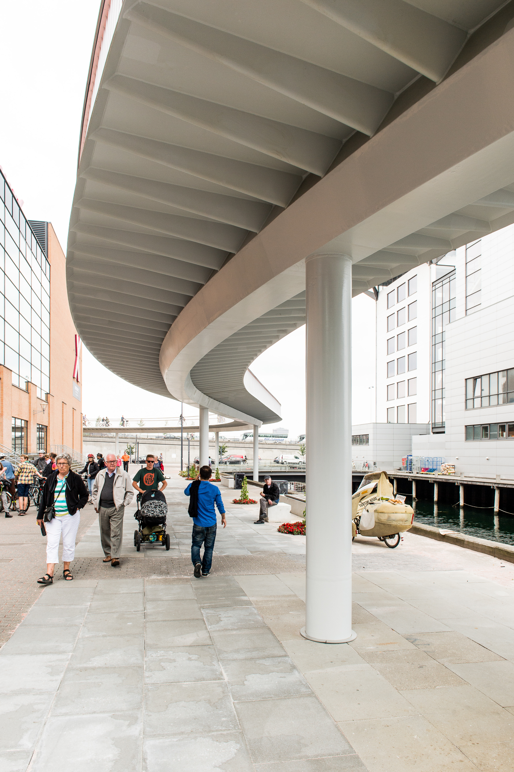
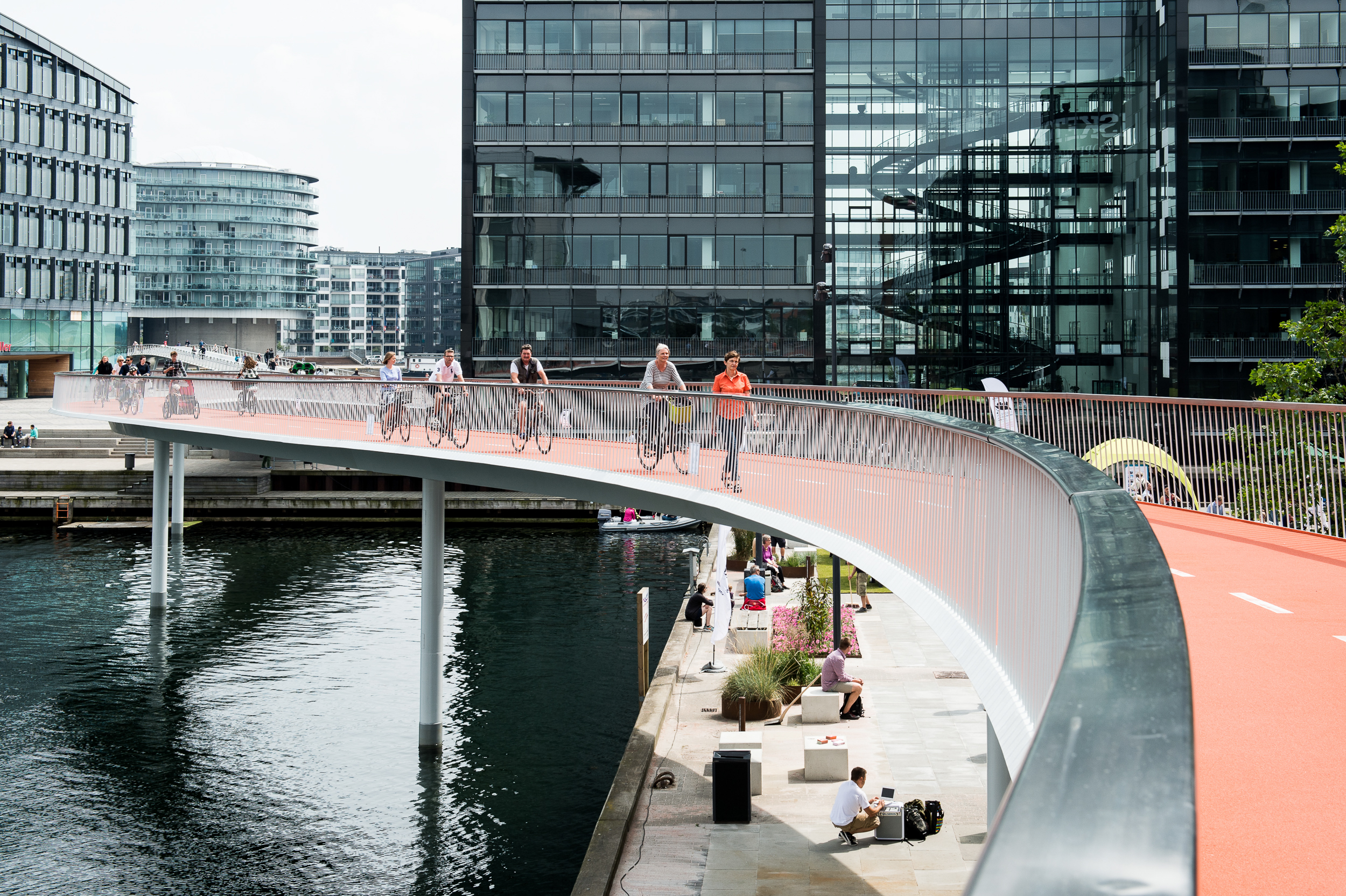
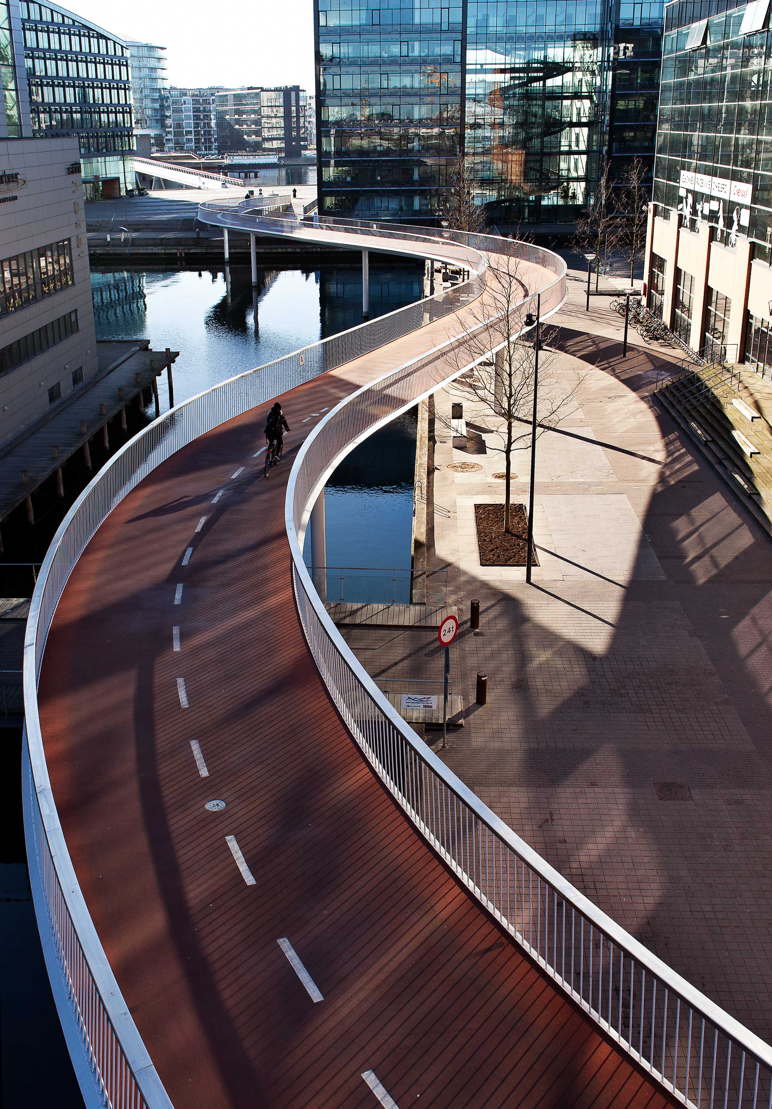
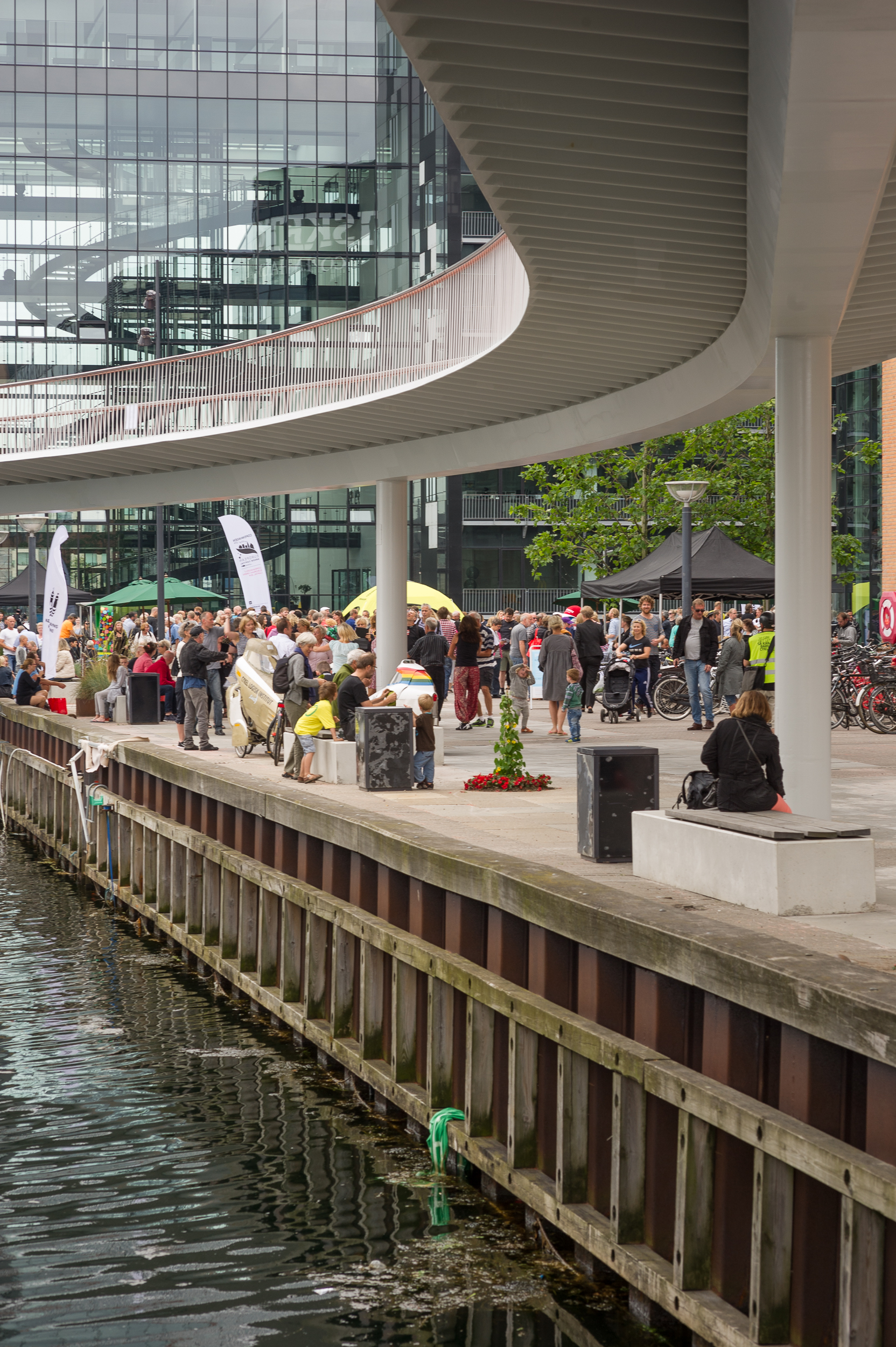
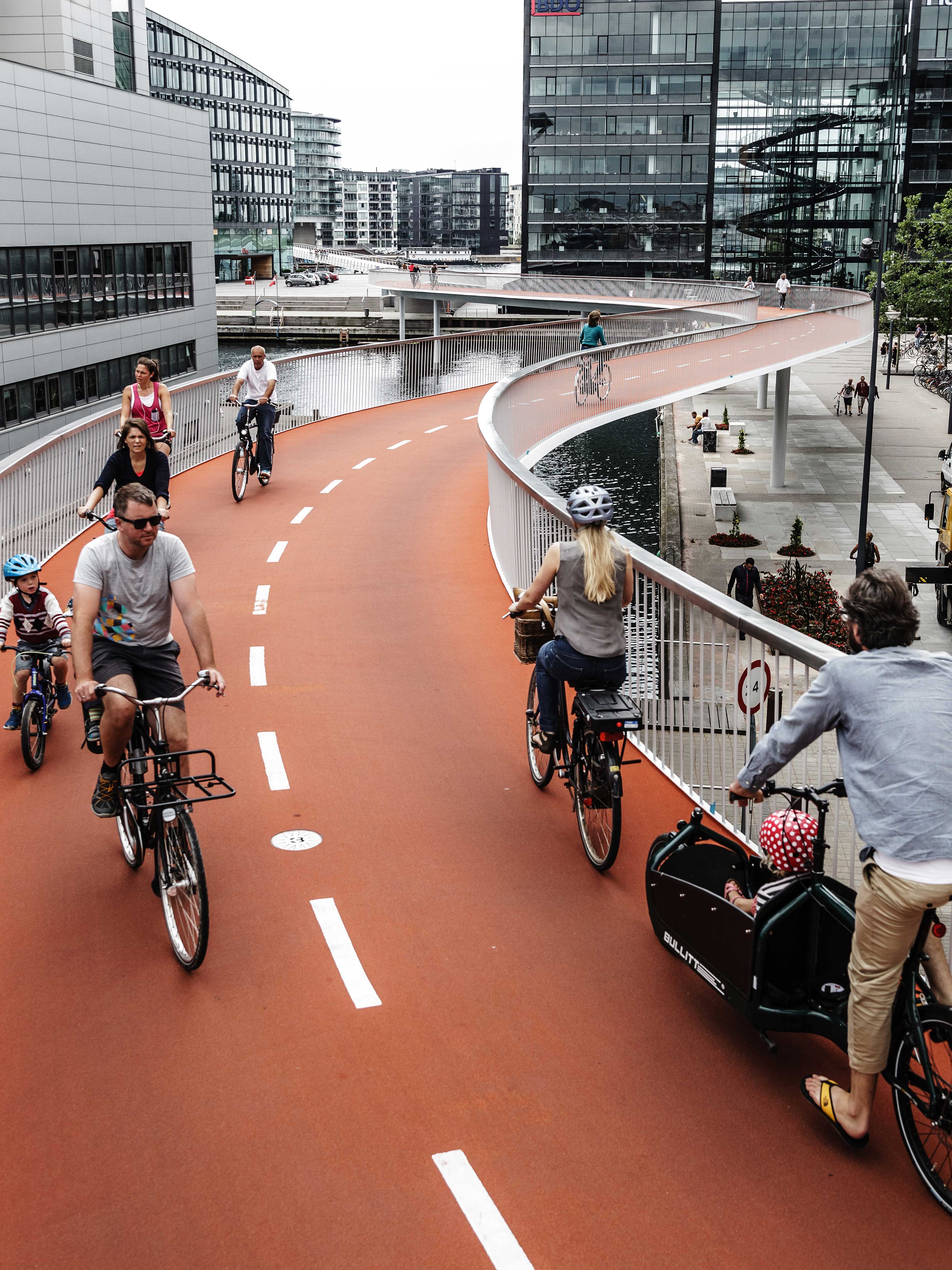
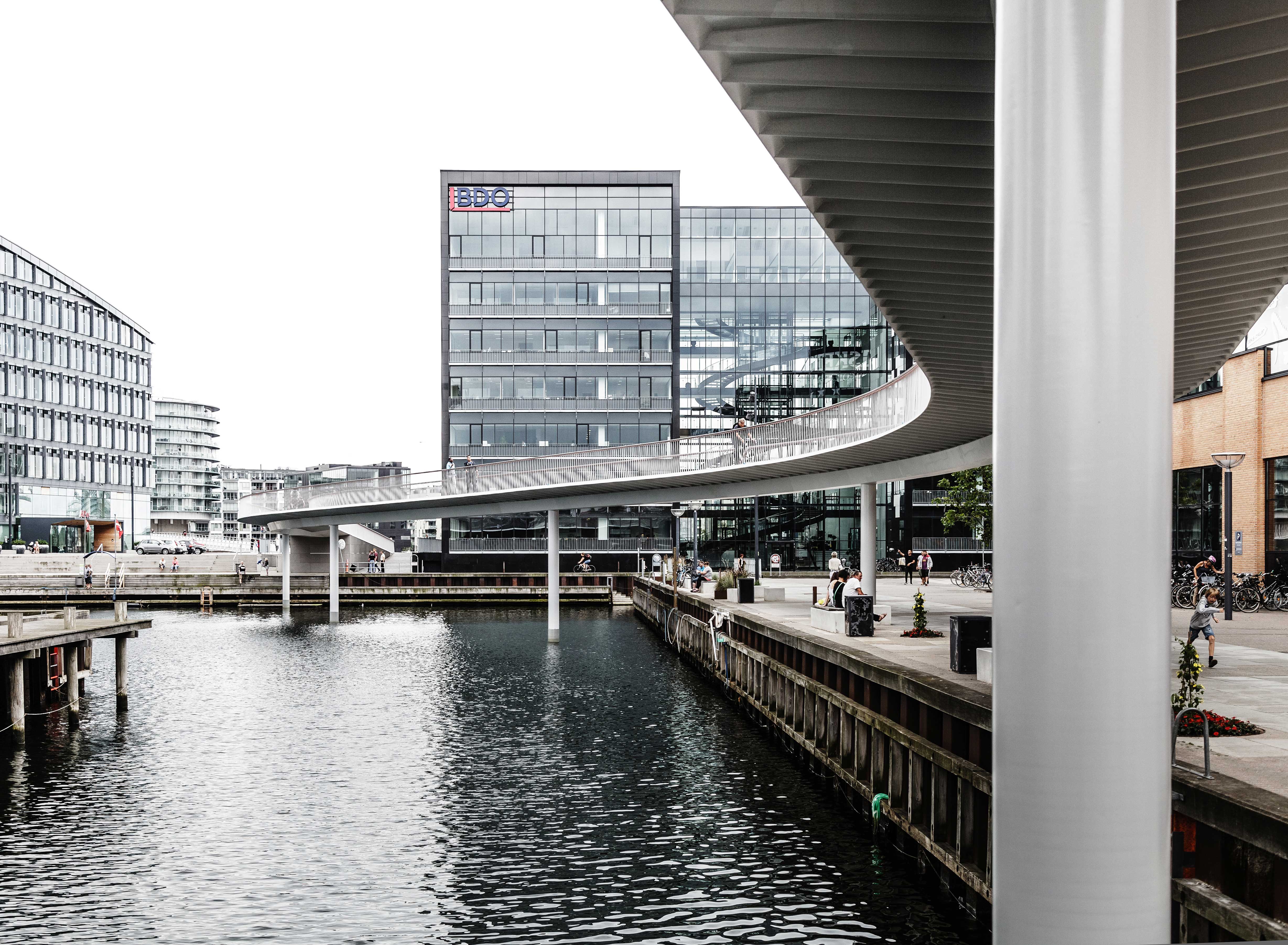
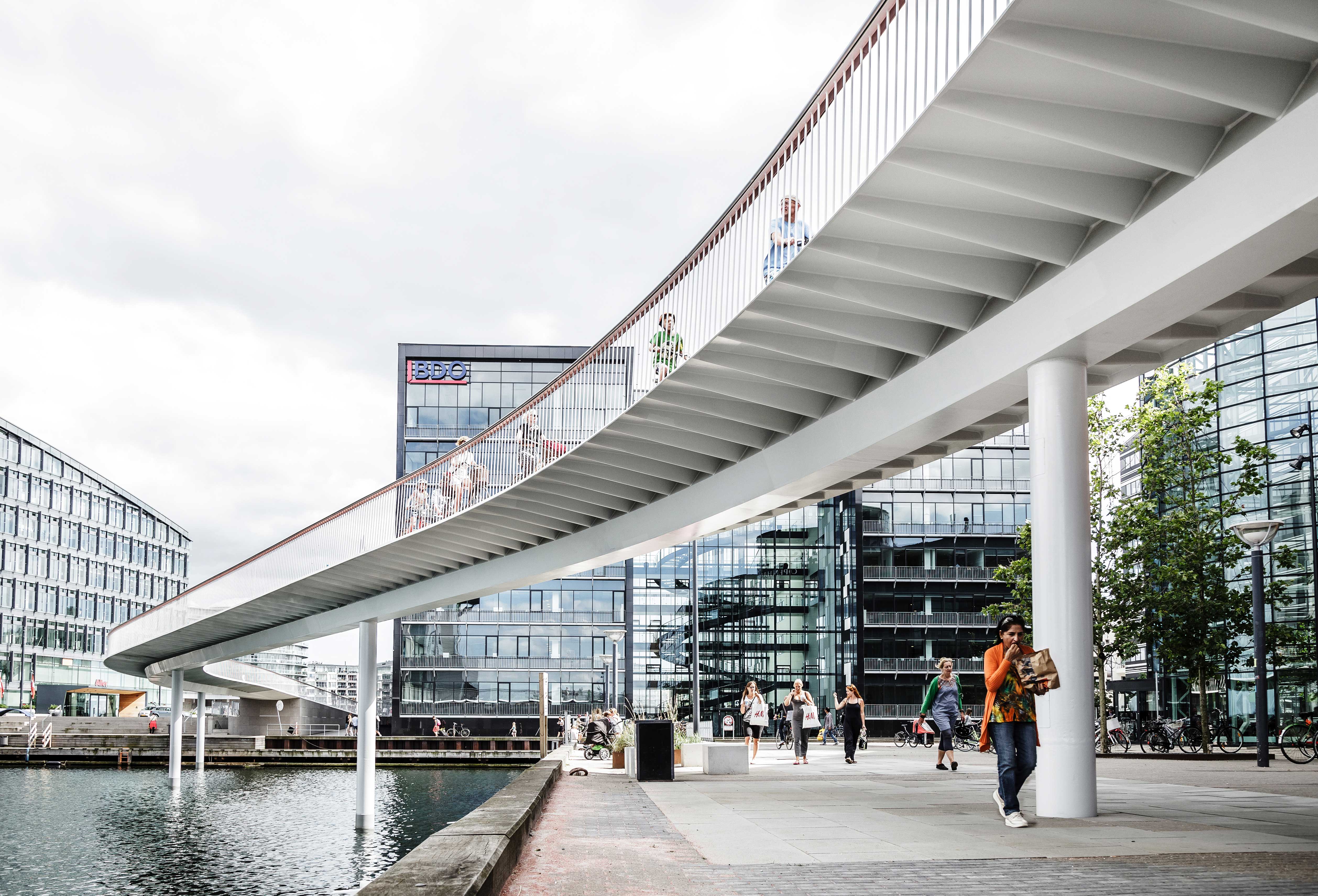
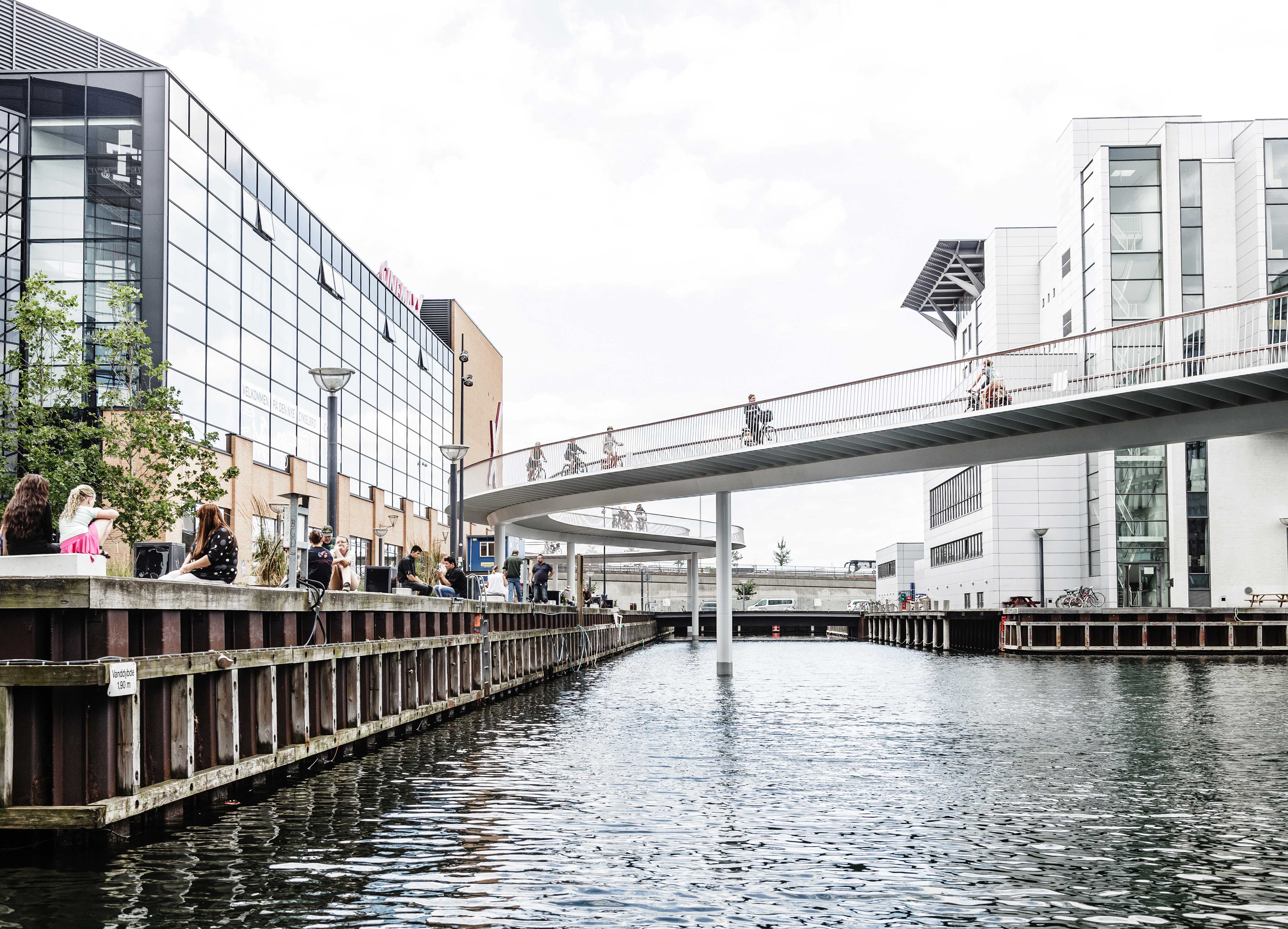
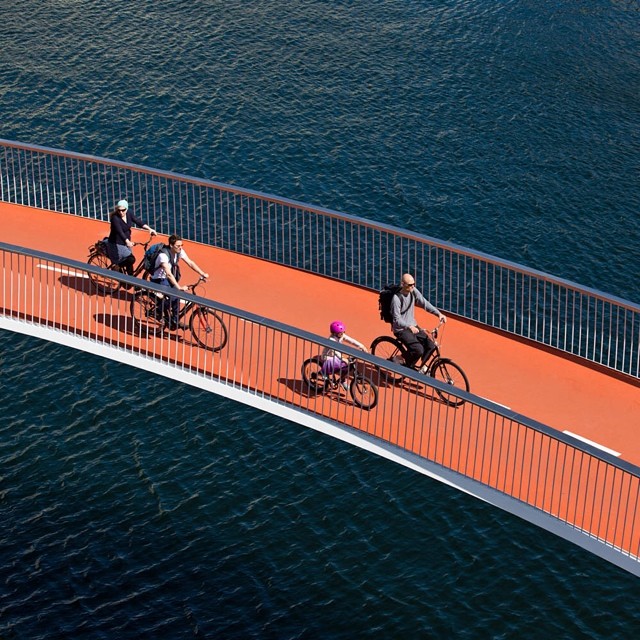
The winning proposal was called “Cykelslangen” (Cycle Snake) and cost five million euros. This is a bridge which, with subtle curves, winds along 230 metres to cover the five-metre gap with a gentle rise. Far from being random, its undulations avoid buildings, reduce the slope of the ramp, and ease the speed for cyclists on the way down. Almost five metres wide, the bridge is protected by stainless steel railings equipped with low-consumption LED lights. Surfaced with orange asphalt, the bridge flooring is supported by a longitudinal steel beam resting on metal pillars every seventeen metres. The spacing between and slimness of these vertical supports let pedestrians move freely under the bridge safely and without obstacles.
Assessment
Opened in 2014, the “Cykelslangen”, together with the pre-existing bridges, represents the culmination of the first transversal connection with the port of Copenhagen to be opened in the last fifty years. The strategic value of this connectedness explains why 12,000 cyclists use it every day. This success in terms of numbers of users, and its pleasing undulations have made it one of the most outstanding icons of the “best city for bicycles”. It is one more lively example of the collective benefits of “Copenhagenisation”, a term used by Danes to refer to policies that make cities more accessible for pedestrians and cyclists, and less dependent on cars. Too many cities still fall into the traps of the automobile industry which, thanks to its hegemony in terms of propaganda, is taking over the concept of “sustainable mobility” with supposedly ecological alternatives like the electric car. Fortunately, Copenhagen has shown the way to real sustainability with solutions like “Cykelslangen”, which are not only more ecological and just, but also more economical, viable and enjoyable.
[Last update: 21/10/2020]