
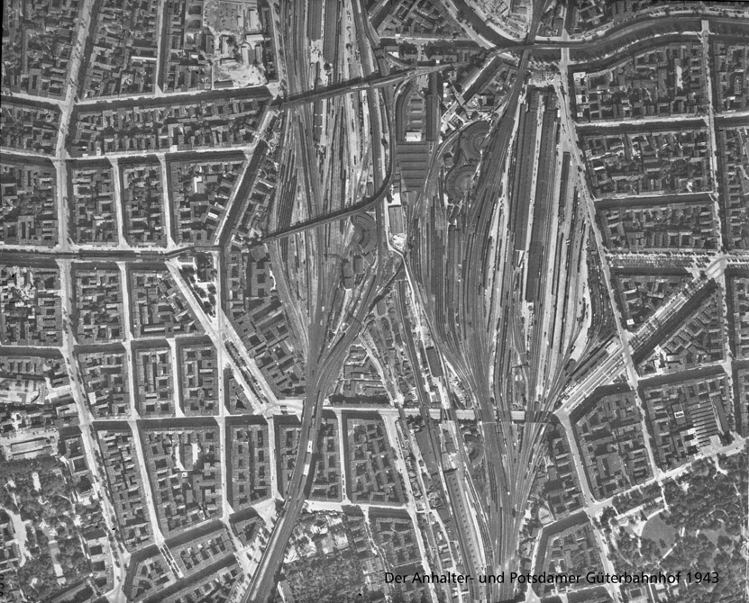

Previous state
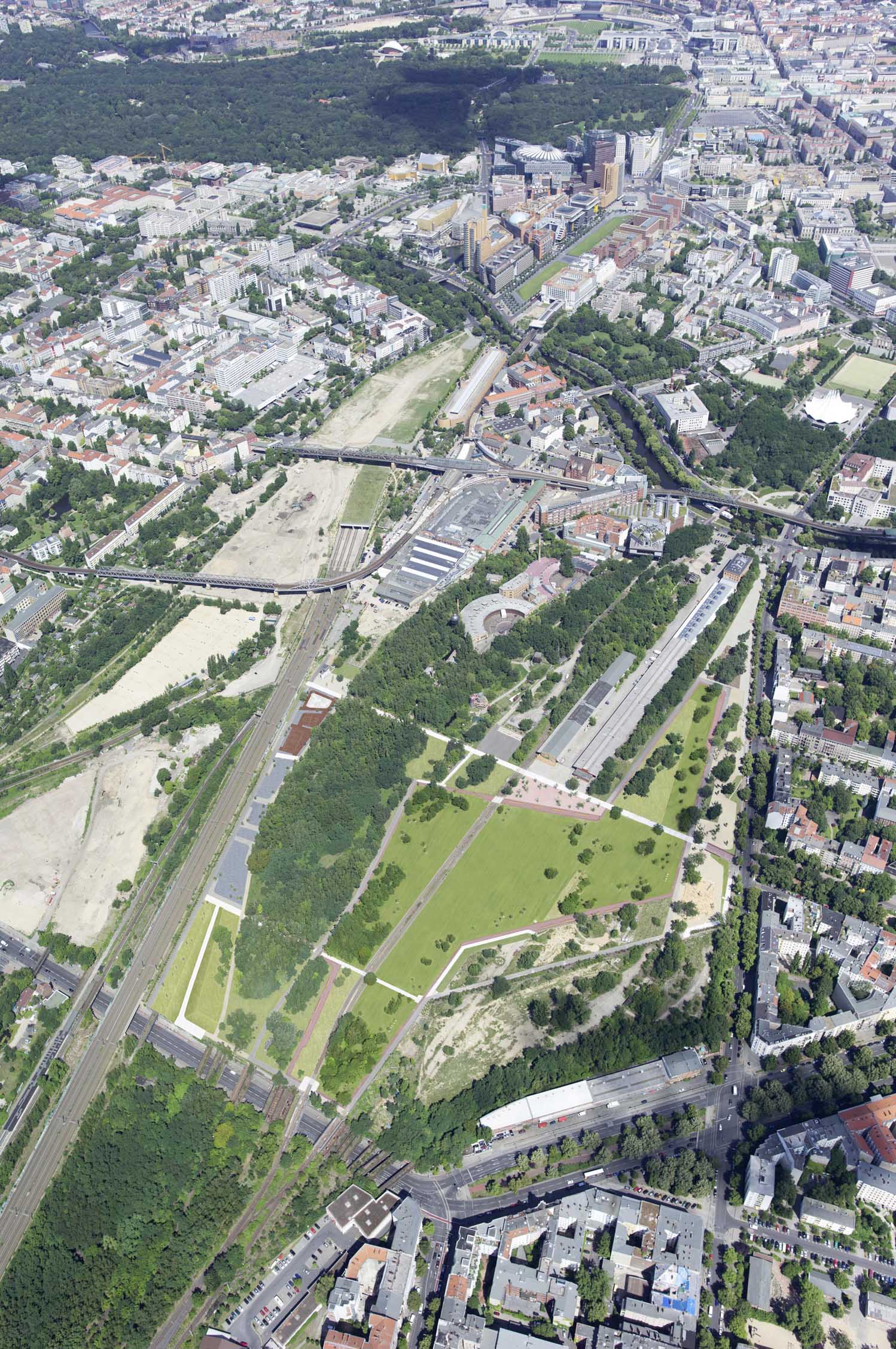
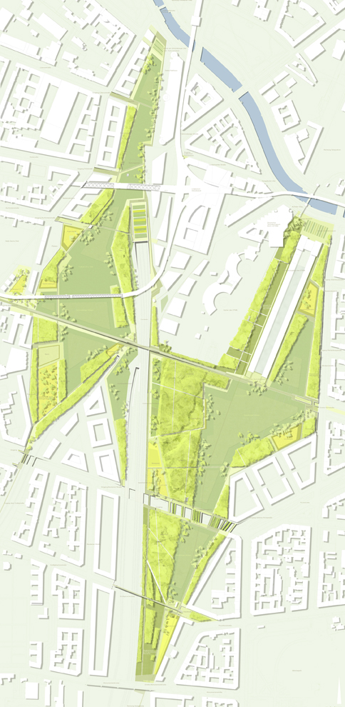
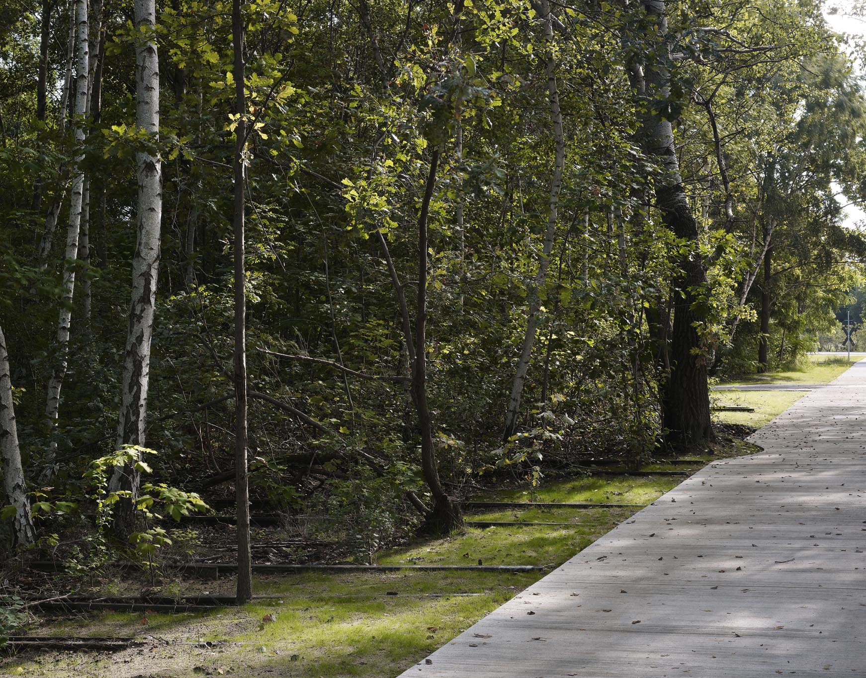
Just over a kilometre south of Potsdamer Platz, near the left bank of the Landwehr Canal, an extensive, triangular-shaped area of waste ground once separated the neighbourhoods of Kreuzberg to the east and Schöneberg to the west. Known as Gleisdreieck, meaning “triangle of rails”, it was formed by the intersection of different railway lines that had entered Berlin from the south since the mid-nineteenth century. Railway lines, sheds and warehouses of three old railway stations located in very close proximity ─Dresdner Bahnhof (1875-1882), Potsdamer Bahnhof (1838-1944) and Anhalter Bahnhof (1839-1952)─ accumulated on a raised platform of some twenty hectares at a height of four metres above the city level.As the infrastructure gradually ceased to be used the whole area became increasingly run down and neglected, to the point of being used as a rubbish tip after 1945. Meanwhile, vegetation took over, turning it into a surprising natural enclave in the middle of built-up territory. The closeness of the Berlin Wall also contributed to the fact that Gleisdreieck was for decades clearly identified as no-man’s-land. Only the homonymous U-Bahn station in Berlin’s underground railway system testified to its existence through its name. Shortly before the fall of the Berlin Wall, however, the German Museum of Technology was installed in the north-western third of the sector, attracting large numbers of visitors and giving visibility to the site. Nevertheless, it was the unification of the city that gave the zone more centrality, whereupon finding a destiny for it became an imperative need.
Aim of the intervention
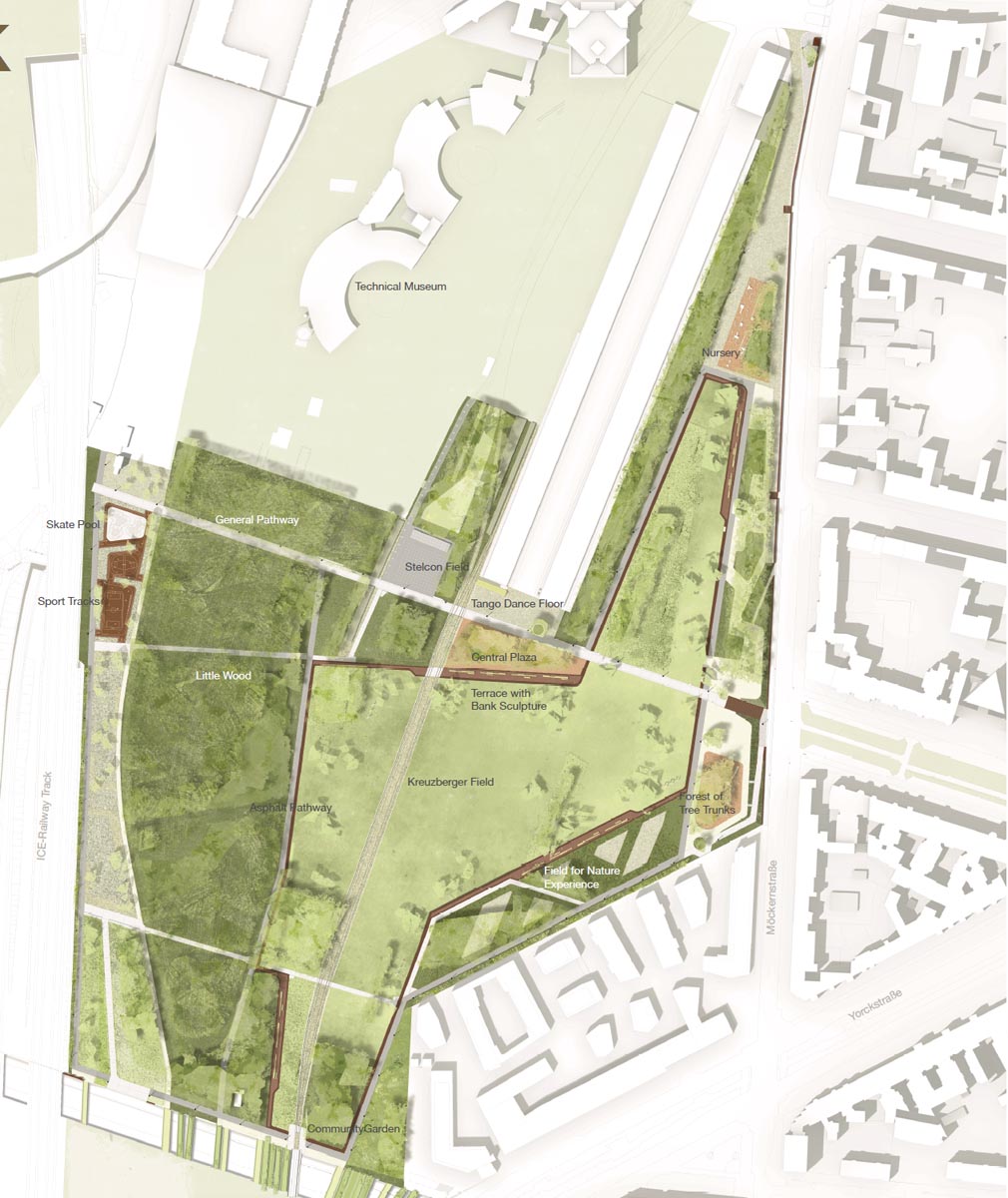
After 2006, the State of Berlin put forward the proposal of converting Gleisdreieck into a large urban park that would integrate the different urban zones which converged there. The problematic, decades-long disconnectedness imposed by the enclave now presented an opportunity for joining the southern area of Potsdamer Platz with Kreuzberg and Schöneberg. The creation of the park would trigger one of the biggest urban expansions inside Berlin, all within a framework of many uses, tempos and social realities. It was necessary to stimulate the development of sixteen new hectares of productive neighbourhoods that would be capable of integrating different generations and social strata around a model of the sustainable city and in harmony with nature. The need to adapt these goals to preserving the pre-existing railway heritage also appeared following intense discussion with local proprietors and residents.Description
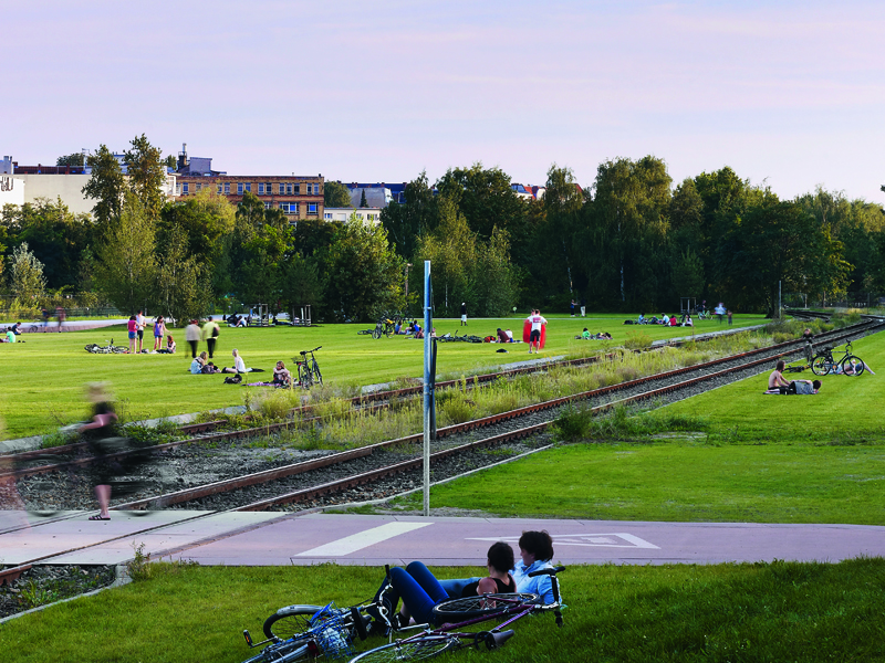
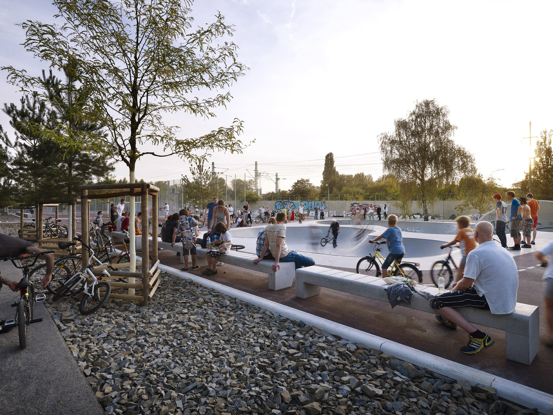
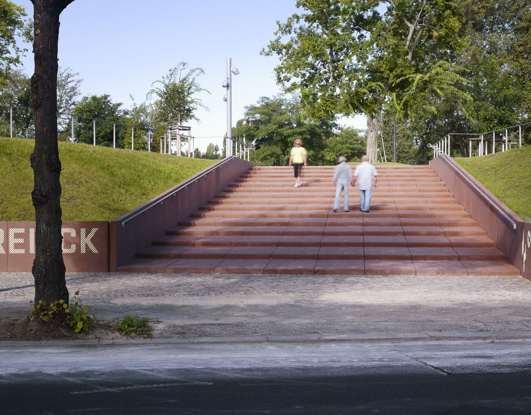
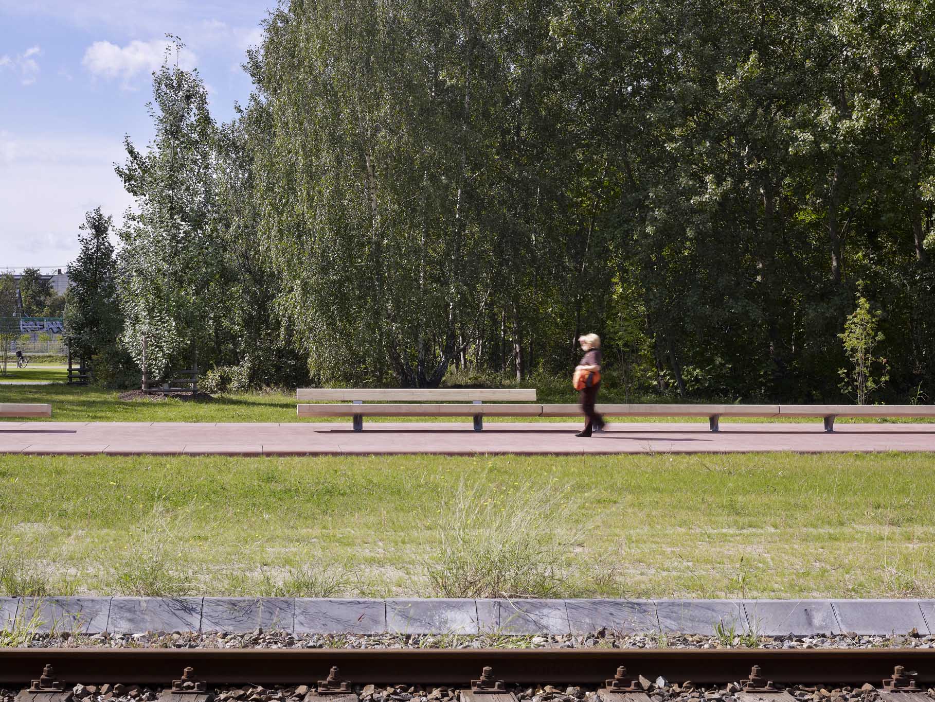
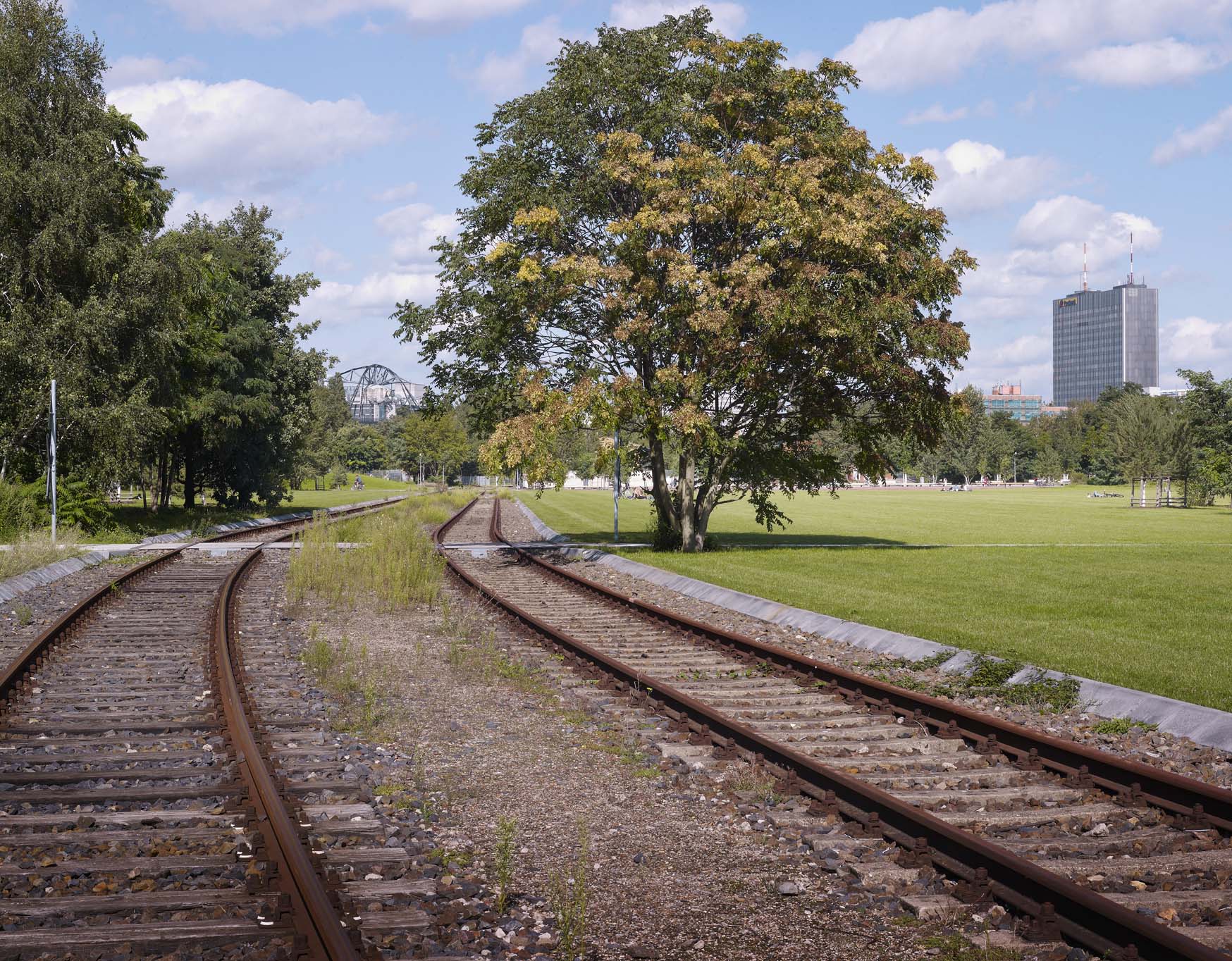
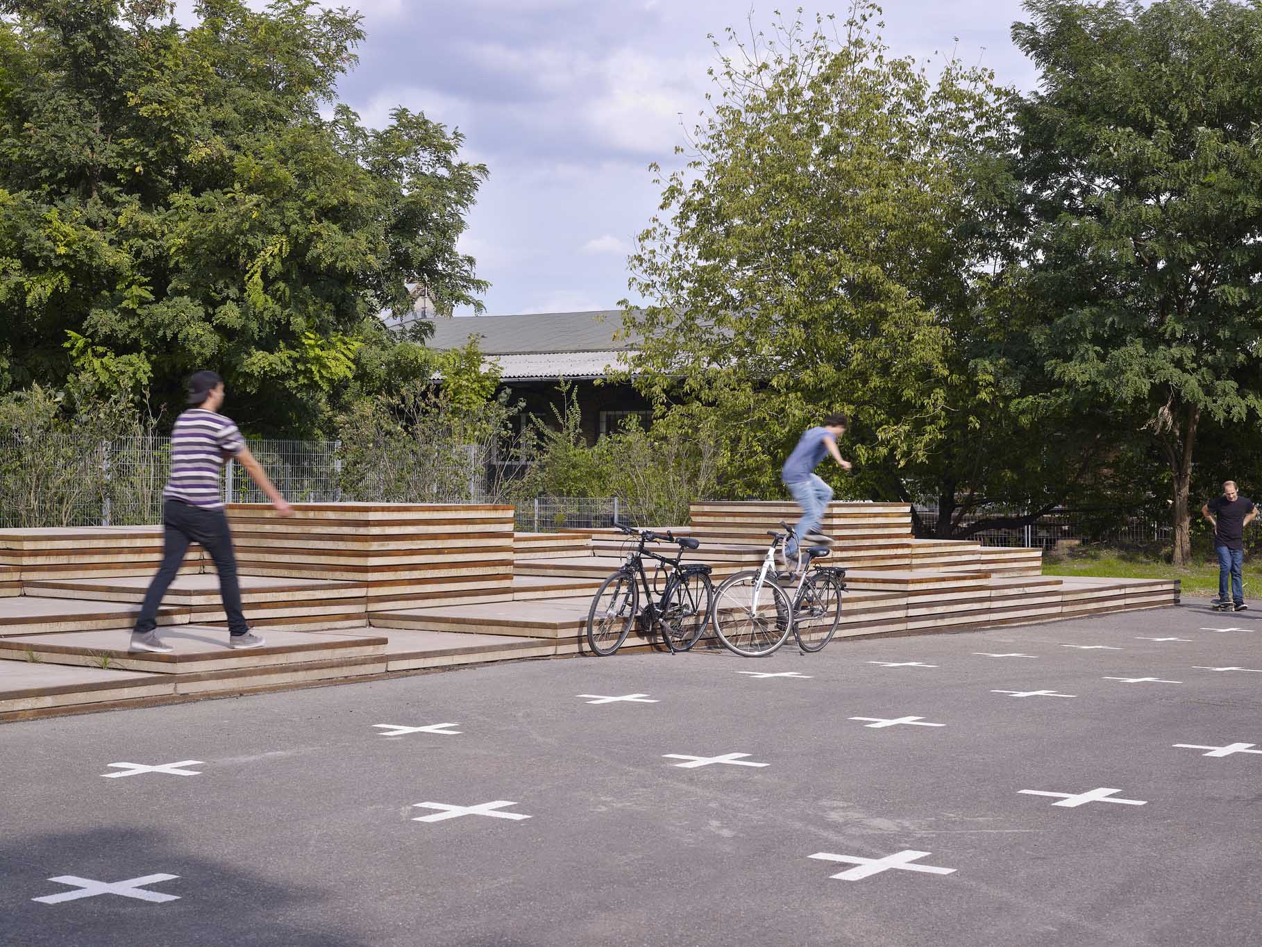
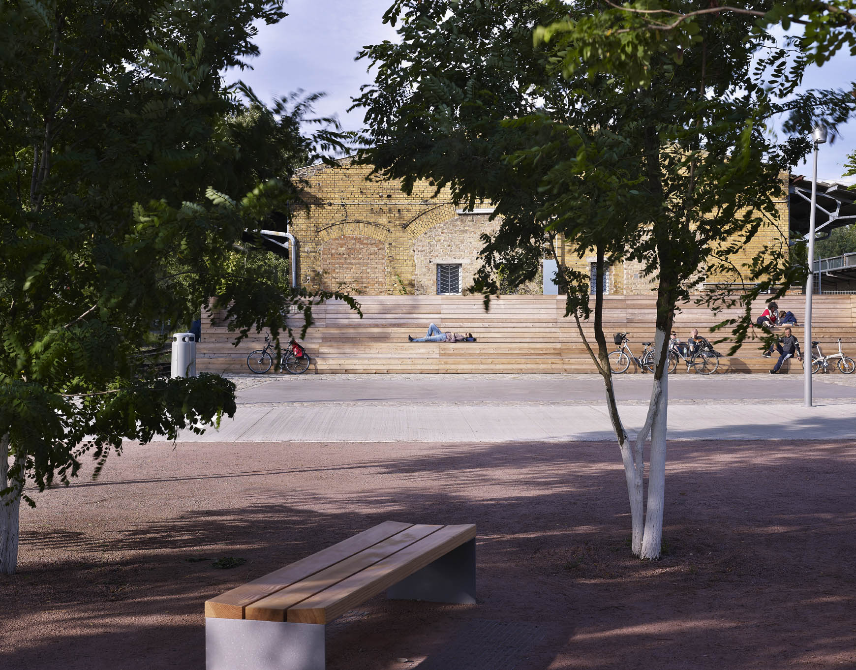
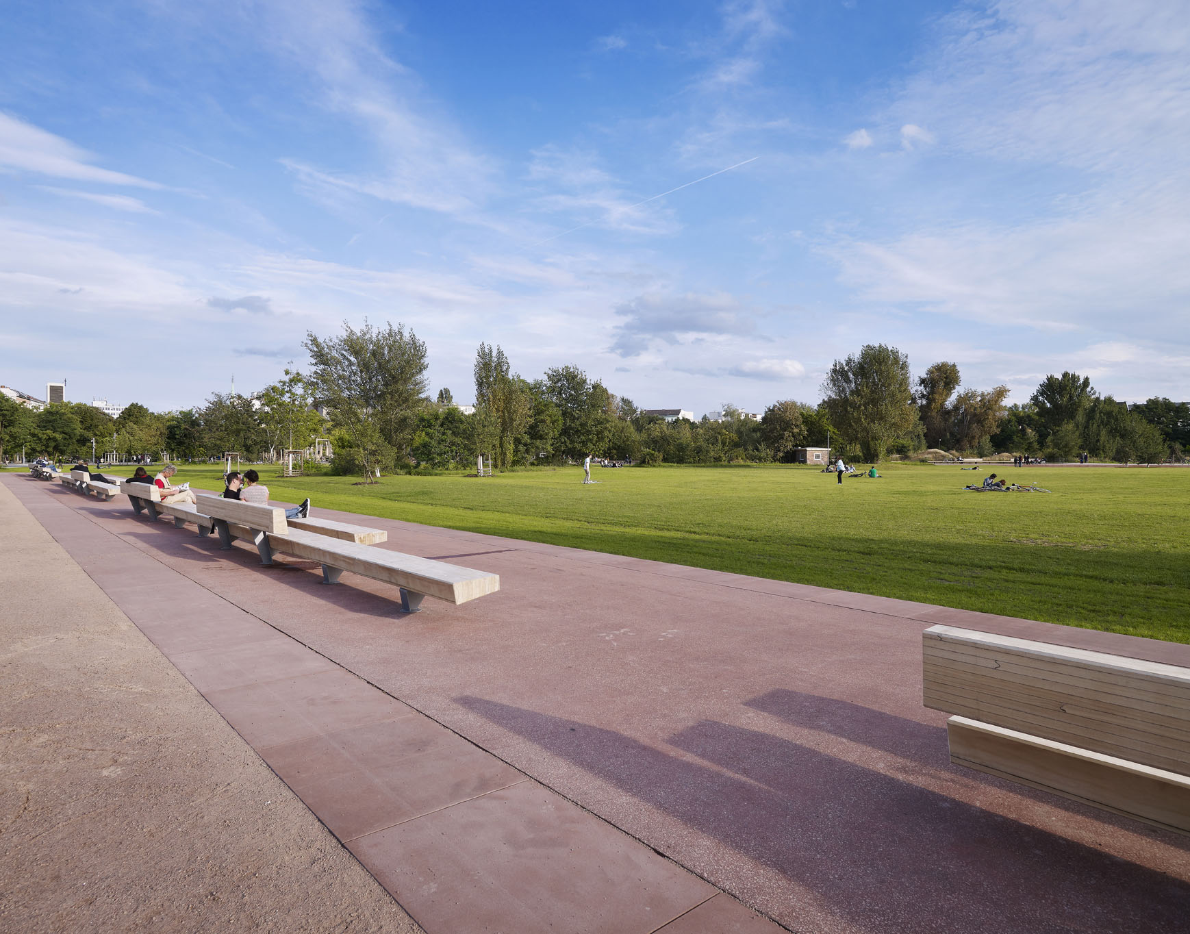
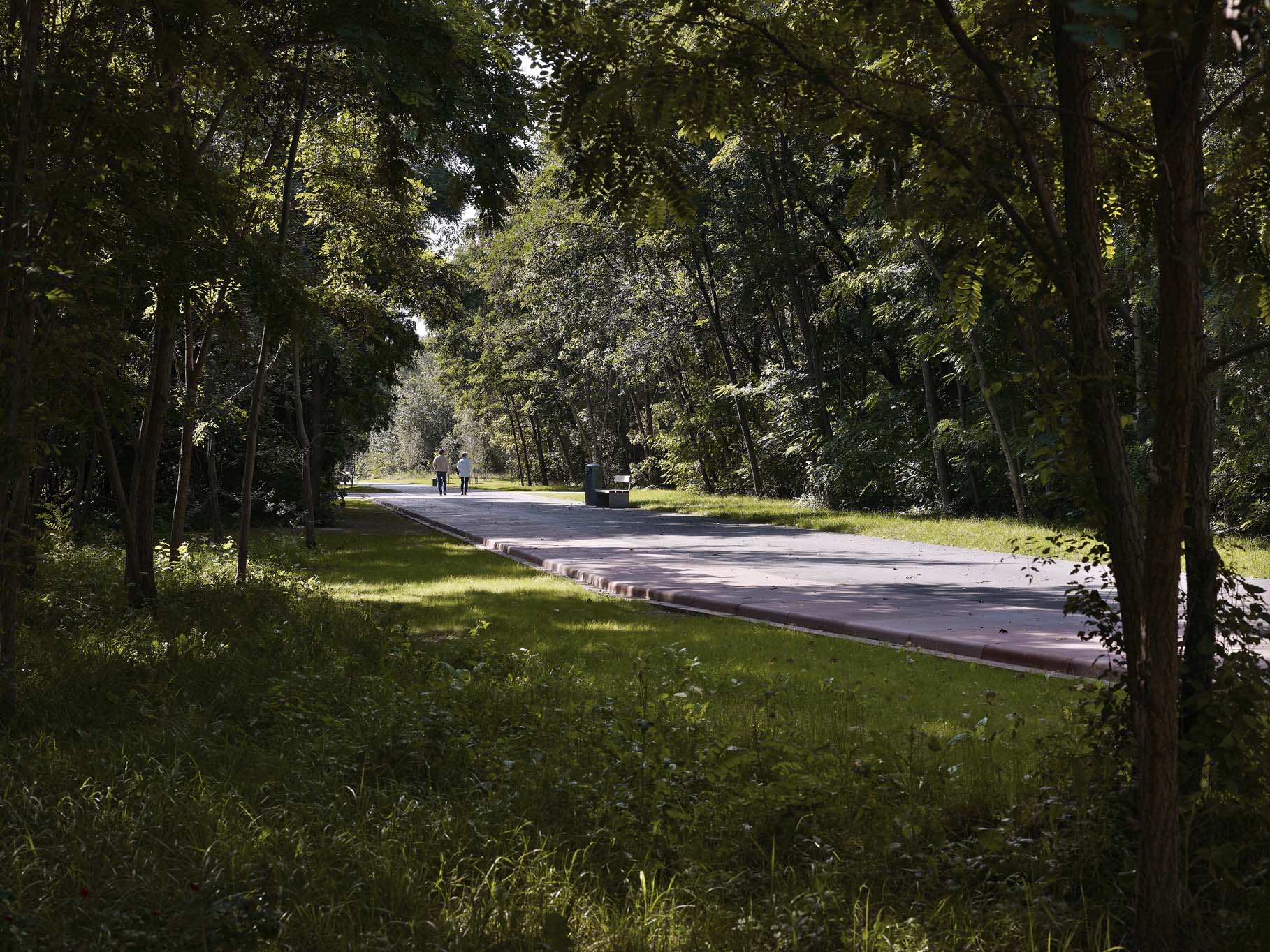
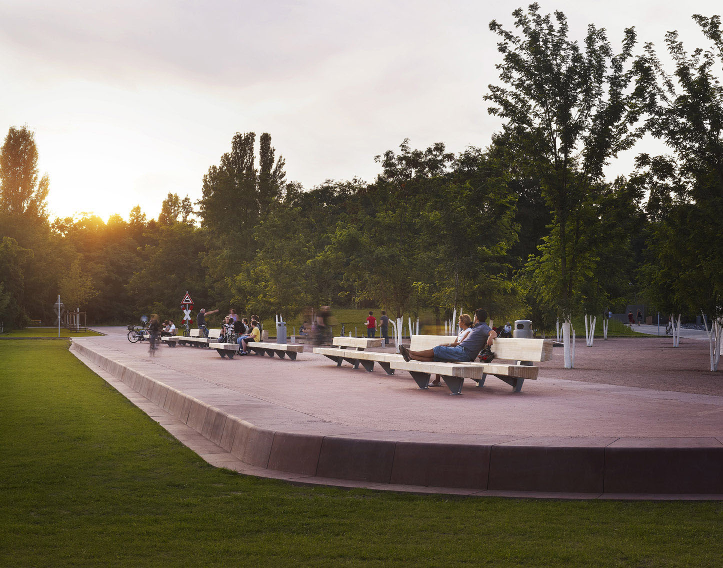
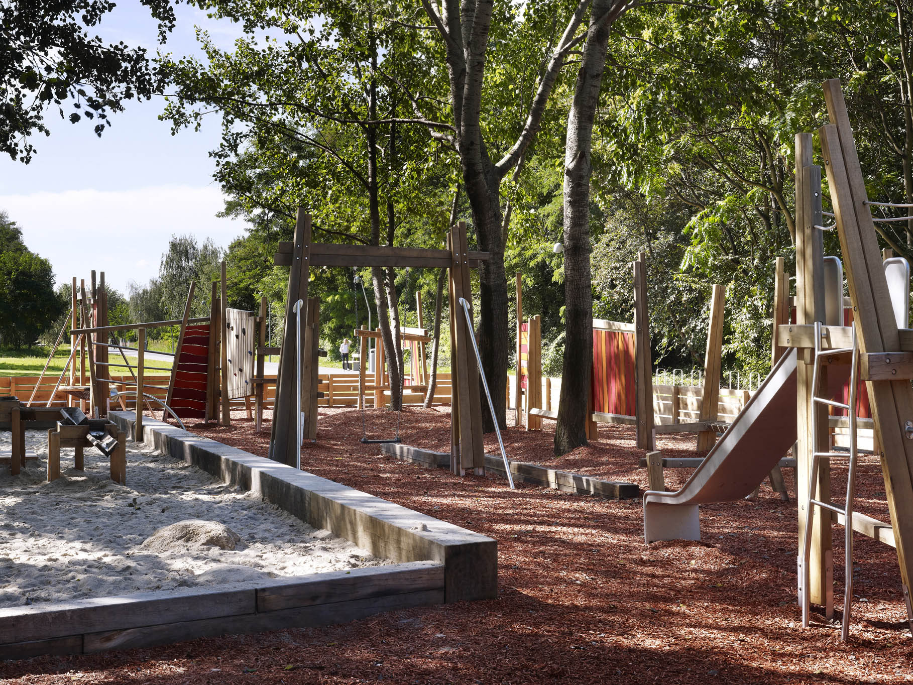
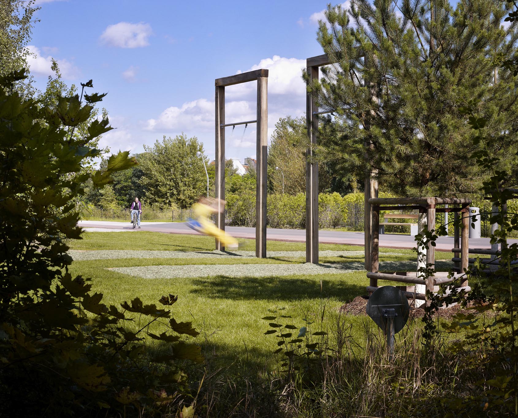
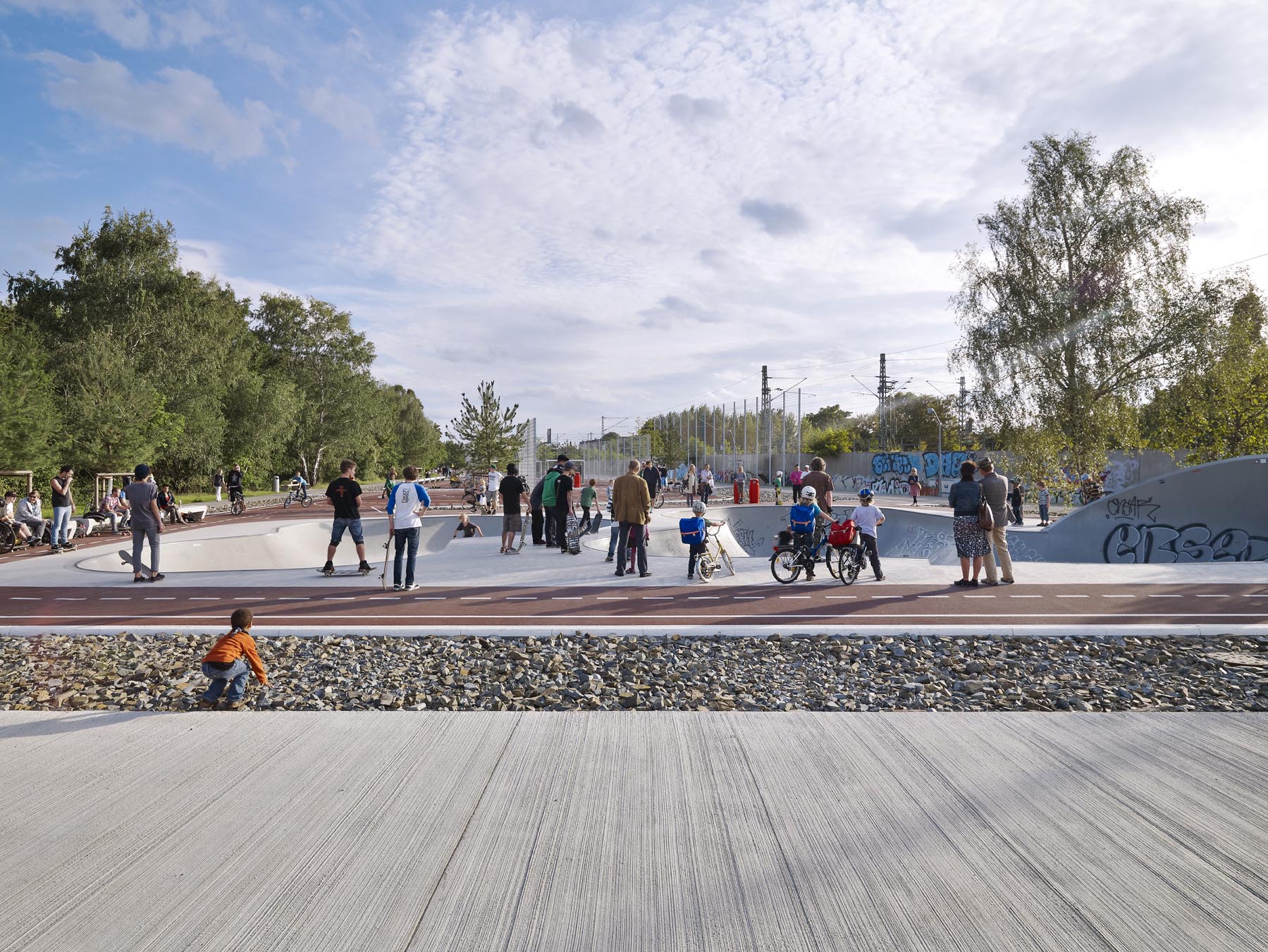
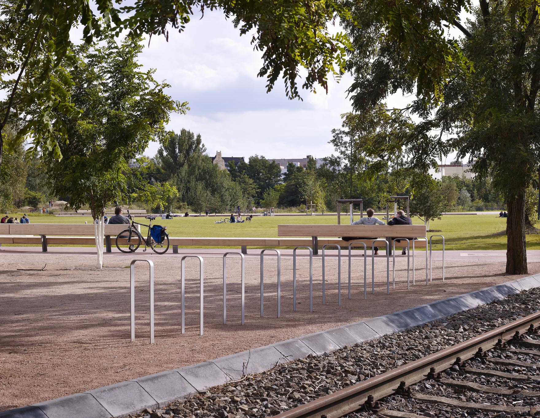
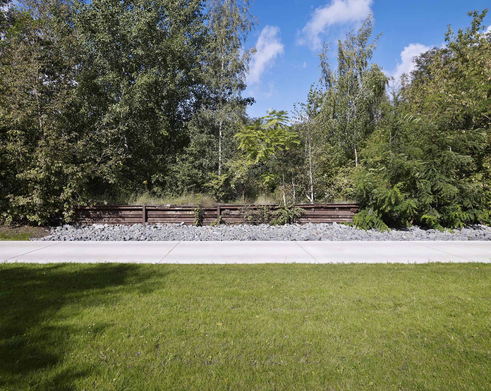
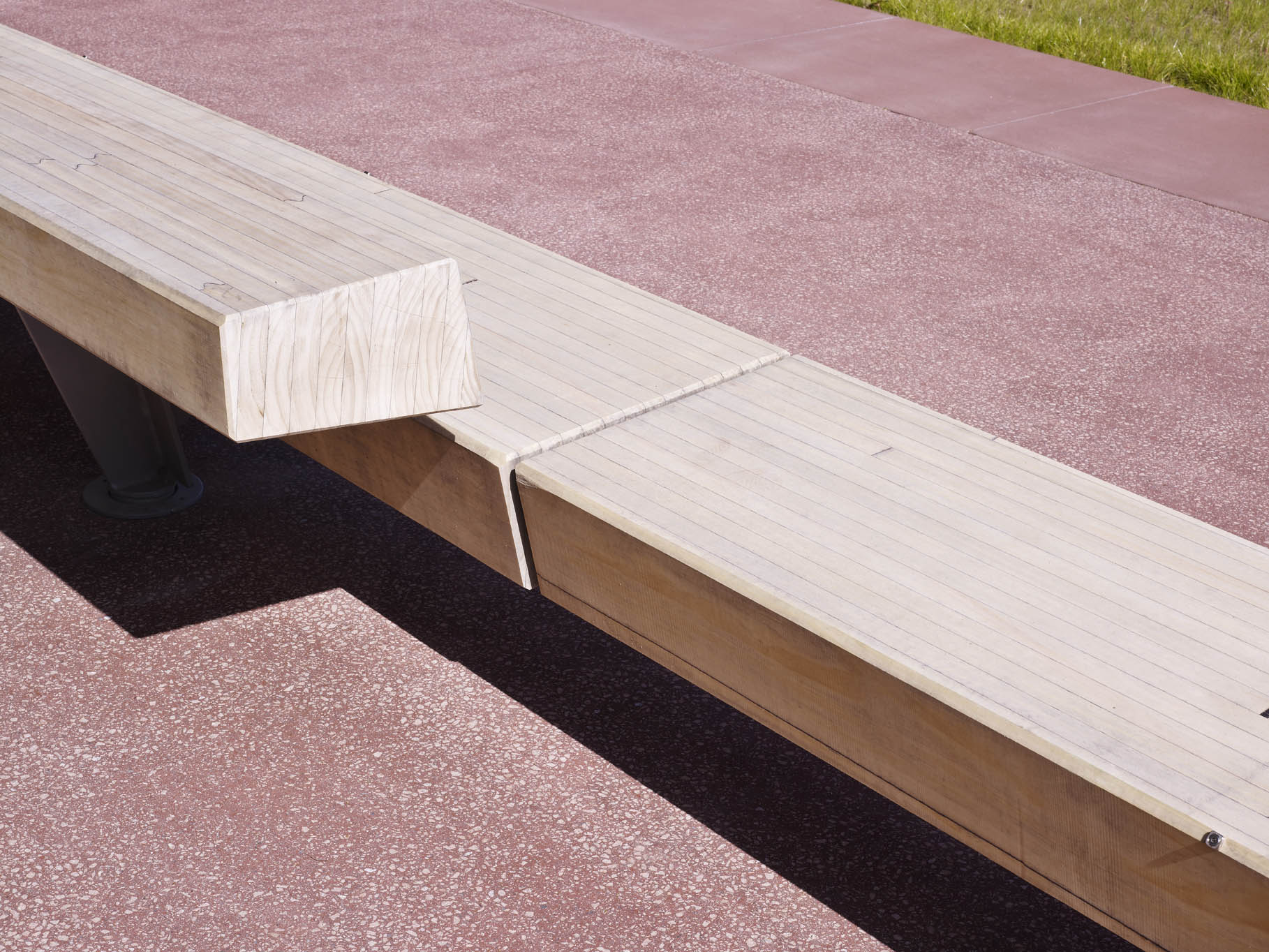
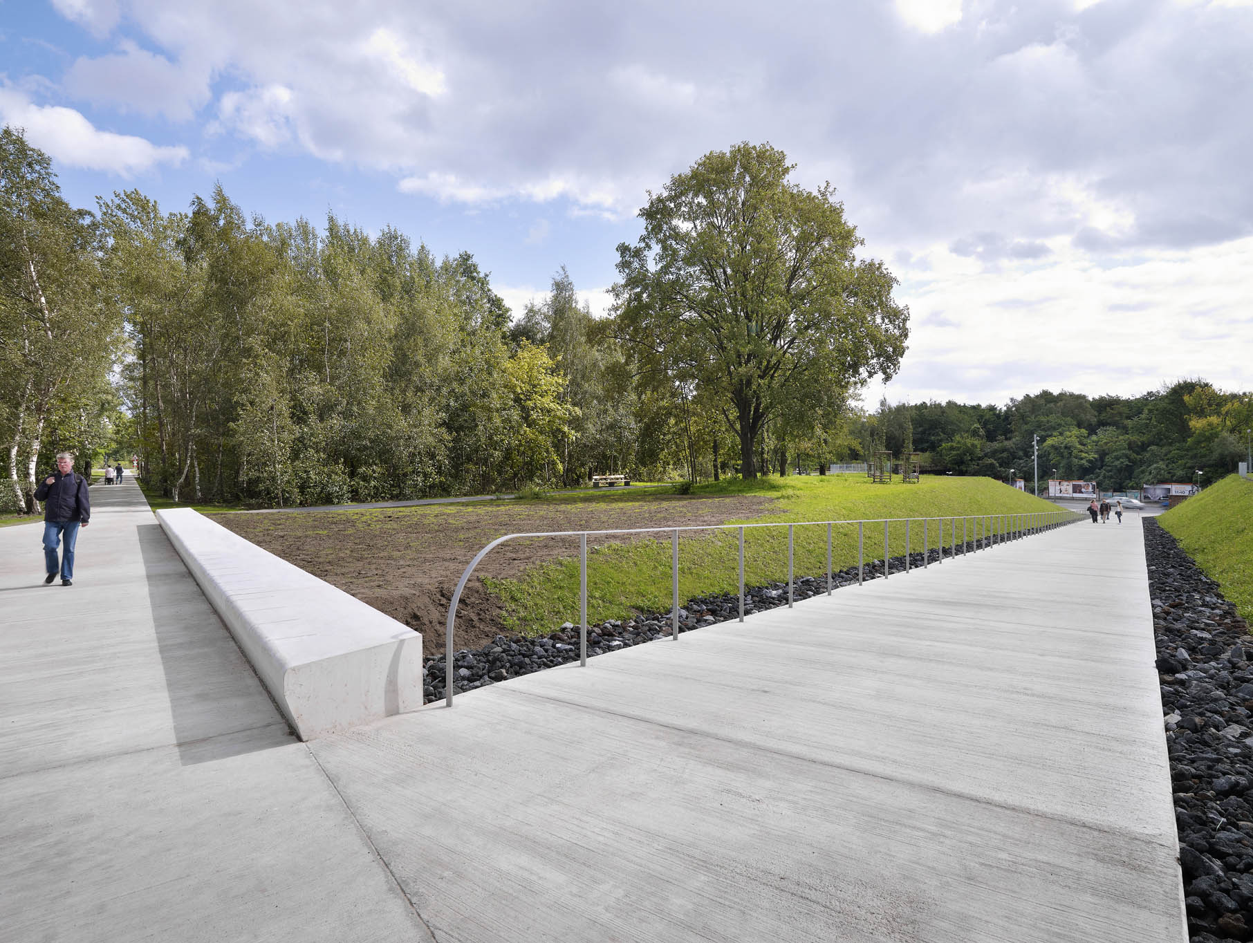
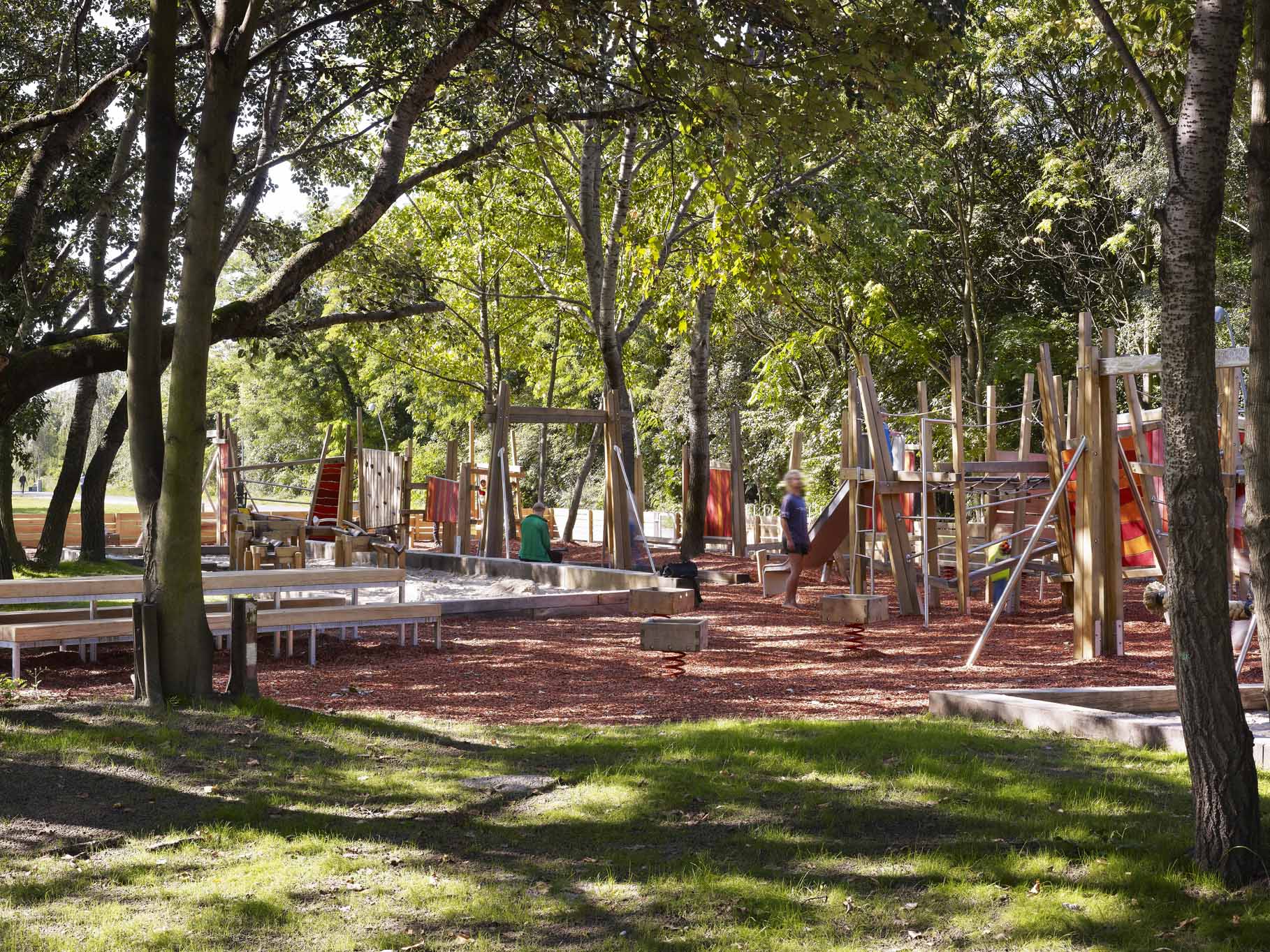
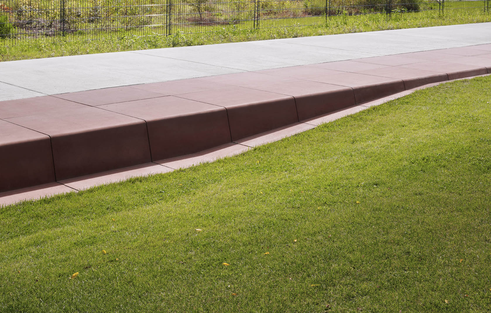
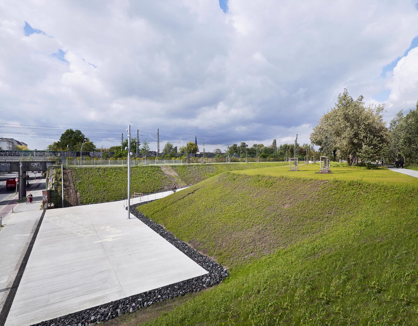
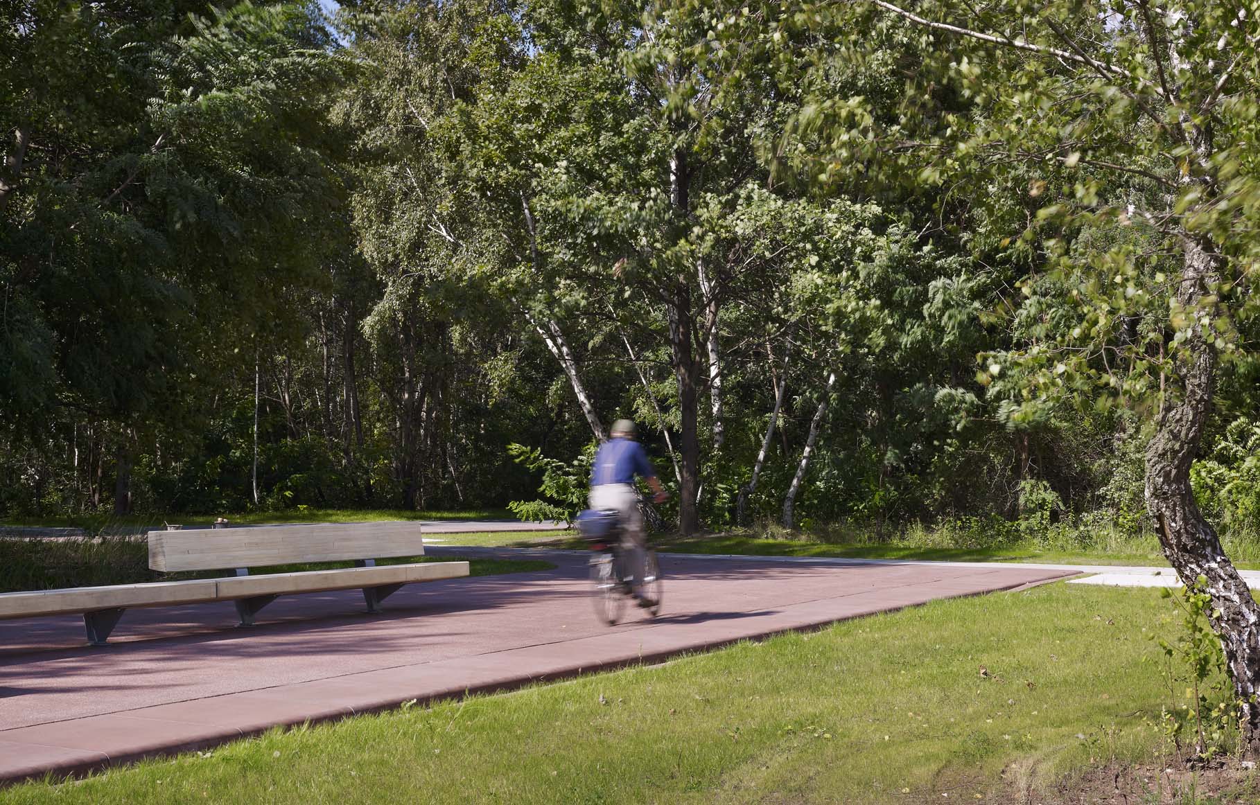
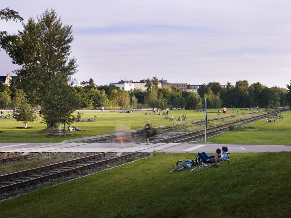
Once the terrain of the park had been submitted to a process of clearing away the undergrowth and decontamination, it was then organised by means of a combination of extant and added elements. The project as a whole was planned around a large central meadow, crossed from east to west by a concrete footpath and from north to south by a pair of railway lines. Once a month, a train slowly crosses these lines, travelling from its shed to the German Museum of Technology. The concrete footpath, which is a continuation of one of the main Kreuzberg boulevards, starts in the east, clearing the four metres difference in height of the platform by means of a stairway, and suddenly ends in the west on reaching the U-Bahn lines.On the northern side of the meadow there is a large concrete slab of rounded edges and sufficiently thick for its perimeter to be used as a place to sit. Well oriented to the south, it functions as a big sunny terrace, full of benches complete with footrests. In the south, the meadow looks over the gap of Yorckstrasse, an underpass crossed by more than fifteen bridges over which the trains once arrived in the nearby stations. On the eastern side of the meadow there is quite a dense forest of pre-existing maples, oaks, birches and lemon trees as well as new trees of these species. At this point, a couple of large metal frames hold two swings. The edges of the park are finished with a collection of distinctive spaces, for example a nursery, sports fields, concave surfaces for skateboards, stages for tango dancing, community gardens or simple areas covered in gravel taken from the place itself.
Assessment
Not exempt from disagreement between people who were in favour of safeguarding the railway heritage and others who wanted to regenerate the adjacent neighbourhoods, Gleisdreieck Park was opened to the public in September 2011. The heart of Berlin now has a new green lung in which the sensuality of small corners with very different atmospheres fits neatly into a large-scale, wide-ranging, rugged and robust general order. This has been possible precisely because the intervention was not limited to restituting industrial vestiges in order to promote railway history. As if it also wished to bear in mind the six decades of human absence in which nature had its way, the park has been able to conserve to some extent the spirit of the non-place that preceded it.David Bravo Bordas, architect
[Last update: 02/05/2018]