Previous state
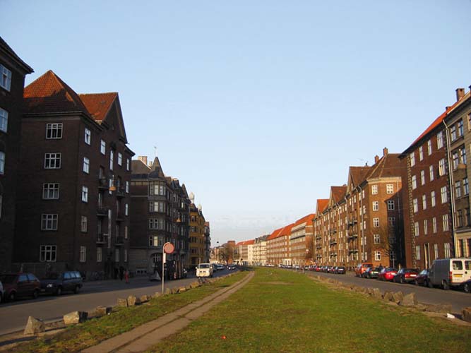
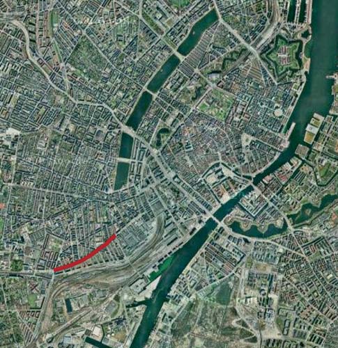
In the mid-nineteenth century, the demolition of the city walls and the abolition of the Demarcation Line that for many years had marked off a surrounding strip designated as a no-build zone led to a sudden expansion of the city of Copenhagen. To the west of the old city centre, the neighbourhood of Verstebro was built, this consisting, in keeping with pubic health standards of the nineteenth-century city, of regular street blocks and wide avenues offering sweeping views. The Sønder Boulevard was one the main road axes of this urban development. True to the change of scale enshrined in the new canon, it was endowed with a symmetrical section of almost thirty metres wide and a slightly curved longitudinal section a kilometre and a half long. The centre of this boulevard, which separated two lateral roads, was shaped by means of a grassy parterre that was densely populated with elms and edged by granite boulders.Before long, and as was happening in many other European cities of the time, a rising bourgeoisie avid for metropolitan settings in which to represent itself, enthusiastically took over the Sønder Boulevard as a place to promenade and forge social relations. Over a century later, however, the pleasurable and leisurely spirit of its origins had completely disappeared. In the 1990s, Dutch elm disease, a fungal affliction that attacks the Common Elm, killed all the trees in the central grove. By the turn of the millennium, the daily traffic consisting of some 2,700 cars and over 1,600 motorcycles drastically segregated the devastated central parterre, and practically the only people who used it were those who saw it as a public lavatory for their dogs.
Aim of the intervention
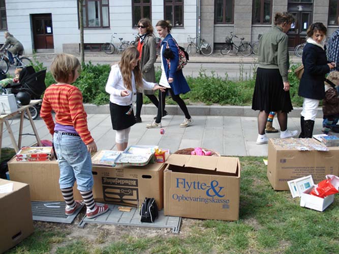
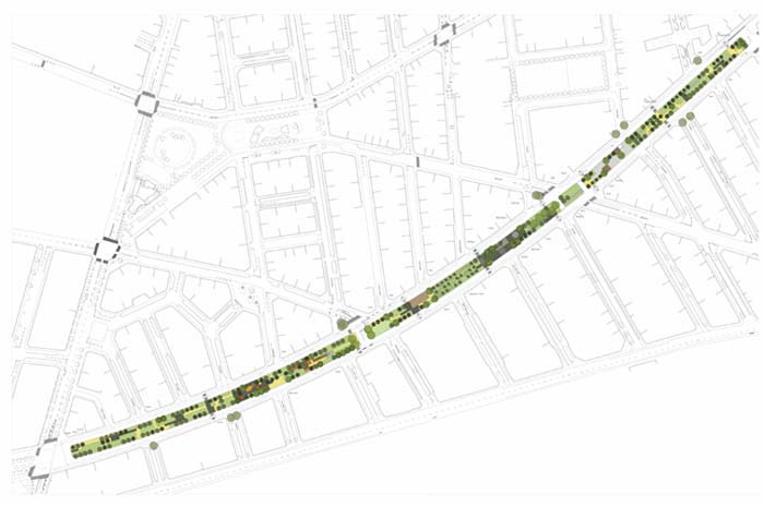
In 2004, the City Council of Copenhagen decided to earmark almost two and a half million euros to revitalise the sixteen thousand square metres of the promenade and to adapt it to present-day needs. Six workshops were convoked in which residents and local businesspeople were able to express their wishes which in many cases, and as might be expected, were fragmentary and divergent. In view of this, the strategy adopted in order to return to the boulevard its lost relevance and former numbers of people consisted in assigning to the space a great number of uses and a wide range of activities that, by juxtaposition or superimposition, could respond to the all the requirements gleaned in the workshops. Such an assignation of space was given priority over the aim of a coherent and unitary project.Description
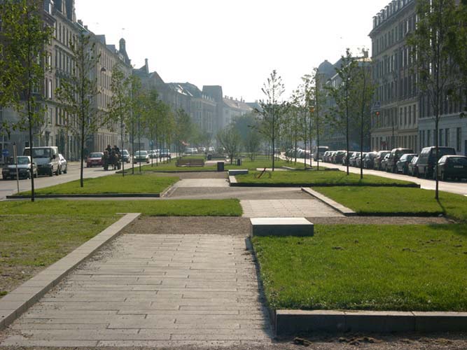
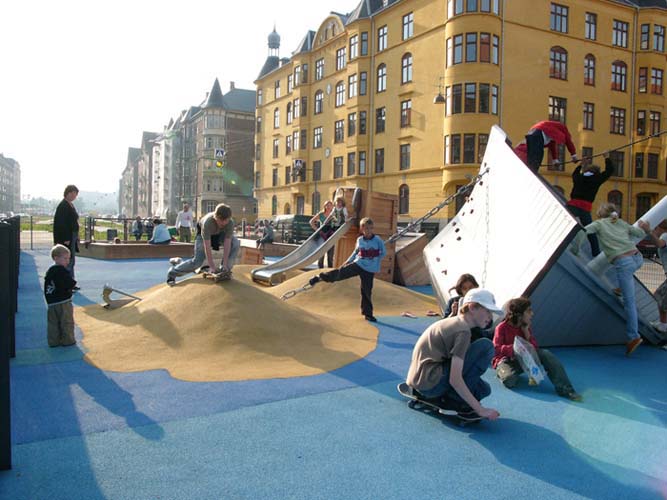
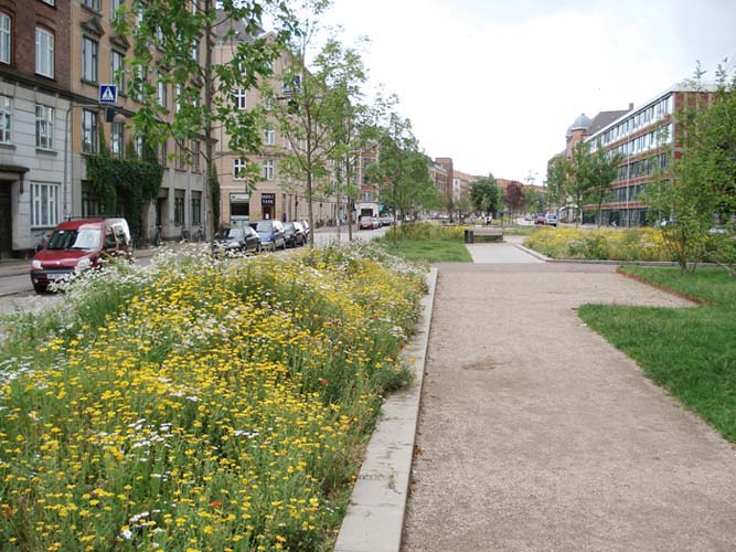
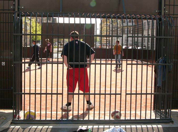
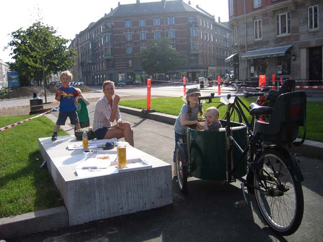
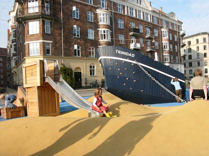
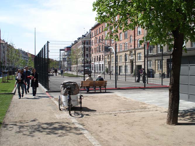
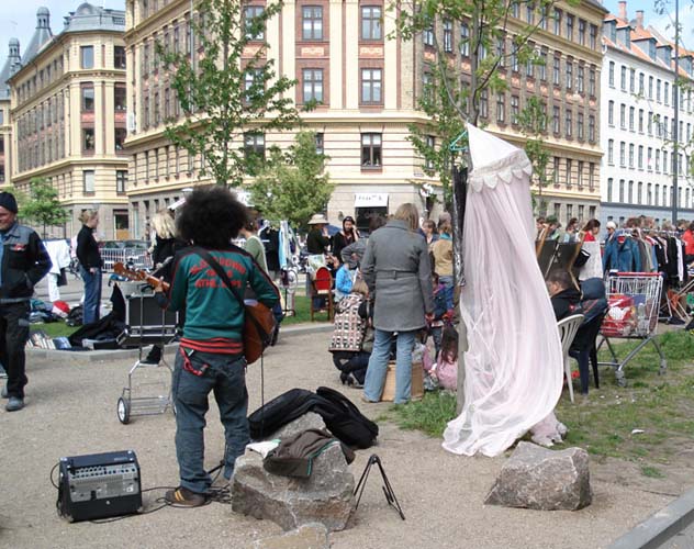
The velocity of circulation in the lateral traffic lanes has been reduced by means of speed bumps and the roads have been narrowed from two lanes to one. This has made it possible to add seventeen metres to the width of the central zone, which has been divided into a large number of orthogonal sections of different sizes and treatments. Although some are conceived for specific functions, for example to accommodate sports areas and facilities, zones for dogs, children’s playgrounds or an asphalted cyclo-cross circuit, the great majority of the sections are defined generically.They take the form of small rectangular areas framed by slight differences of level and initially covered with lawn. However, this is only a provisional finish as, through an arbitrated and regulated process, the residents have the right to transform and use these sections for different purposes. The spaces have undergone progressive transformation as functions are assigned to them and they have become small garden plots, meditation gardens, spaces for barbecues, open-air cafés and platforms for performances.
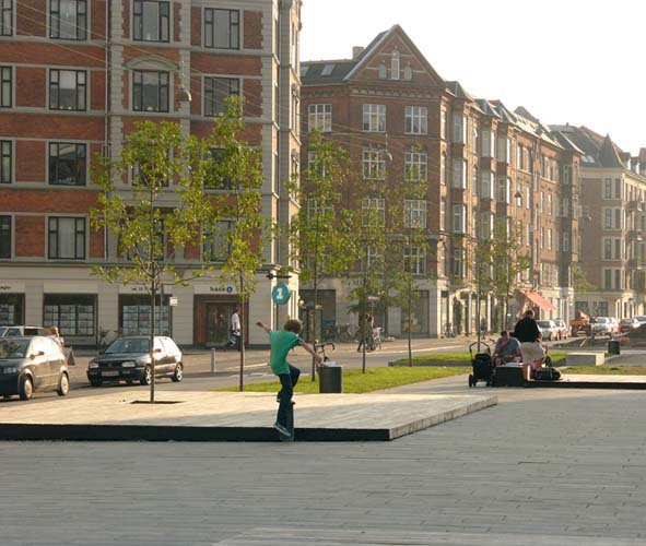
A pedestrian path, sometimes paved and sometimes with a gravel surface, is lined with benches and waste paper bins and makes it possible to move through the different sections the whole length of the promenade. New rows of trees have been planted along the edges, grouped according to species, which have been chosen so that they bud, flower and shed their leaves at different times of the year in such a way that the boulevard’s appearance is always changing. In the central section of the route is an area planted with palm trees where blocks of stone from pre-existing rockeries have been distributed in the form of a grid.
Assessment
Once certain degrees of concreteness and specificity have been reached, urban design excessively delimits the uses that public space might have. These uses, by definition eventual and diverse, are then terminally corseted by a formality that attempts to supplant the complexity of urban life.In this intervention, uses precede form. Urban design has been halted in time to give way to users who appropriate the different sections and freely transform them in keeping with their requirements. The form will never be fixed because the Sønder Boulevard is now a flexible, diverse space that is undergoing constant change.
David Bravo Bordas, architect
[Last update: 02/05/2018]