Previous state
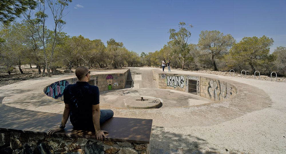
With cliffs more than a hundred metres high looking over the sea, Cape Santa Pola is a rocky massif of some twelve square kilometres. This geographic formation, described as a first-order geodesic vertex, is abundant in geological, ecological and anthropic treasures. Since it has one of the Mediterranean’s very few coral reefs of biotic origin the Government of Valencia has catalogued it as a Site of Geological Interest. Moreover, it has extensive green areas of pine stands and a considerable variety of flora and fauna, as well as elements of historical and archaeological interest. In the sixteenth century a watchtower was built, taking advantage of the elevated position and, much later, the high land of the cape was used during the Spanish Civil War for emplacements of antiaircraft guns and military quarters cut into the rock by the Republican Army. There is also an eighteenth-century lighthouse as well as several large water tanks from the same period which, until well into the twentieth century, supplied the town of Santa Pola at the foot of the promontory with drinking water.
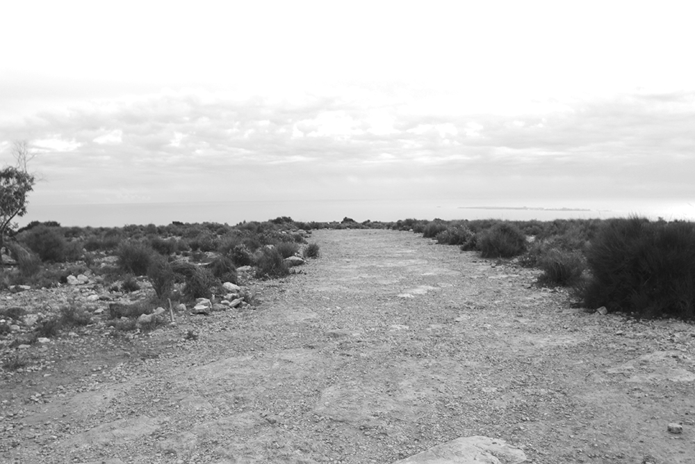
Between the cliff and the coast there is a road running alongside a series of small coves linking, from south to north, Santa Pola with Gran Alacant and Arenals del Sol, two residential zones which, with the speculation of the last few decades, have been steadily eating into the forested land of the massif. A large number of pensioners spend a good part of the year here, together with summer visitors who enjoy walking and nature sports. However, this has also drawn attention to the fact that, when these activities are large-scale and unregulated, they are harmful for the environment. Until 2013, the only attempts to mitigate the damage took the form of superficial repair of some of the paths and clearing unauthorised rubbish tips and rubble dumps.
Aim of the intervention
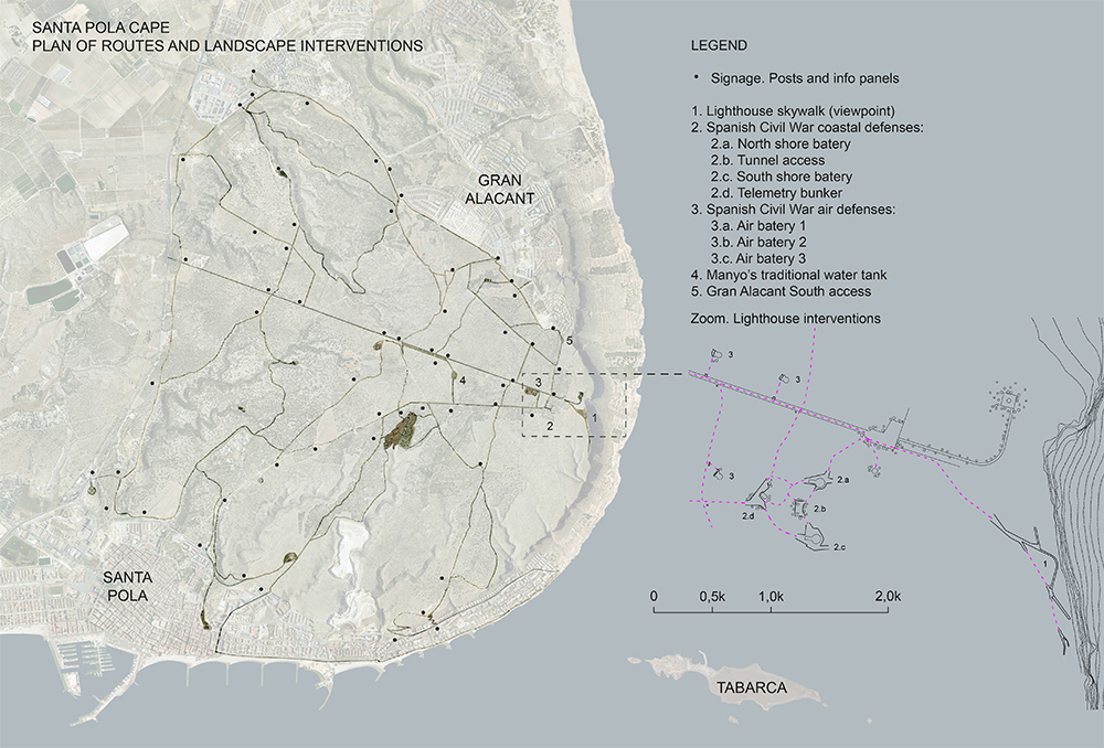
The Santa Pola Town Council then decided to rehabilitate the landscape of the zone in order to regulate and consolidate its access and routes. The intervention, for which more than two hundred thousand euros were allocated, aimed to connect the old centre of Santa Pola with the residential zones on the northern coast by means of a series of cycling routes giving access to different points of interest. Understandably, the strategy for regulating and rehabilitating such a large area of land could not be exhaustive. Rather, it meant a series of subtle projects that would regulate human presence in the anthropic parts of the landscape in order to conserve its biotic parts.
Description
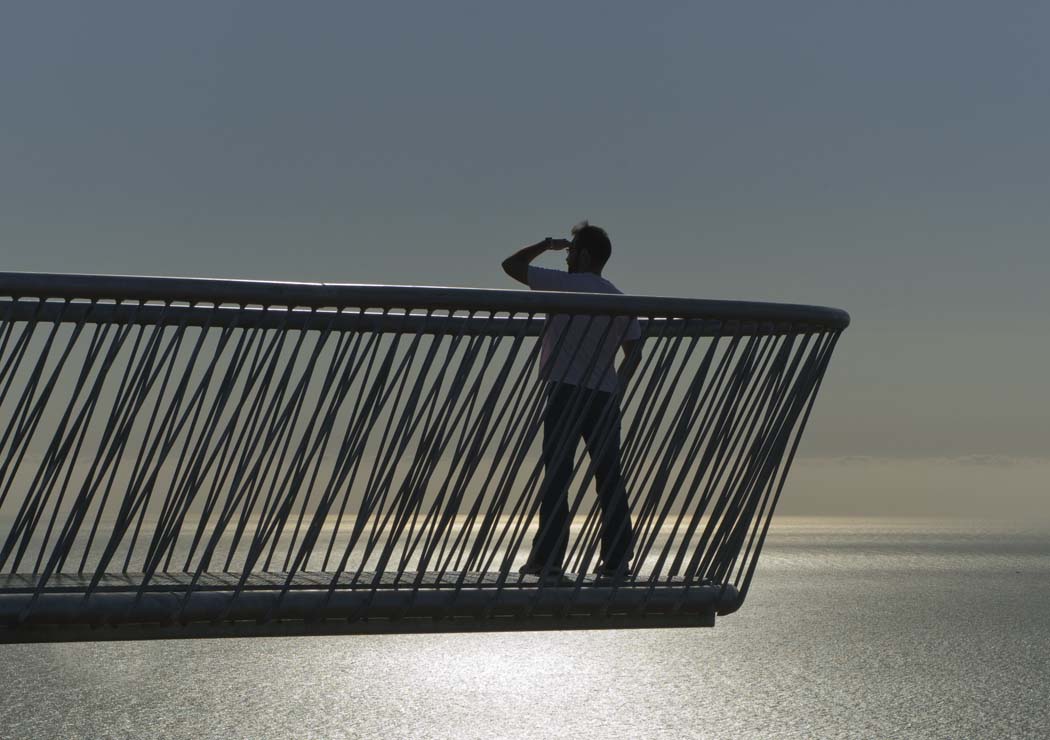
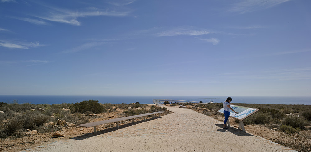
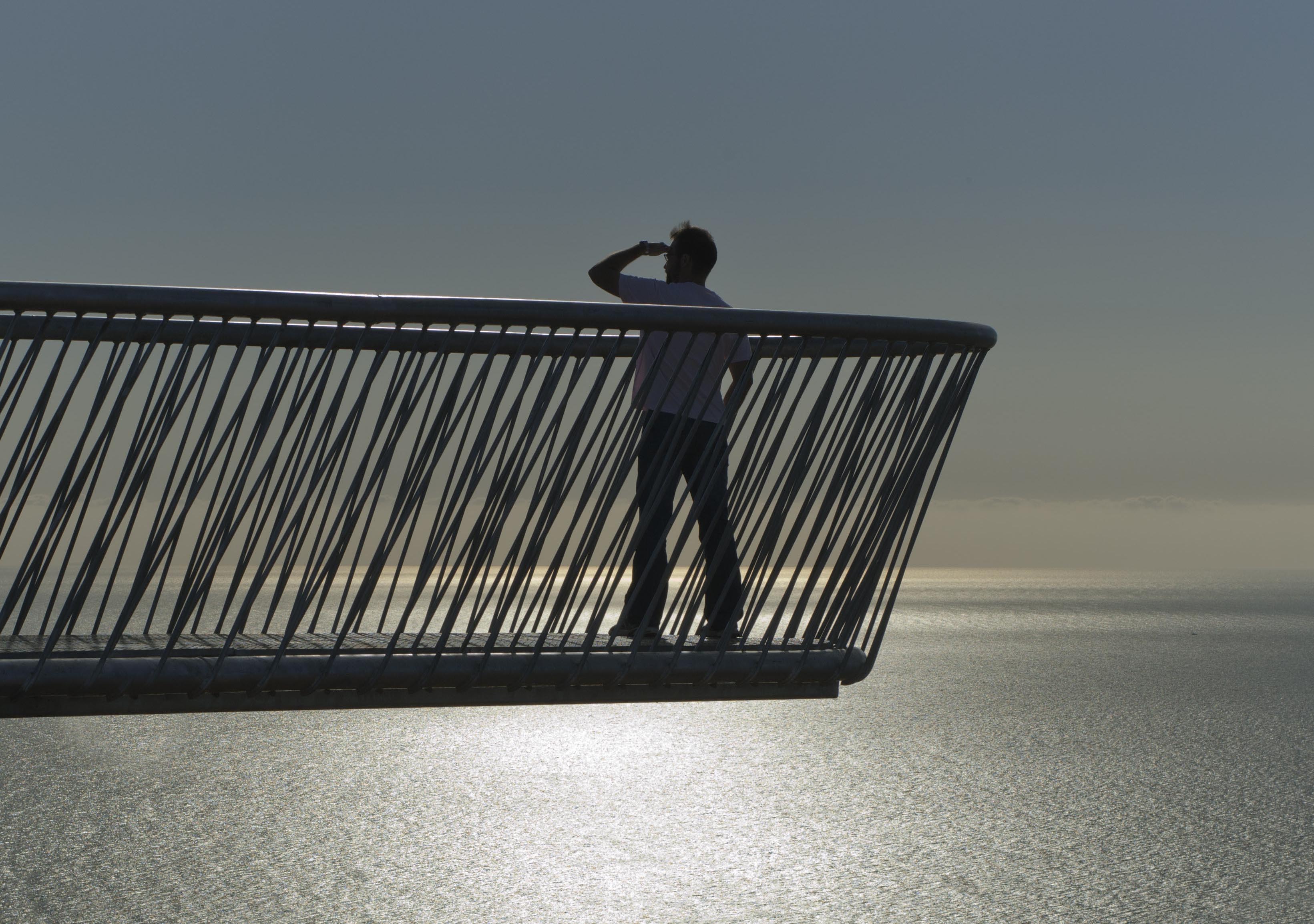
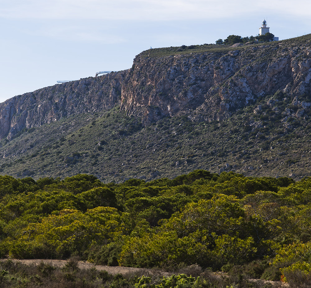
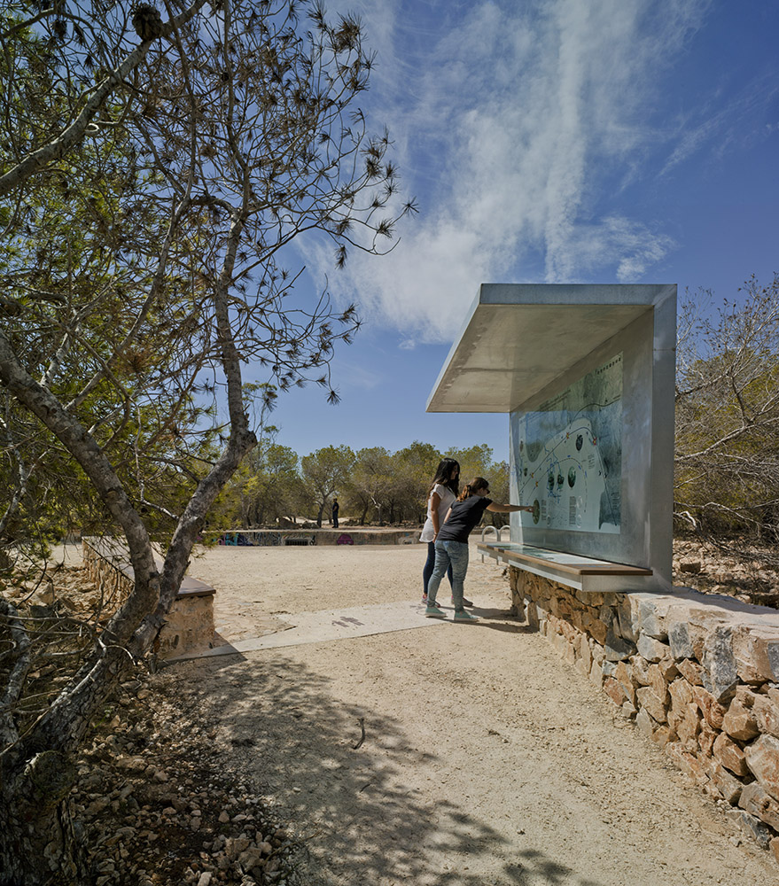
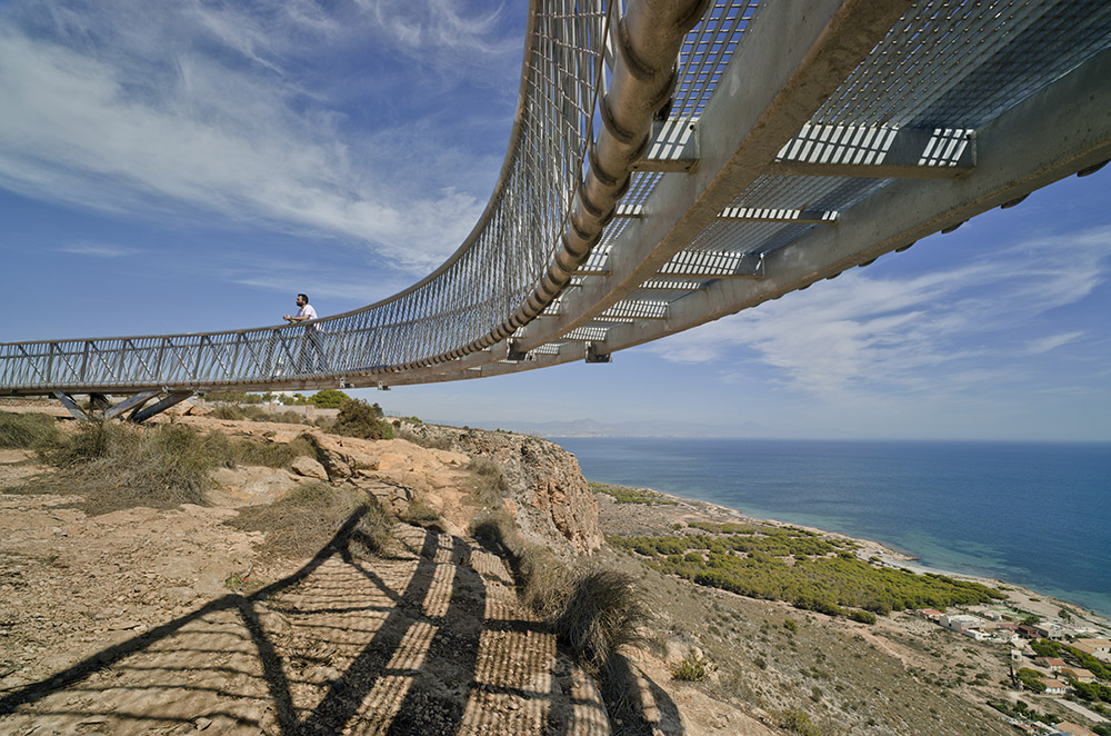
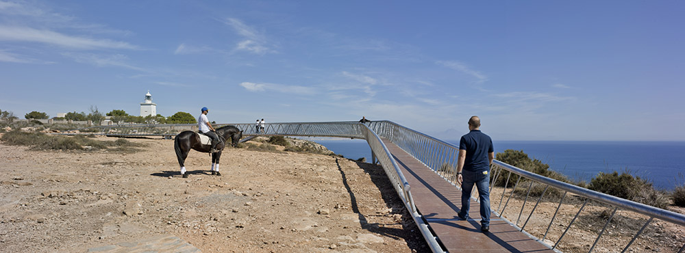
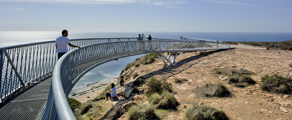
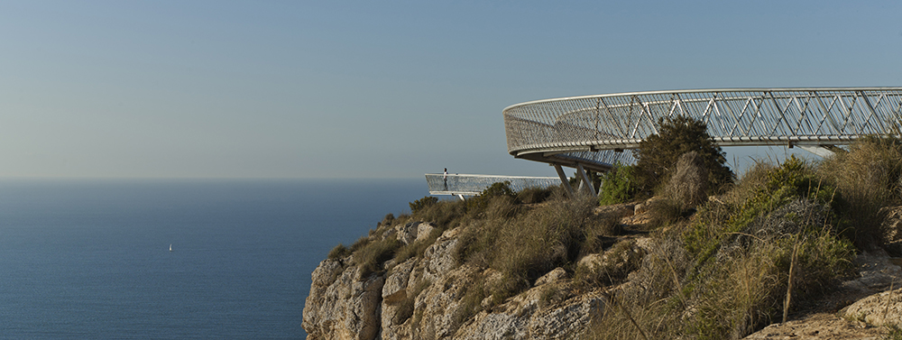
After consulting several cycling associations and groups working to safeguard the natural environment and protect heritage, a project was drawn up to organise the different uses of the territory, to adapt the new routes and accesses to the pre-existing network of paths, and to respect the small scale of a large number of spots which still conserve crosses and monuments. The network of cycling tracks consists of six itineraries uniting both parts of the municipality. As it passes close by the lighthouse, the route along the coast takes the form of a sinuous cantilever bridge giving a close-up view of the fossil structure of the cliffs. It also acts as a magnificent lookout over the Mediterranean with views of Nova Tabarca Island which lies just over four kilometres off the coast. The Manyo water tank has been restored, as have the three antiaircraft gun emplacements dating from the Civil War. Several information points and signposts indicate the historical value of these and other monuments as well as guiding walkers. Facilities have been installed throughout the zone so that visitors can rest and enjoy the scenery.
Assessment
The plan to open up a new network of cycling routes on Cape Santa Pola was highly controversial in both the media and social networks. Many people feared that consolidating access points would encourage more visitors and accelerate the ecological deterioration of the zone. Others complained that standardising signposting and marking out routes would tame the wild magic of this once marginal landscape. Others spoke out in favour of the respectful subtlety of the project, which has rehabilitated a large area of land at a relatively low cost. In any case, there can be no doubt that such natural areas adjoining towns and residential areas are constantly under threat. However, when they are opened up to the public with a view to educating citizens about their natural and historical values, people are encouraged to see them as their own, respect them, love them and even defend them in future against further damage caused by aggressive urbanplanning.
David Bravo │ Translation by Julie Wark
[Last update: 25/10/2023]