Previous state
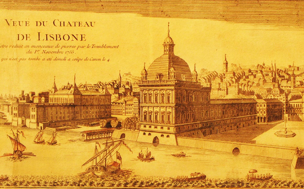
At the beginning of the sixteenth century, King Manuel of Portugal wanted to move his court to the port of Lisbon, the centre of trading and manufacturing activity of a maritime empire extending through the continents of Asia, Africa and America. He therefore decided to leave St George’s Castle on the top of the Alfama hill and to construct the Ribeira Palace on the northern bank of the Tagus River. The new royal residence was flanked by two primary open spaces, both opening on to the river. One, on the eastern side of the palace, was the Praça do Comércio —popularly known as Terreiro do Paço (Palace Square)— the main entrance to the city for ambassadors and foreign monarchs. The other, downriver, was Ribeira das Naus, a shipyard that concentrated the activities of merchants and customs agents and where, for centuries, the ships of the Portuguese fleet were built.The Ribeira Palace was destroyed in the devastating earthquake of 1755, but both Praça do Comércio and Ribeira das Naus have endured until the present day. The former, a key element in the enlightened reconstruction of the city undertaken by the Marquis de Pombal, is still the city’s representative nerve centre. The latter, active as naval infrastructure until well into the twentieth century, underwent several changes over time. The notched profile of the waterfront, shaped by the indentations and projections of old wharves, was gradually filled in with a series of land fillings. Later, the appearance of a four-lane highway divided the area of Ribeira das Naus into two parts. The northern side was left as a Navy-owned military zone, closed off by a fence, while the riverbank side fell into disuse to become a squalid zone that was even deemed to be dangerous. For decades, this desolate condition contrasted with the beauty of the views across the Tagus River and the strategic connectedness of the place. In fact, the riverbank section offered pedestrians a direct route from Praça do Comércio to Praça Duque da Terceira, six hundred metres to the west and site of the Cais do Sodré station, a hub connecting railway, underground, tram, bus and ferry transport.
Aim of the intervention
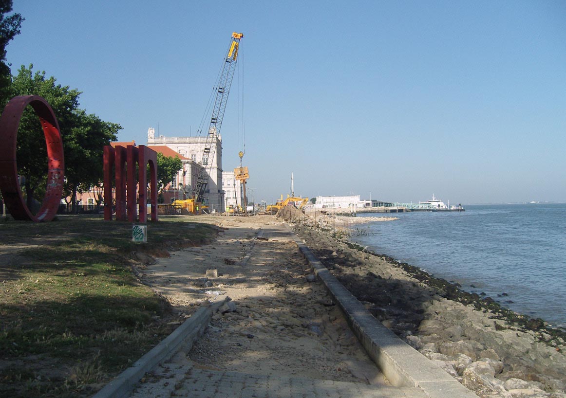
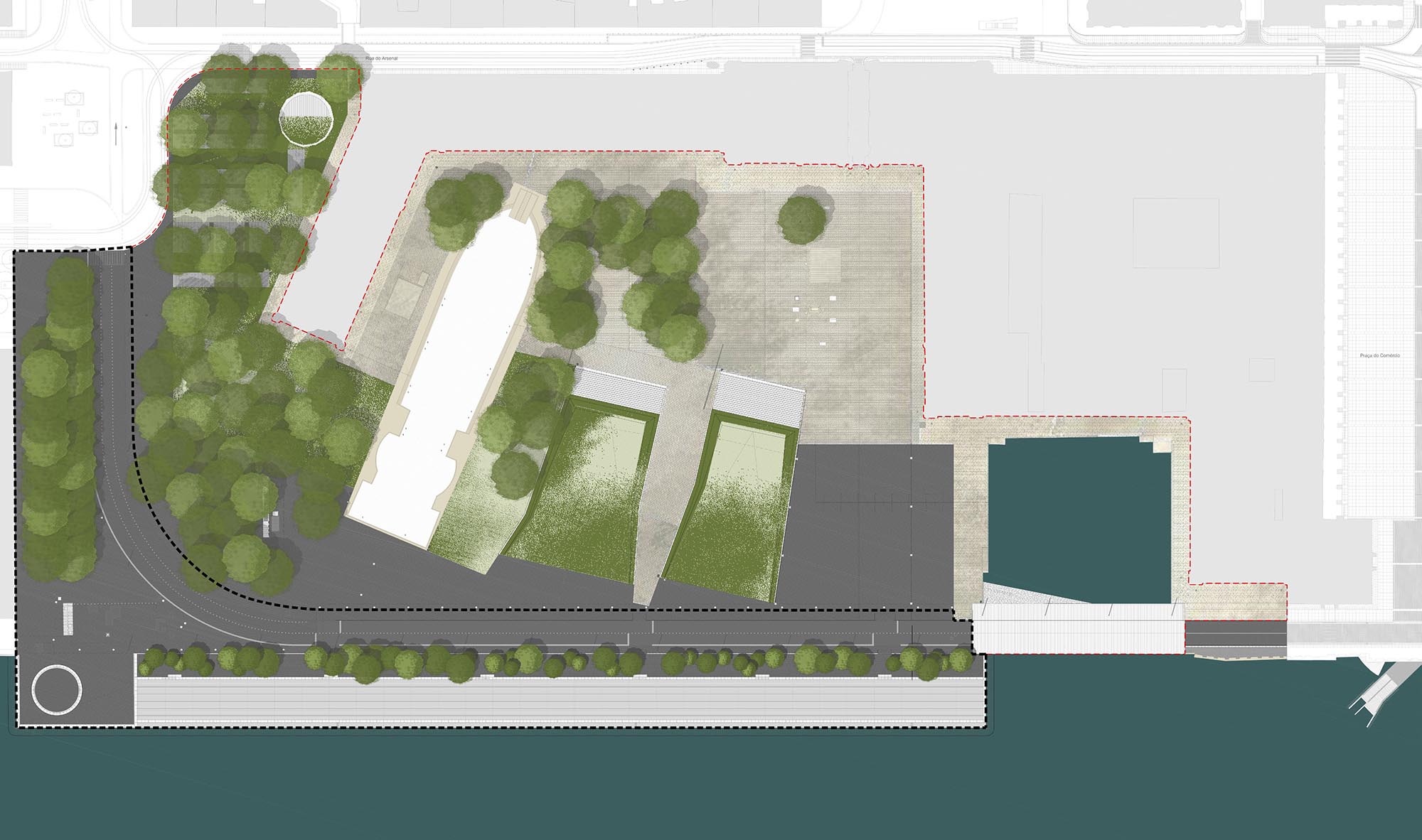
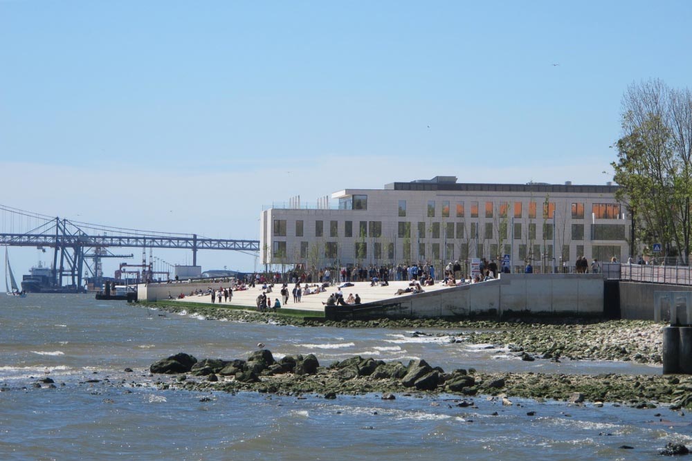
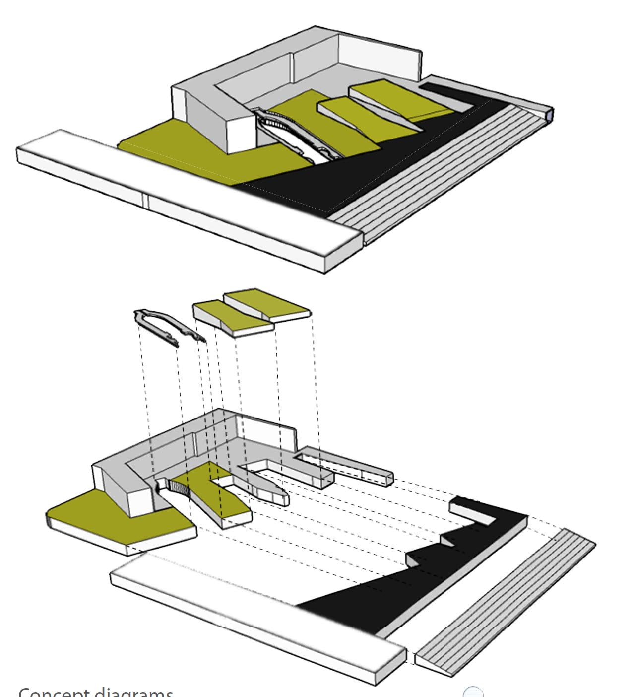
In 1990, an archaeological dig revealed two major remains of the old shipyards. One of these was the Caldeirinha wharf, where a large number of ships had been able to moore. The other, which was still being excavated in 2002, was a dry dock for constructing long-hulled vessels. The find was important because it prompted wider awareness of the historic significance of the site and the need to rescue it from neglect and oblivion. In 2009, the City Council decided to allocate almost four million euros for a landscaping project that would bring to light the partially buried archaeological findings, integrating them into a renovated riverside walk. The new public space had to make the most of two highly significant potential benefits. Lengthwise, it was to constitute a promenade linking Praça do Comércio and Praça Duque da Terceira. Crosswise, it was to become an attractive place highlighting Lisbon’s relation with the river and its own past.Description
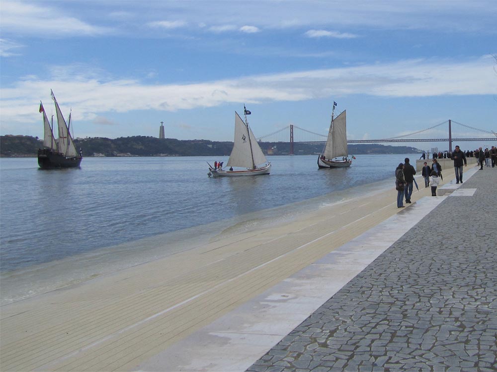
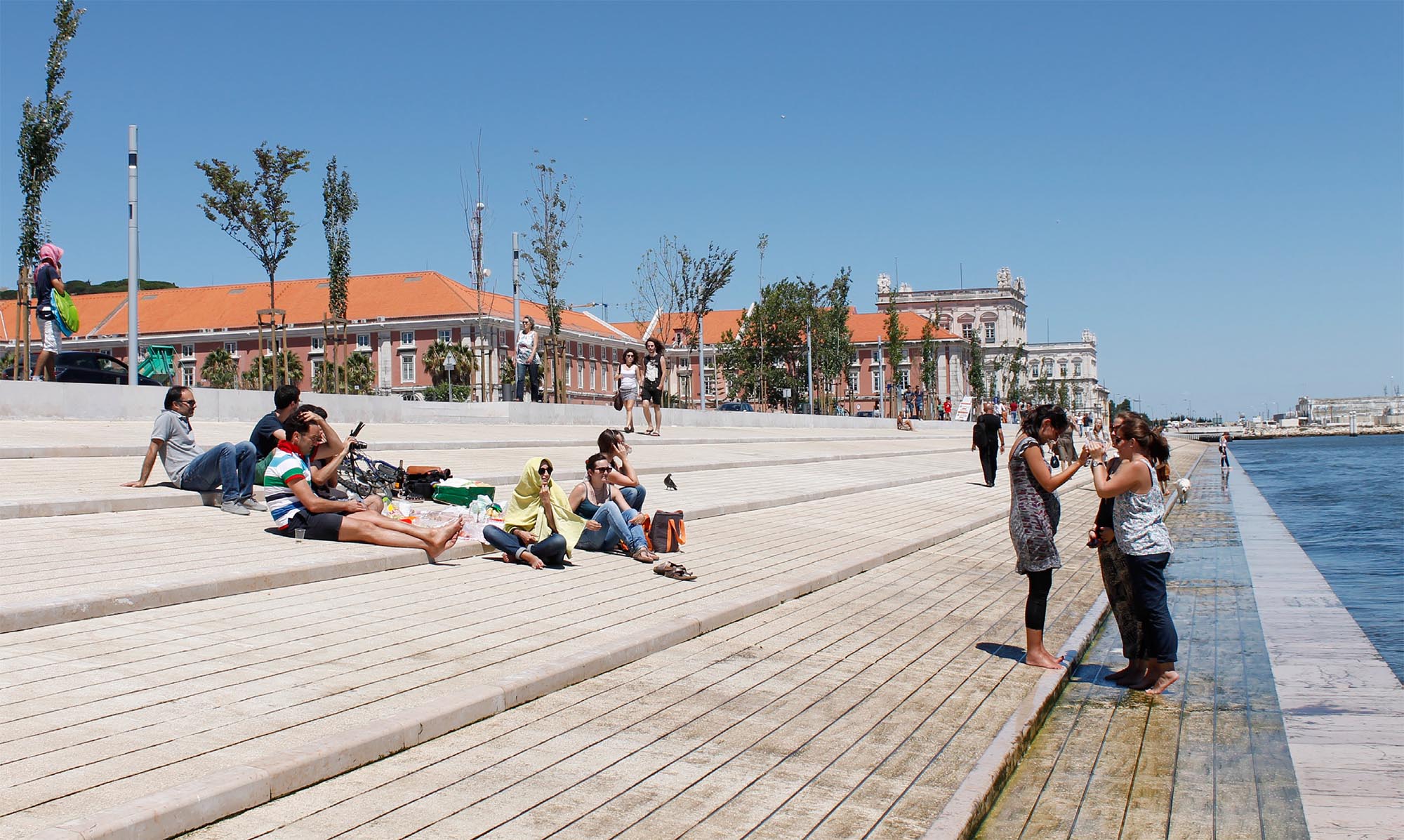
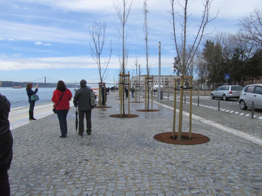
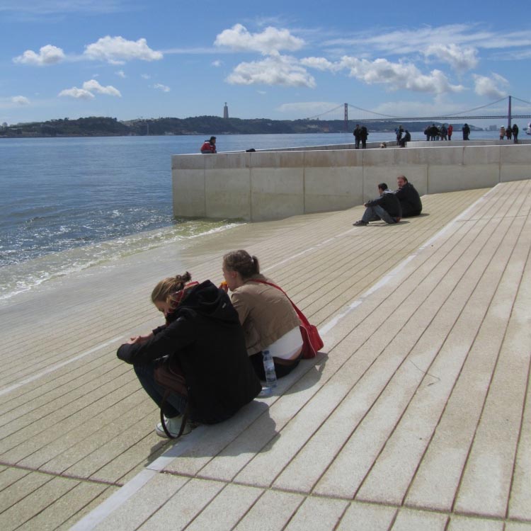
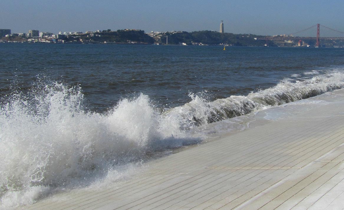
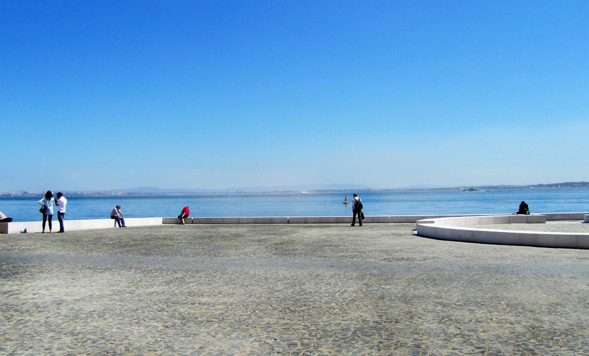
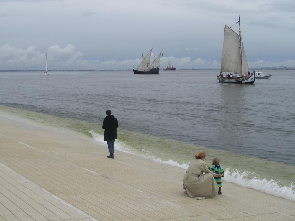
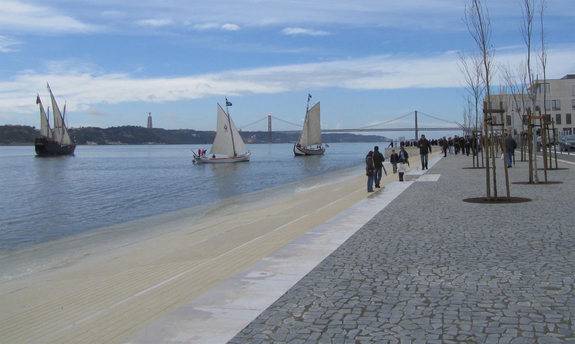
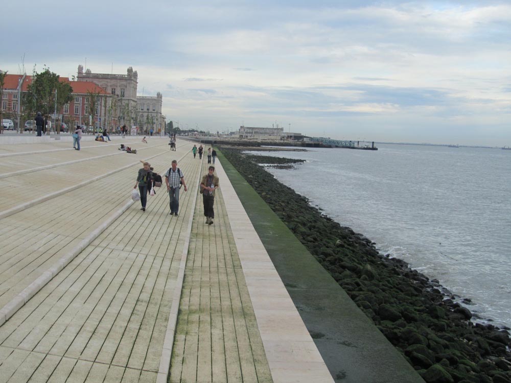
The first phase of the intervention consisted in opening up the Avenue Ribeira das Naus, a riverside walk offering cyclists and pedestrians a route between the Cais do Sodré station and Praça do Comércio. On the northern side of the promenade slow circulation of vehicles is permitted on an asphalted road, separated by a longitudinal line of trees from the pedestrian section, which is paved with irregular shaped diabase tiles. At one point, the paving slopes downwards to form terracing leading to the water’s edge. The general impression is that of a south-facing beach enlivened by the movement of boats sailing on the Tagus River. At the westernmost end of this terraced bank there is a wharf where passengers may embark and disembark.Assessment
In the forthcoming second phase, excavation of the old Caldeirinha wharf, located on the inland side of the asphalted road, will be completed so that it can be revealed. The now partly visible dry dock of the old shipyards will also be recovered. Both sets of ruins are to be incorporated into a green zone which will include an interpretation centre for the former Ribeira Palace, thus rescuing from oblivion a key fragment of Lisbon’s past. Meanwhile, the Ribeira das Naus riverside promenade is already a central space which has recovered lost dignity, while also restoring the city’s contact with its river.David Bravo
Translation by Julie Wark
[Last update: 18/06/2018]