
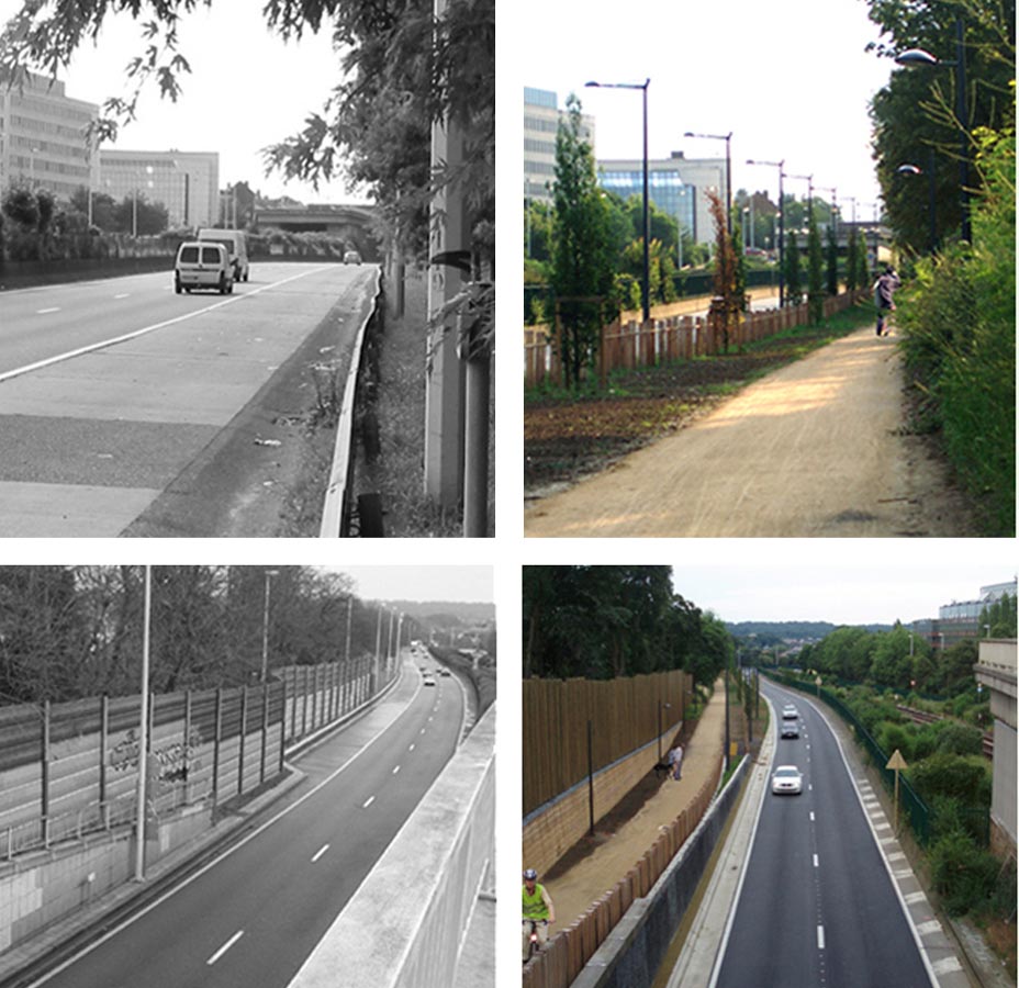
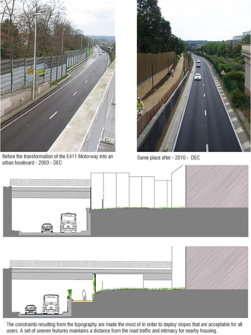
Previous state
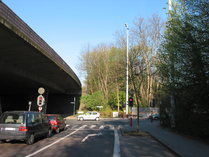
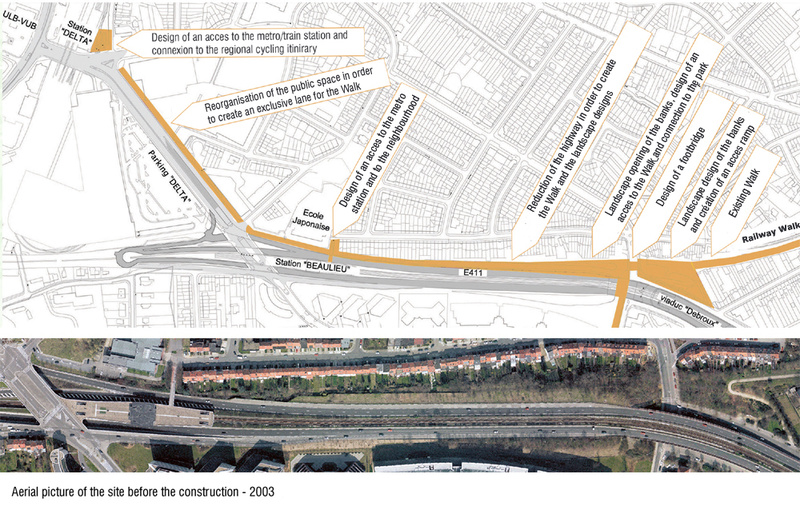
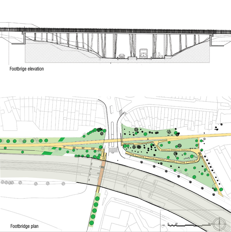
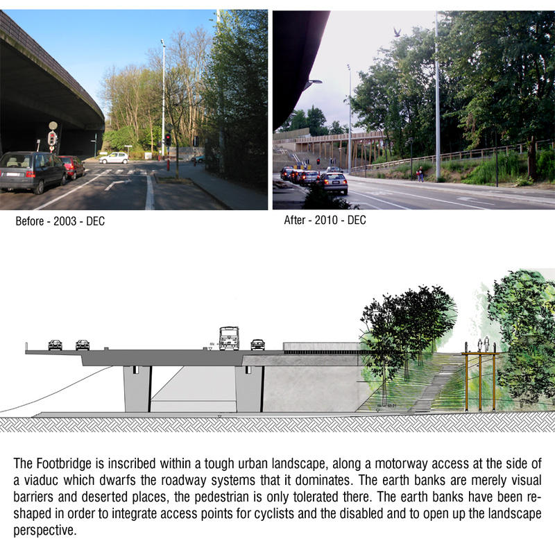
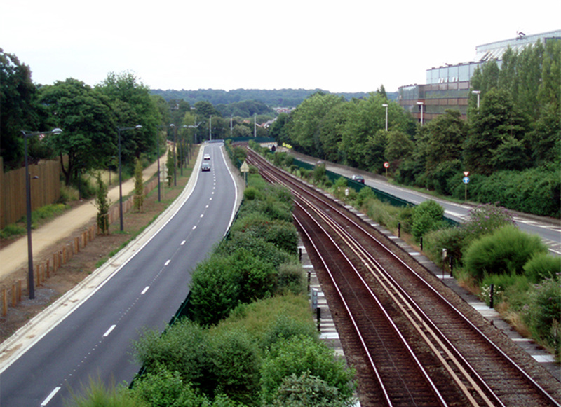
Constructed in the 1970s, the E411 motorway links Namur and Brussels. Shortly after passing through the Forêt de Soignes, one of Western Europe’s biggest peri-urban forests, it approaches the Belgian capital from the southeast of the metropolitan area through the town of Auderghem. At this point it takes the name Avenue Herrmann-Debroux and, when it enters the town, takes the form of a viaduct with two lanes each side. In the centre, it is slashed along its length by Line 5 of the underground railway system.The impact of this major piece of infrastructure was considerable but not sufficient to destroy Auderghem’s otherwise harmonious relationship with its natural setting and, accordingly, the zone still enjoys considerable prestige. One of the most damaging effects, perhaps, appeared in a section of some five hundred metres in length, running between the Beaulieu and Demey underground stations. Here, the viaduct was so wide that it cut off the railway line to Tervuren, some six kilometres away, after which the latter had to be dismantled. When nature began cocooning with green the strip left by the railway lines some sections were used as beautiful walking tracks. However, ramblers enjoying them soon came up against the barrier imposed by the fact that priority had been given to vehicular traffic.
Aim of the intervention
At the beginning of the twenty-first century, the Government of the Brussels-Capital Region saw the need to cater to other forms of mobility besides the private vehicle. It therefore conceived of the Promenade Verte, a route for walkers and cyclists some sixty kilometres long and circling the entire metropolitan area. In the process of creating this route around the city’s perimeter it was found that the best place for crossing Auderghem was by way of the old railway line. This made it possible to incorporate into the metropolitan network the beautiful pre-existing paths, but it also raised the challenge of how to deal with the barrier represented by Avenue Herrmann-Debroux.Description
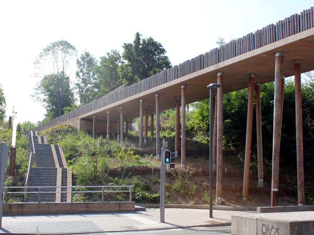
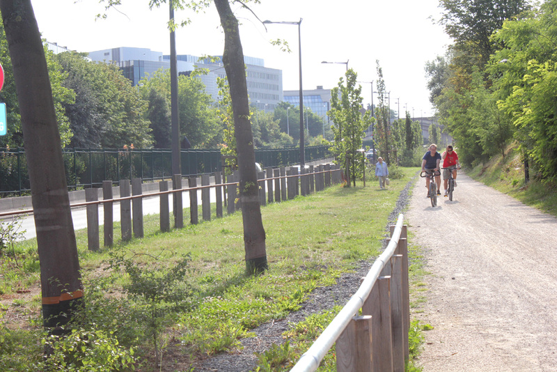
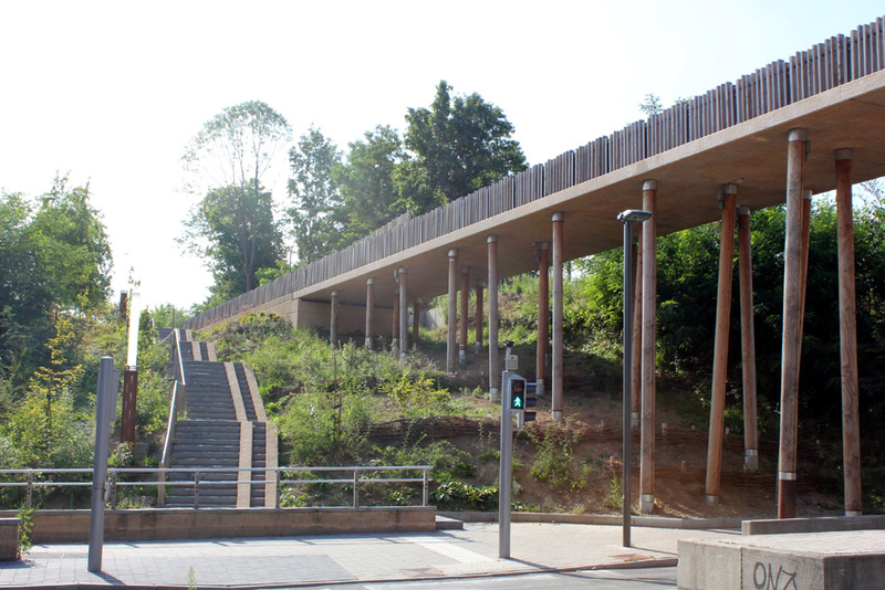
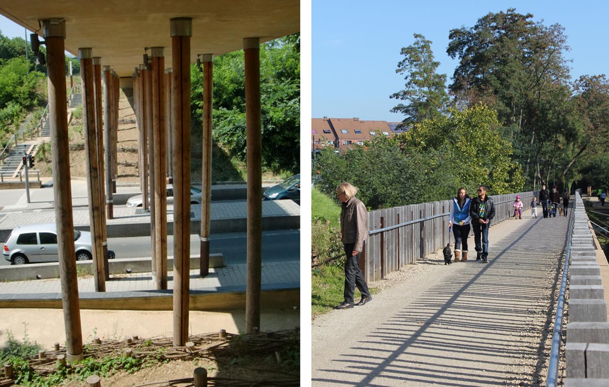
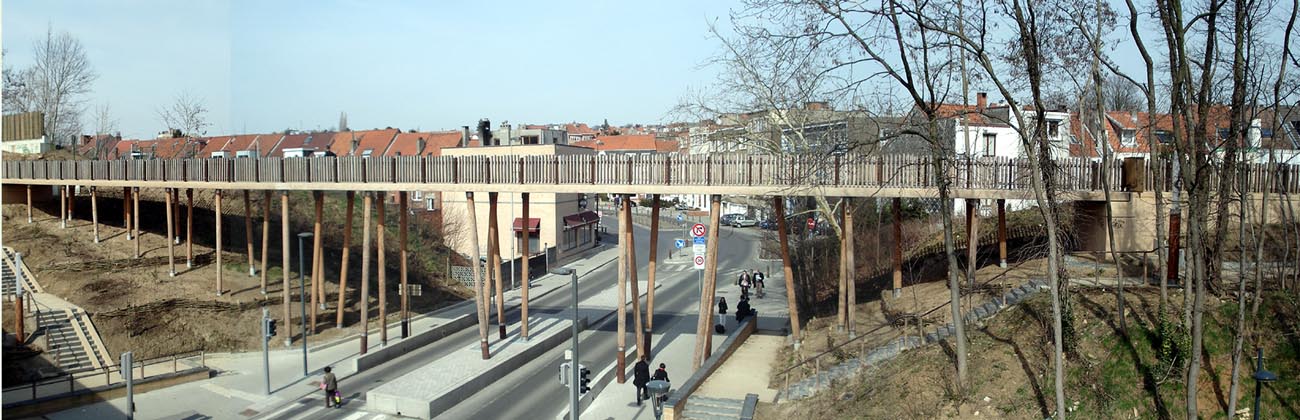
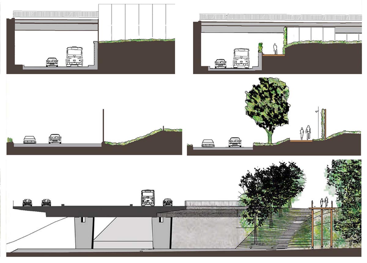
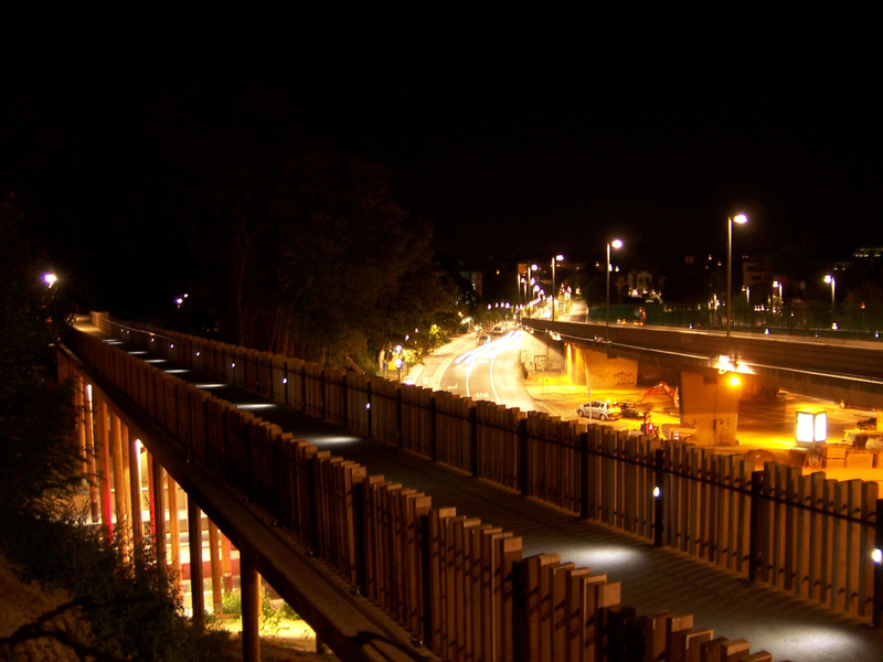
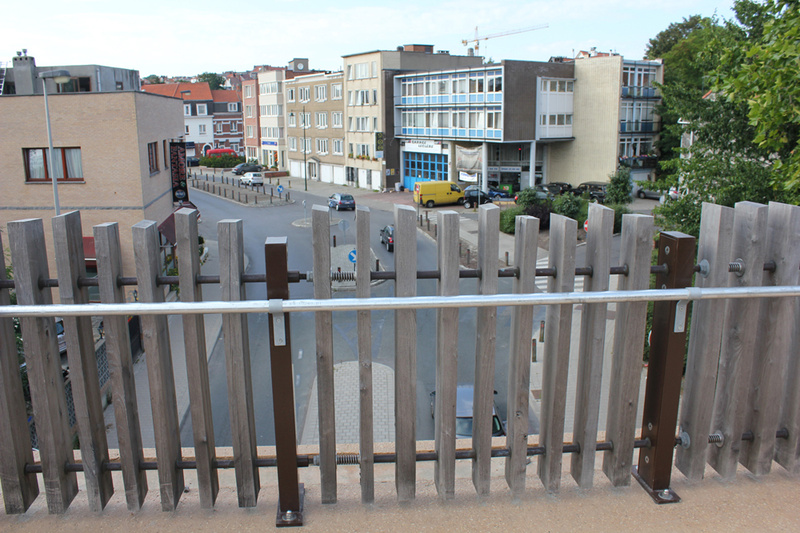
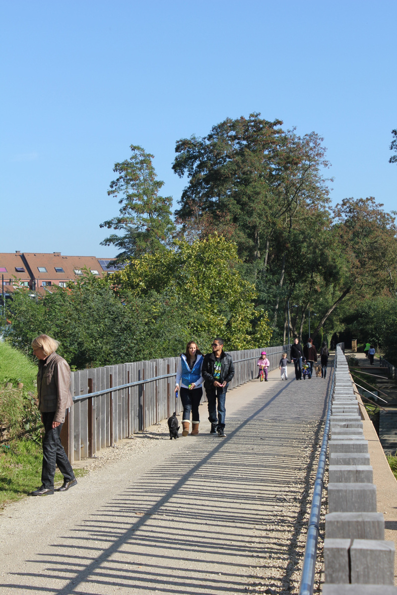
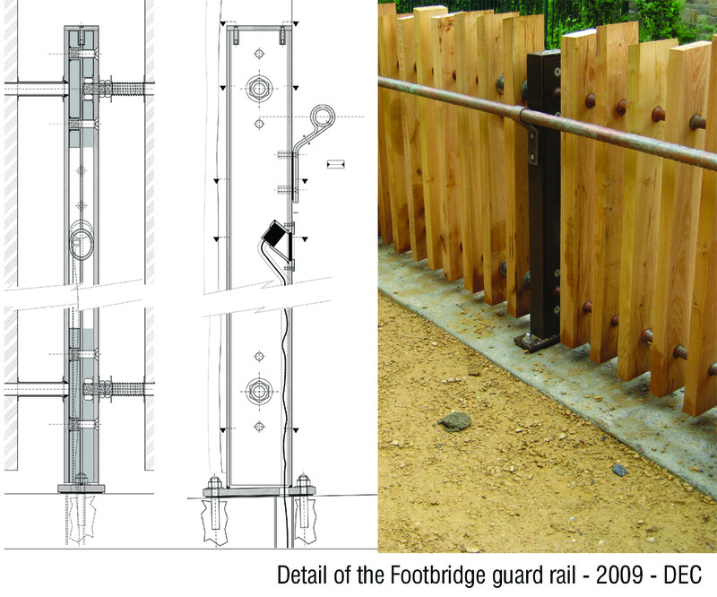
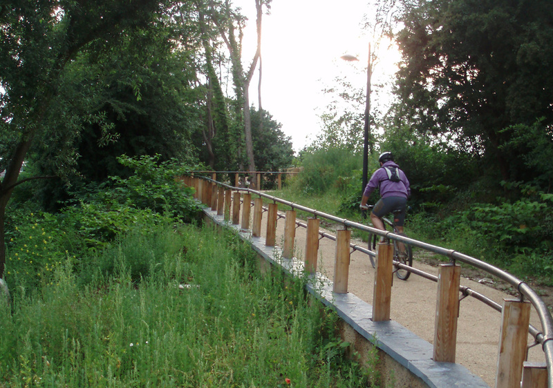
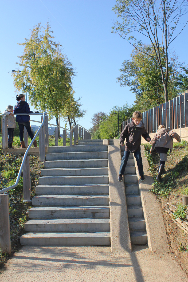
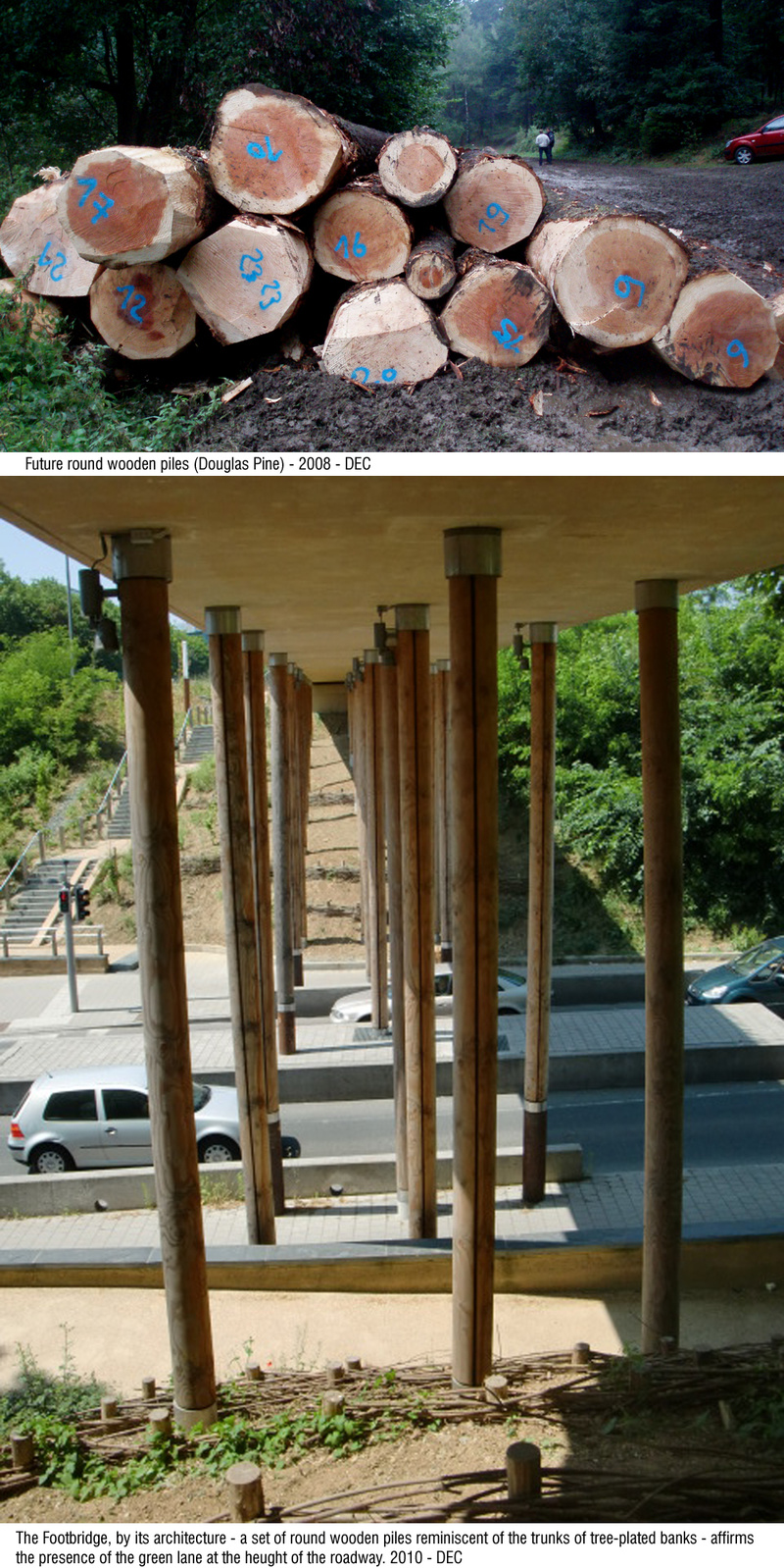
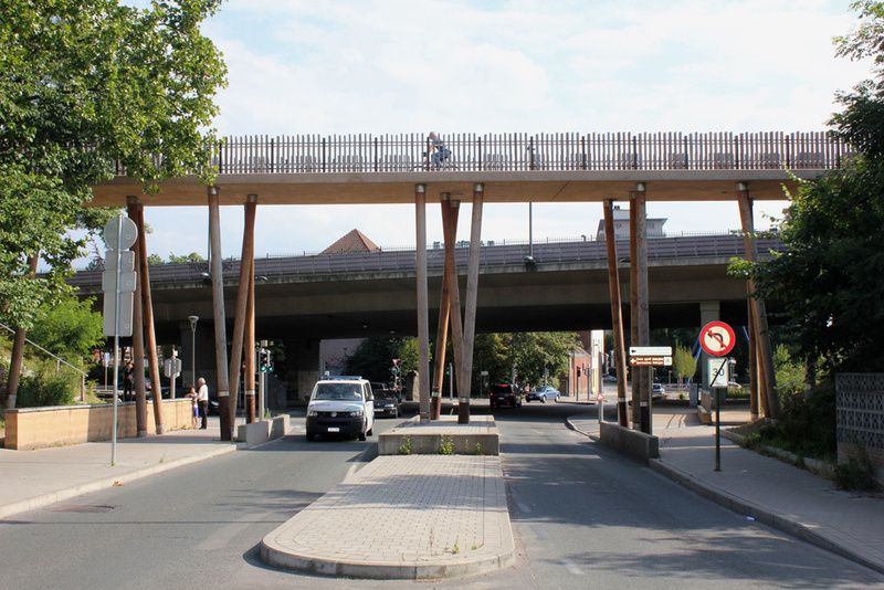
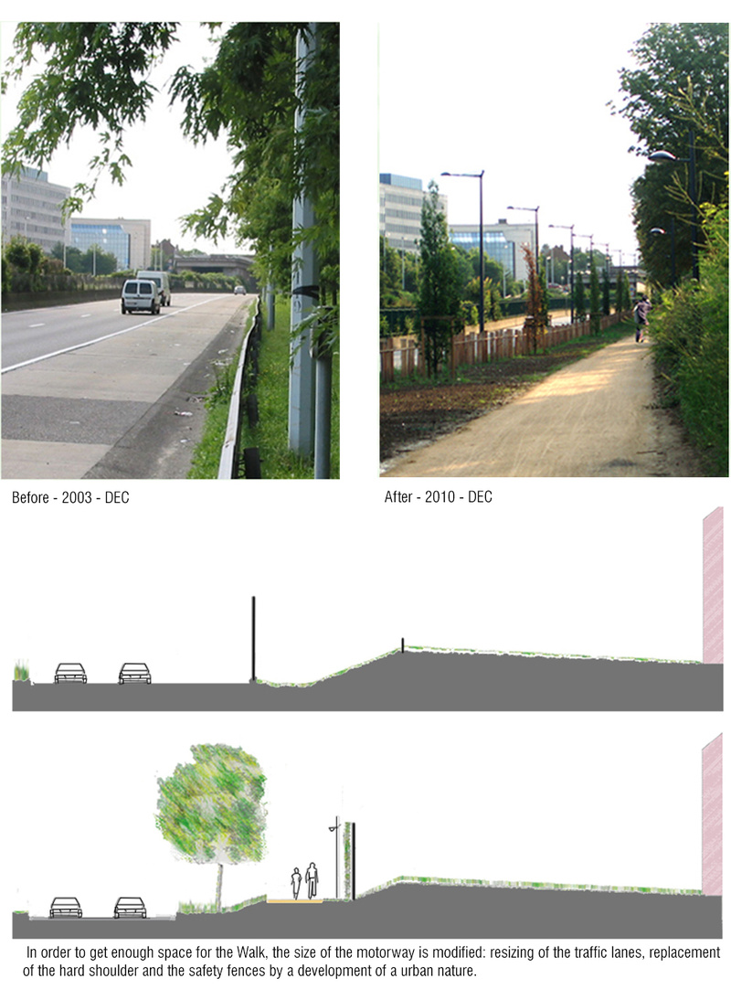
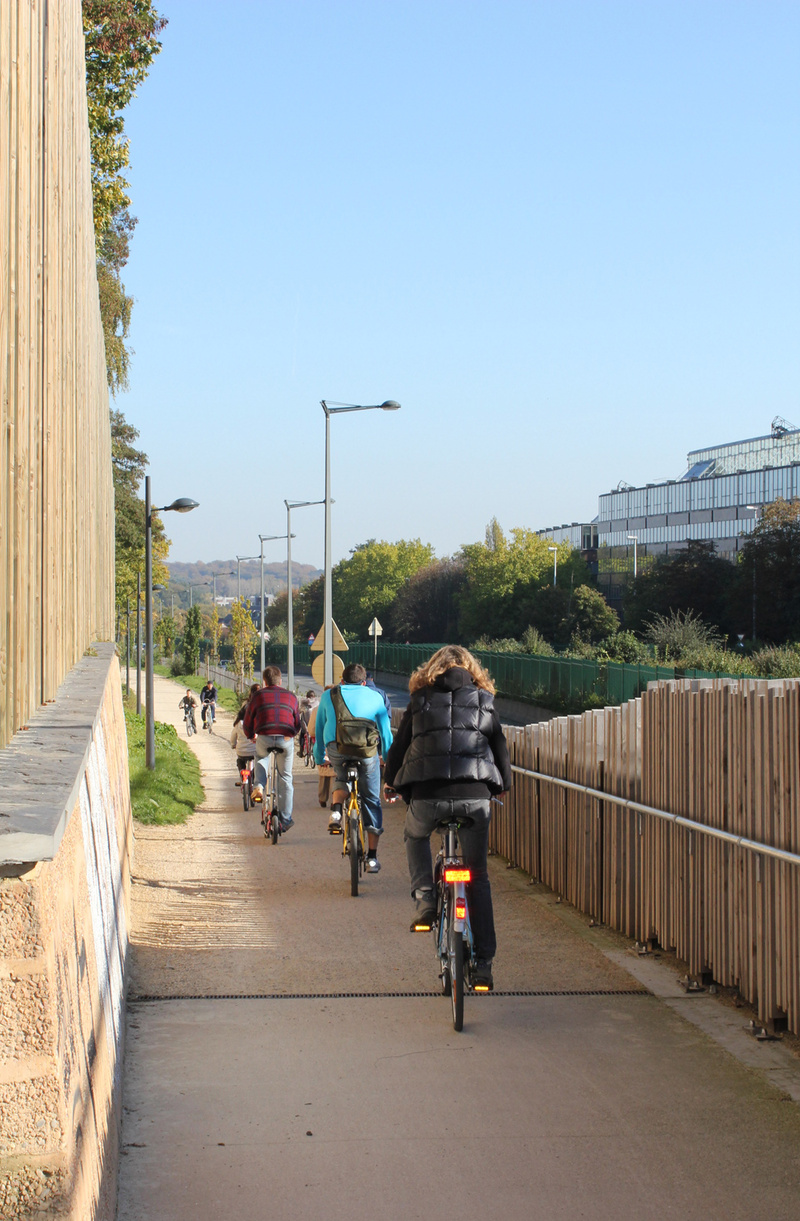
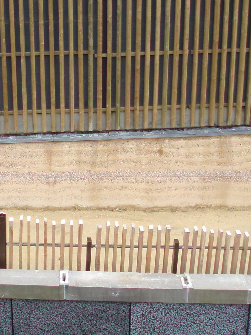
In order to extend the existing path, a new footbridge constructed at a tangent to the viaduct now crosses above Boulevard des Invalides, which is eight metres below Avenue Herrmann-Debroux. The concrete slab of this bridge is sixty metres long and it is flanked by railings consisting of vertical wooden slats. Slender, cylindrical columns, also in wood and slightly angled to resemble tree trunks support the structure. Two high plant-covered embankments, equipped with ramps and steps, connect the lower boulevard with both ends of the footbridge.Starting from the western end, a new dirt track runs parallel to Avenue Herrmann-Debroux. In order to make way for it, the width of the avenue had to be reduced and the traffic lanes were therefore scaled down to smaller dimensions. The path is more than half a kilometre long and it is lined by wooden slats like those of the footbridge although here they have been added to provide acoustic protection for the gardens of houses behind it. Once past the Beaulieu station, with which it is connected by means of an overpass, the path climbs up beside Avenue Beaulieu where, some three hundred metres higher up, it reaches the Delta underground station.
Assessment
An extension of almost a kilometre and a half has made it possible to connect the pre-existing path with two underground stations, and to bring it into the town of Auderghem. Local residents now have better access to the Promenade Verte and, with that, another way of relating with the Brussels metropolitan area.In fact, like nineteenth-century parks, green routes such as this one not only offer an alternative to built-up zones where people can go to enjoy nature and leisure activities but, in particular and often thanks to old railway lines, they also have the outstanding quality of breaking through the different types of large-scale infrastructure by means of which the automobile gained a stranglehold on the peripheral rings of cities during the twentieth century. The paths they open up are of exceptional, yet also routine, value since they offer to pedestrians and cyclists who go to work, school or elsewhere on a daily basis the alternative of a more agreeable, healthier and more sustainable ─in a word, more civilised─ form of mobility.
David Bravo Bordas, architect
[Last update: 02/05/2018]