Previous state
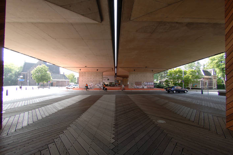
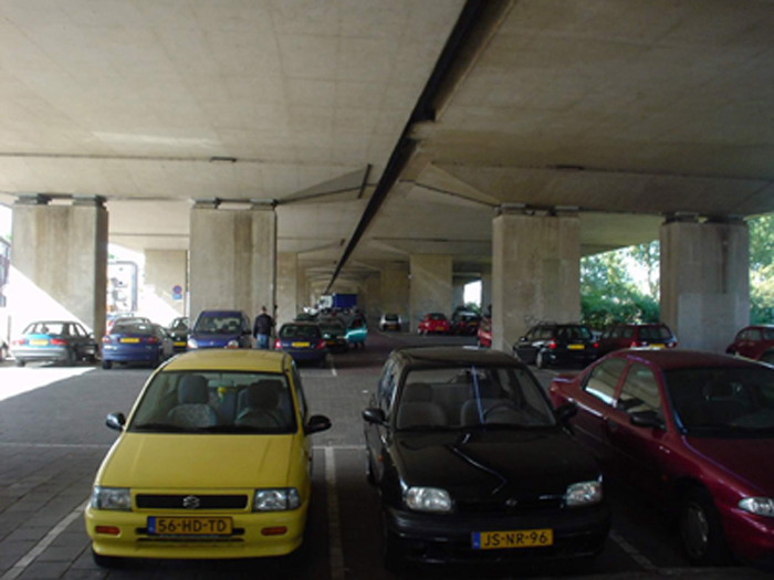
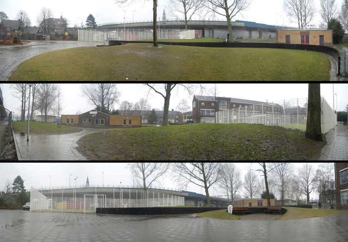
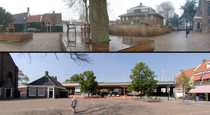
Koog aan de Zaan, eleven kilometres north-west of Amsterdam, is a small city on the banks of the River Zaan. In the 1970s, as part of a rough territorial organisation of the region, the river banks were densely built up and the city, was assimilated into the new municipality of Zaanstadt with six other urban nuclei.At the same time the A8 was built, which passes through the city centre on stark seven-metre high pillars just after crossing the river. In an ironic application of the modern separation between state and church, this dramatic slashing of the urban fabric passed over the High Street leaving the church on the south side and the town hall on the north side. For over thirty years, beneath the slab of the monumental infrastructure there remained a strip about forty metres wide and four hundred long at the mercy of badly parked cars and partially occupied by a small shooting range.
Aim of the intervention
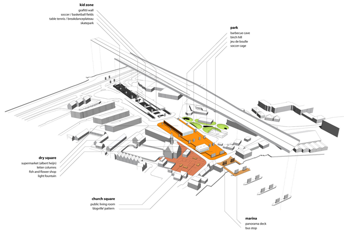
In 2003, Zaanstadt City Council decided to carry out a town planning intervention to restore the connection between the two sides of the city and enliven the strip covered by the motorway, returning to it the condition of public space for the community. In a highly participatory process, a document entitled A8ernA was drafted, containing the citizens' demands and establishing a programme of uses that had to include a connection with the River Zaan, a park, an exhibition space understood as a 'graffiti gallery', a car park for 120 vehicles, a supermarket and a flower and pet shop. The conservation of the small shooting range was also required.The project proposed is based on an optimistic attitude which views the monumental presence of the infrastructure as an opportunity rather than an obstacle. The opportunity lies in the fact that, owing to its morphology and its central location close to the river, the slab of the motorway can be understood as a large civic arcade perfectly capable of housing all the citizens' programmatic requirements and even extending them.
Description
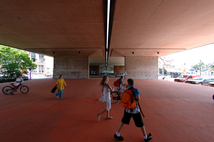
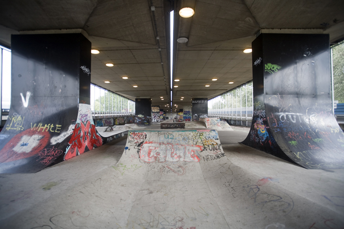
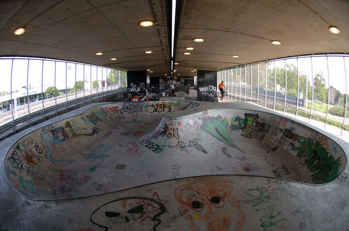
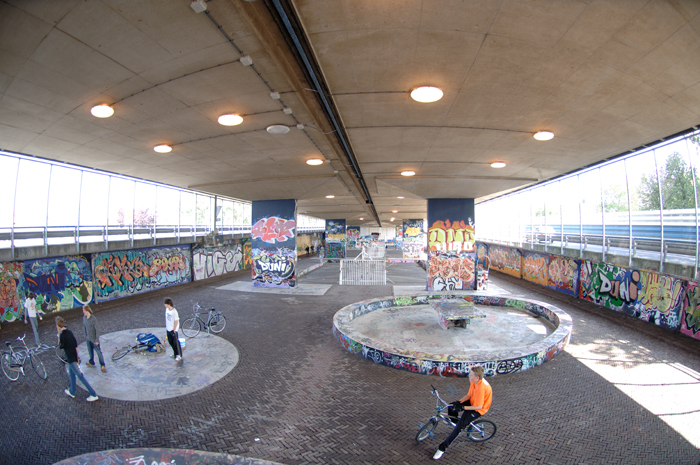
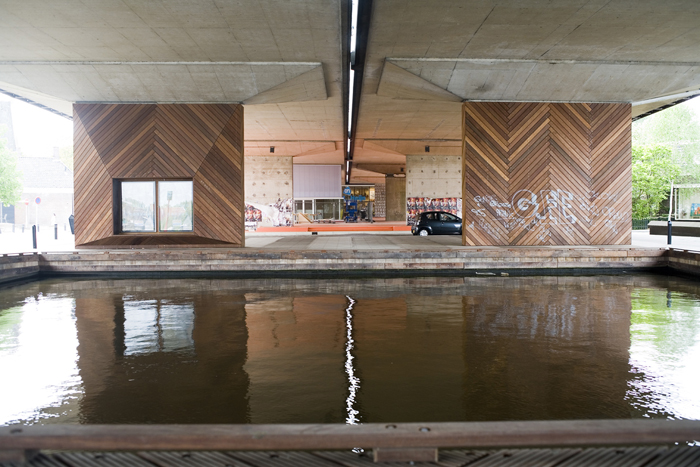
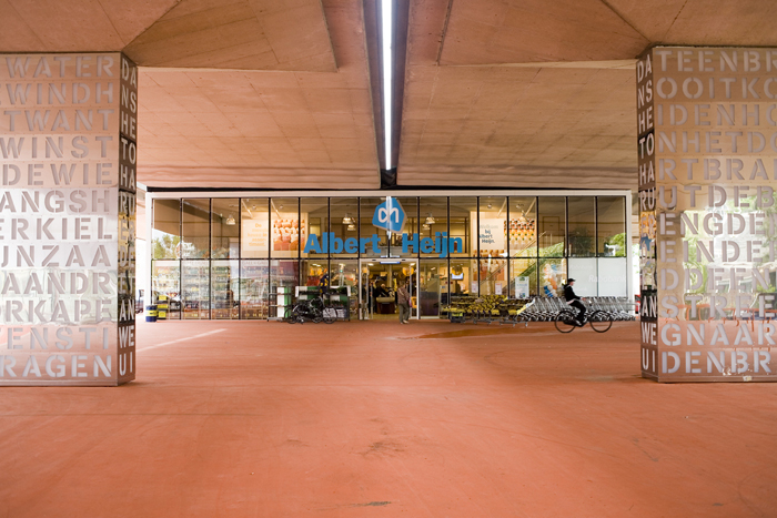
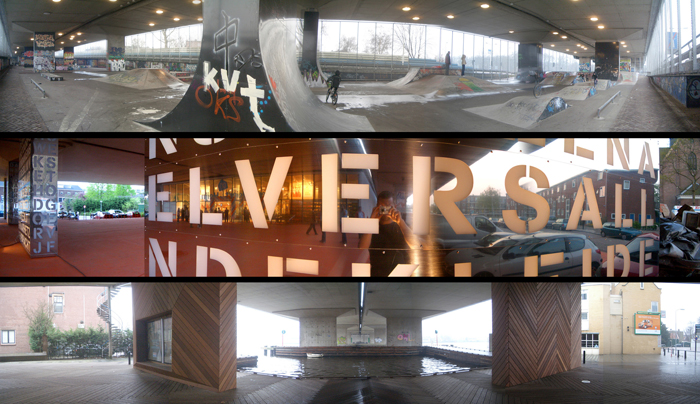
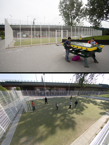
Two intercrossing streets divide the large arcade into three differentiated zones. In the central one is a covered square where we find the supermarket, the flower and pet shops, some letter boxes and a luminous fountain. At the eastern end, crossing the High Street, there is a 'sculptural' bus stop and a small harbour with a panoramic platform. The harbour brings the water as far as the High Street and fills the ceiling of the new public space with light reflections when it is sunny. The panoramic platform provides the citizens with an exceptional window over the River Zaan which, given the high density of industrial buildings on the banks, had until now been left out of the public domain. At the western end there is a children’s and teenagers’ playground consisting of a ‘graffiti gallery’, a skateboarding park, a break dance stage, some football and ping-pong tables, a seven-a-side football pitch, a basketball court and the ‘lovers’ benches’. The skateboarding park consists of a series of large semi-spherical concavities built with a sophisticated technique using blocks of polystyrene cut to measure with a computer-controlled saw and coated with concrete.There was also work done outside the space covered by the motorway, at the height of the covered square, on both the town hall and the church sides. It generated a succession of public spaces following an axis perpendicular to the motorway and parallel to the High Street. In front of the church, it was decided to free the square of the existing greenery to make the space flexible for housing open air fairs and celebrations. On the paving of the refurbished square, with a change in the colour of the blocks, the urban fabric that preceded the building of the motorway is redrawn. From time to time pieces of wood set into the paving point to the position of the living rooms of old demolished houses. On the town hall side there is a new park with topographical features that adds a little green to the intervention. The park includes a bowling ground, a small grassy hill planted with birch trees, a space for barbecues and a football pitch surrounded by a metal fence. The shooting range has been kept beneath the motorway exit ramp.
Assessment
The outstanding merit of this intervention–both the commission and the resolution–lies in the treatment of a great paradox. With no modification to its morphology, the motorway, which before was an impenetrable town planning barrier, has now become a large threshold which reunites the city in two senses: first by bringing its three parts back in touch: the south, the north and the River Zaan; second by bringing the citizens together under a single roof which covers the host of uses they demanded and proposed.In this sense A8ernA is an occupation rather than a work or a construction, to be understood as a reinterpretation of the way to inhabit a pre-existing space. With an attitude which is unusual in interventions on the public space, the solution proposes a new content instead of a new container. As if it were a matter of furnishing an unfriendly house to make it into a home, the pieces are juxtaposed in an amalgam of heterogeneous objects. This deliberately eclectic and fragmentary arrangement counteracts the unitarian character of the monumental presence of the porticoed slab.
David Bravo Bordas, architect
[Last update: 02/05/2018]