
Previous state
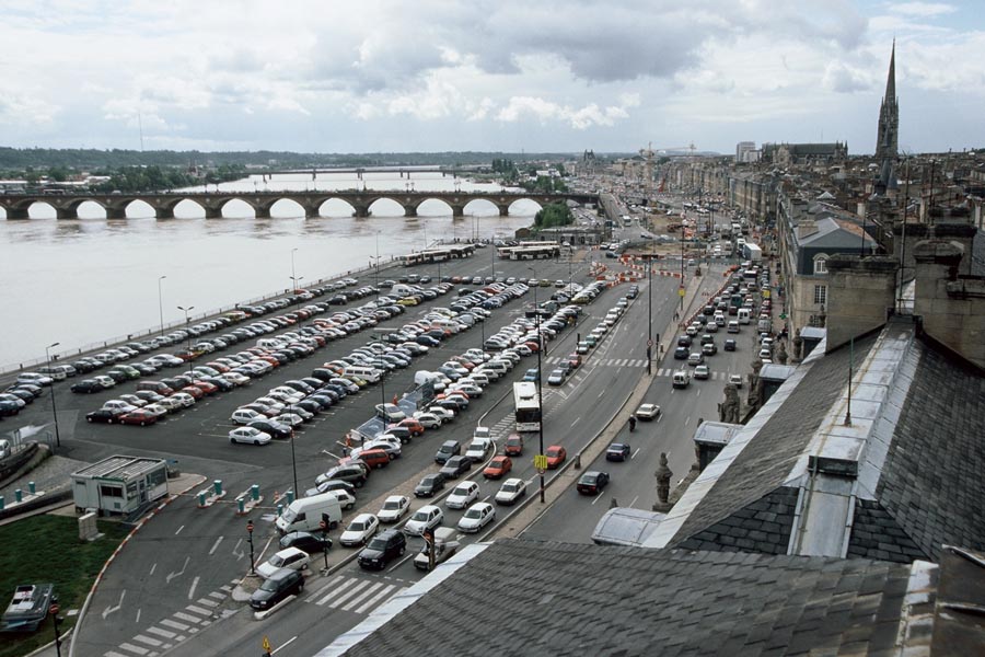
The pronounced bend in the Garonne River as it flows through the centre of Bordeaux explains why the old port neighbourhood, which was inscribed on the UNESCO World Heritage List in 2007, is popularly known as Port de la Lune (Port of the Moon). The city fathers, seeing the river as a natural defence and reserving the right bank as natural spaces and farmland, built the greater part of Bordeaux on the left bank which, from the sixteenth through to the end of the twentieth century was a key focus of commercial activity. The eighteenth century has bequeathed, as witness to this apogee of the port’s importance, a richly endowed waterfront composed of majestic neoclassical limestone buildings and the highly emblematic public space of the Place de la Bourse (Stock Exchange Square), which was inaugurated in 1749 and given the function of representing the city’s prosperity to the numerous travellers who came by river. Just over half a century later, it was to be supported in this task by the Place des Quinconces, a wide esplanade flanked by two woods consisting of trees planted in staggered lines and also opening on to the Gardonne. However, at the end of the twentieth century, the need to modernise the port installations meant that the commercial activities were moved downstream, towards Bassens and Verdon-sur-Mer. Accordingly, in a considerable area of the Port de la Lune docks, there was not much left but open-air car parks and abandoned industrial sites.
Aim of the intervention
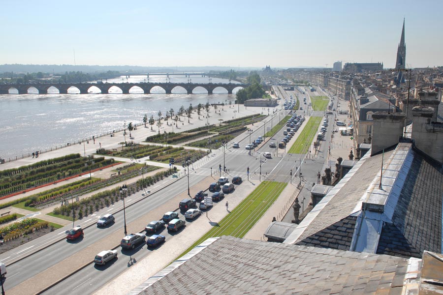
City planners then began to reflect on what kind of relationship Bordeaux should have with the river. Ambitious projects appeared with a view to the repossession of its banks for the citizens, for example with the construction of new bridges to complement the three existing ones or creating a network of tramlines to run along the riverfront. This public transport infrastructure, which began to operate in 2005, came hand in hand with a policy giving priority to pedestrian mobility over vehicular traffic in the city’s historic centre, a policy that entailed the construction of new car parks on the outskirts. This made it possible to do away with the open-air car parks in the docks area which, now on the tram route, was calling out for refurbishment and being opened up to everyone. After an international competition calling for entries in 1998, the subsequent remodelling required seven years of work, the restoration of almost half a million square metres and an investment by the Communauté Urbaine de Bordeaux of seventy-eight million euros.
Description
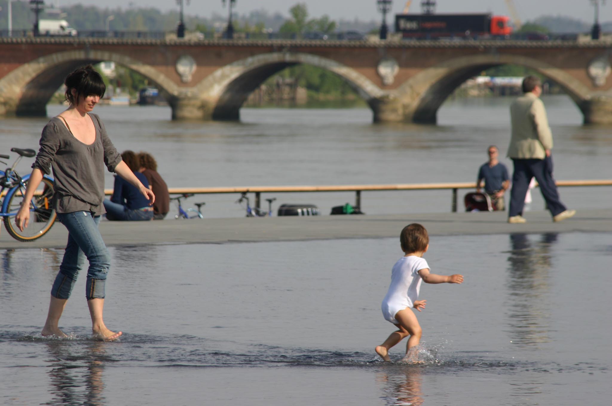
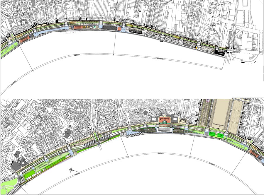
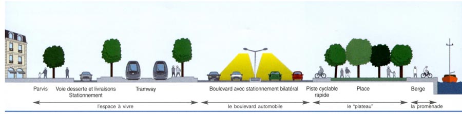
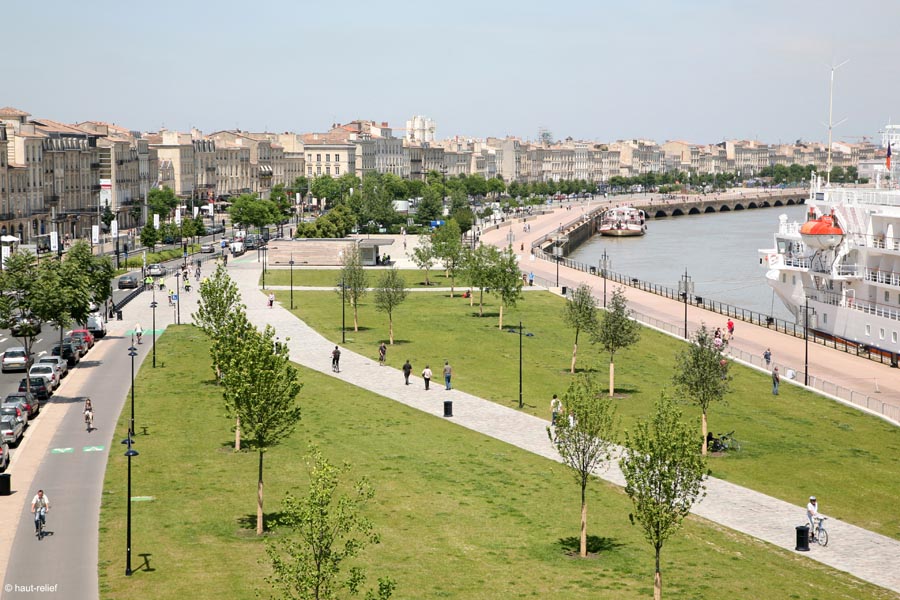
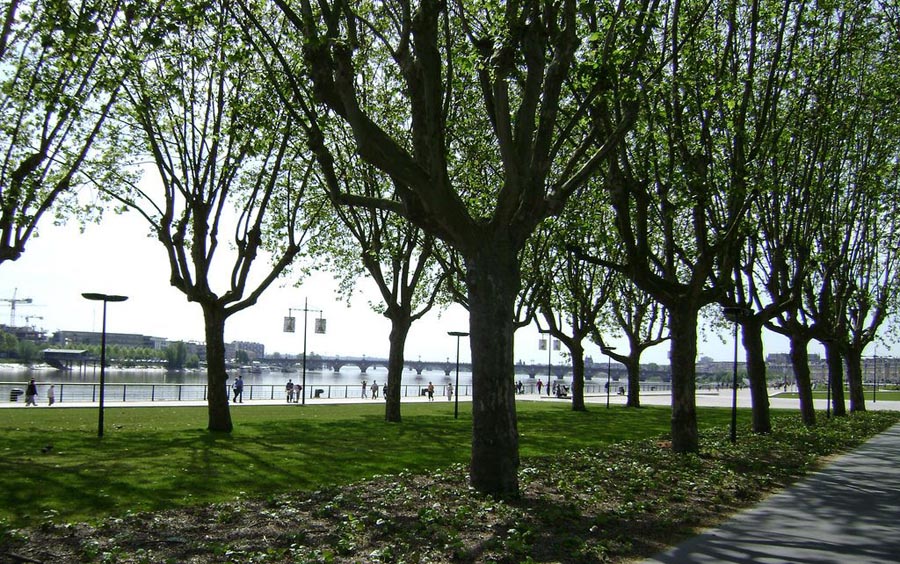
For more than four and a half kilometres along the riverfront on the strip of some eighty metres in width that separates the tramway from the Garonne, the docks have been restructured on the basis of a varied series of simple spaces including esplanades, fields and gardens offering versatile place for many different activities. In the longitudinal sense, they are divided into equitably shared and functional routes offering different options of mobility for pedestrians, cyclists, private vehicles, public transport and merchandise deliveries. There are also green strips entering the space from the Saint Michel Park at the southern edge of the Port de la Lune, spreading along the left bank with more or less intensity according to the nature of the spaces they traverse.
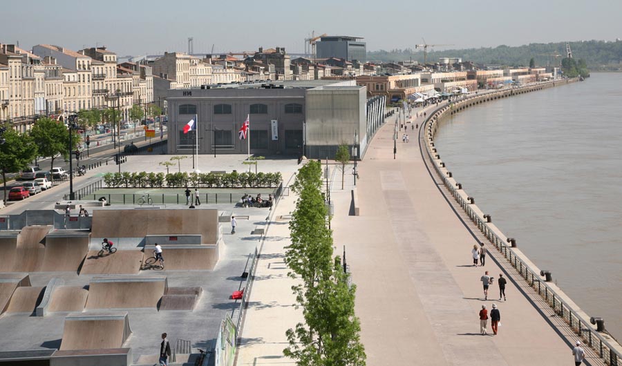
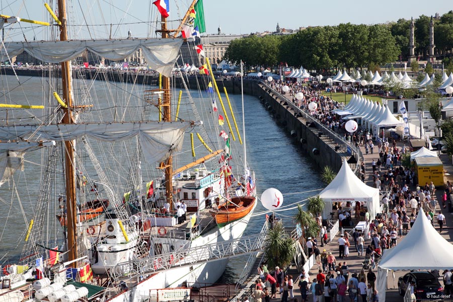
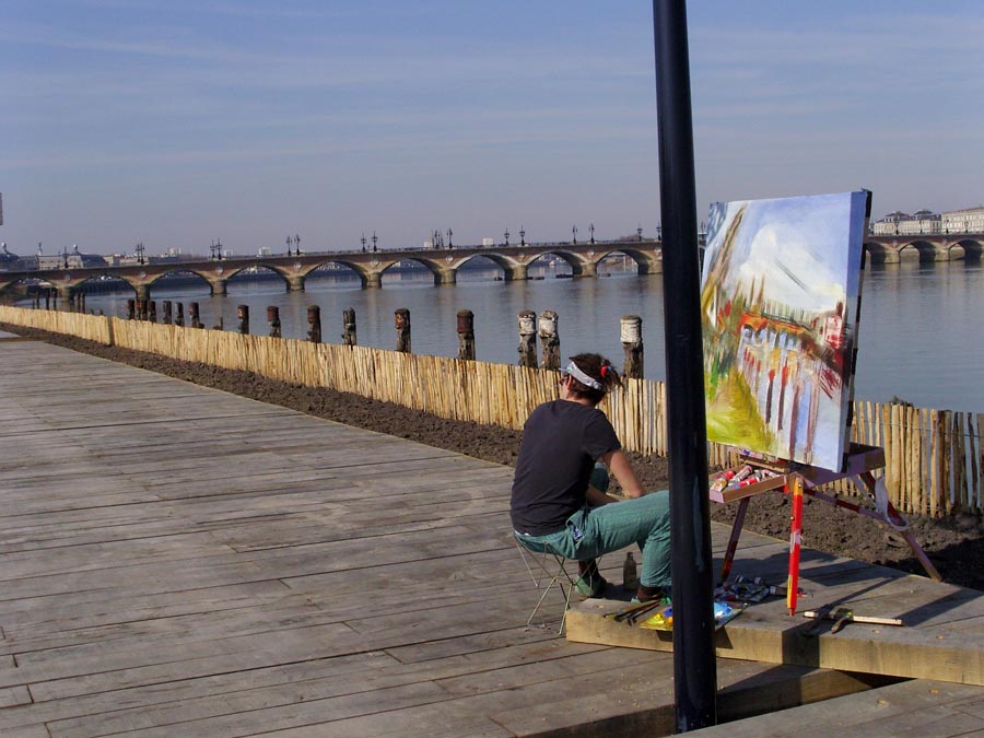
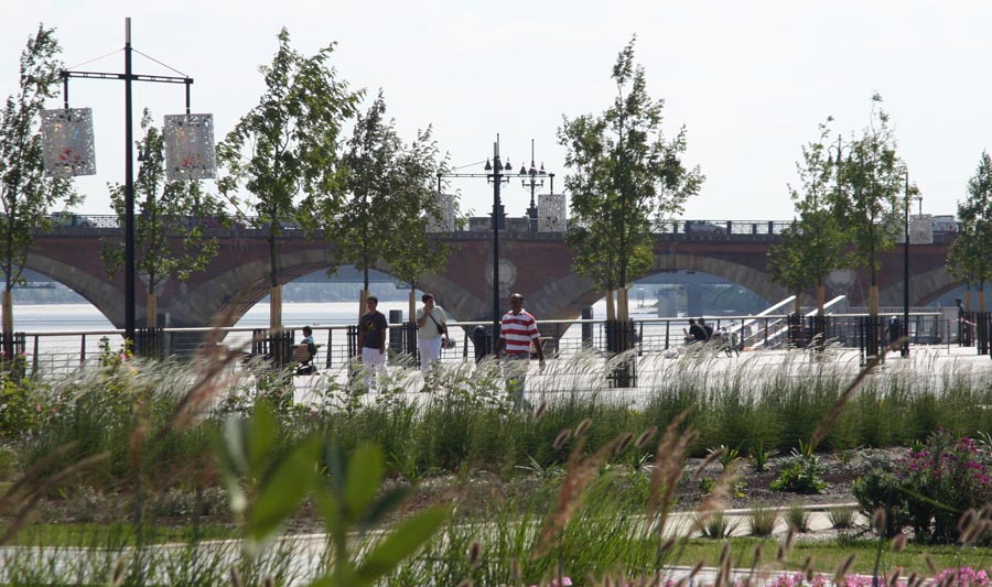
Starting from this park, the Sainte-Croix, La Monnaie, Grave and Salinières wharfs constitute the section of the intervention where the green strip is at its densest and where the space is oriented to the river rather than the city so as to embrace activities related with its waters, such as sailing, mooring for the boats, baths and swimming pools. Further downstream from the Pierre Bridge and after the Richelieu wharf, the intervention is progressively more urban in tone and the vegetation is less dense permitting a closer relationship between watercourse and city. Here, the space must provide for more multitudinous and intensive use, for example temporary markets, cultural events and sporting competitions.
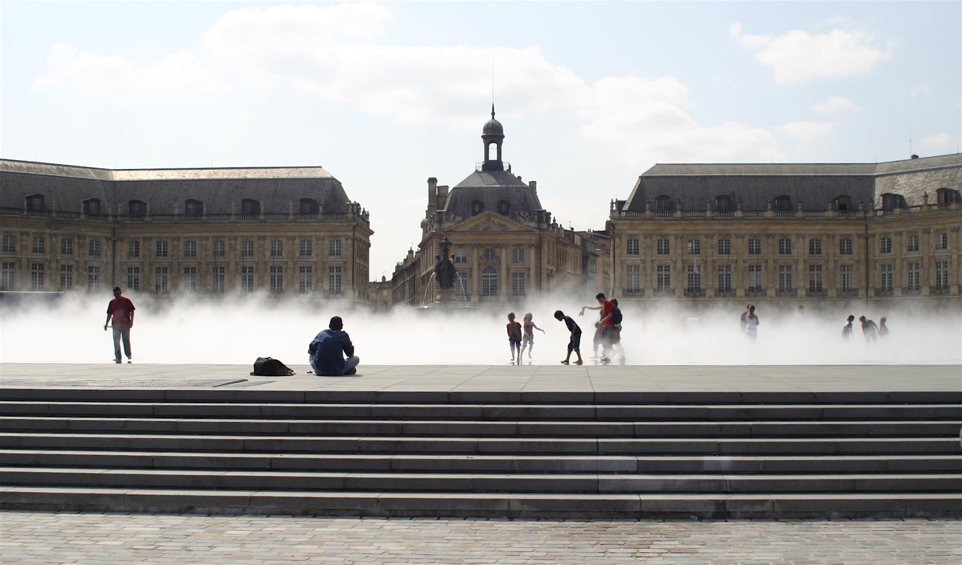
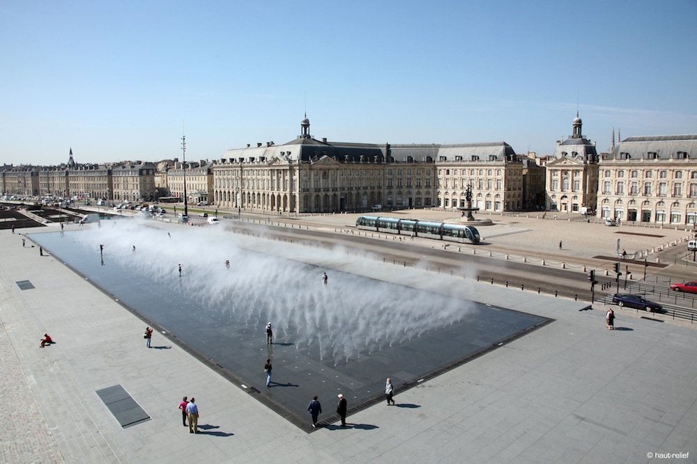
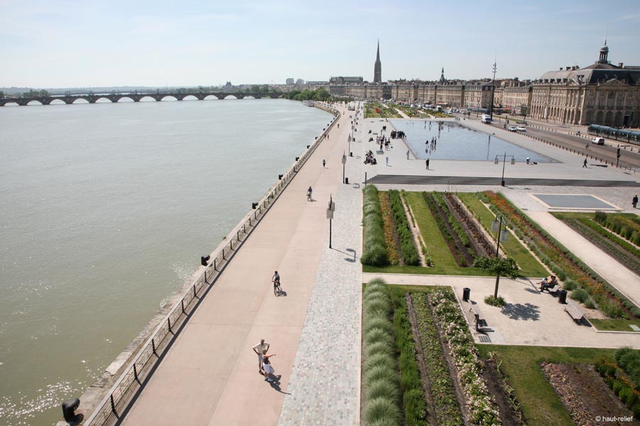
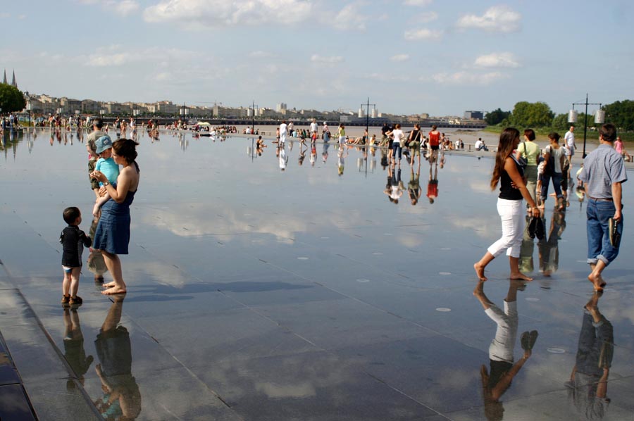
At the La Douane wharf there is a large paved rectangular esplanade which allows a clear opening up of the Place de la Bourse to the river. This has been named the Water Mirror since it is equipped with a series of spouts that cover it with a sheet of water reflecting the sky and the impressive neoclassical façade of the square. Eventually, the esplanade loses this cover of water to reveal its “cale bordelaise” paving, which Bordeaux has traditionally used in its urbanisation, to accommodate crowd-pulling events. Before reaching the river’s edge, the esplanade drops down in a stairway that invites one to sit and contemplate its waters. At the foot of the stairs are a pedestrian thoroughfare and a bicycle track finished with a layer of ochre-dyed concrete that harmoniously matches the limestone of the neoclassical facades.
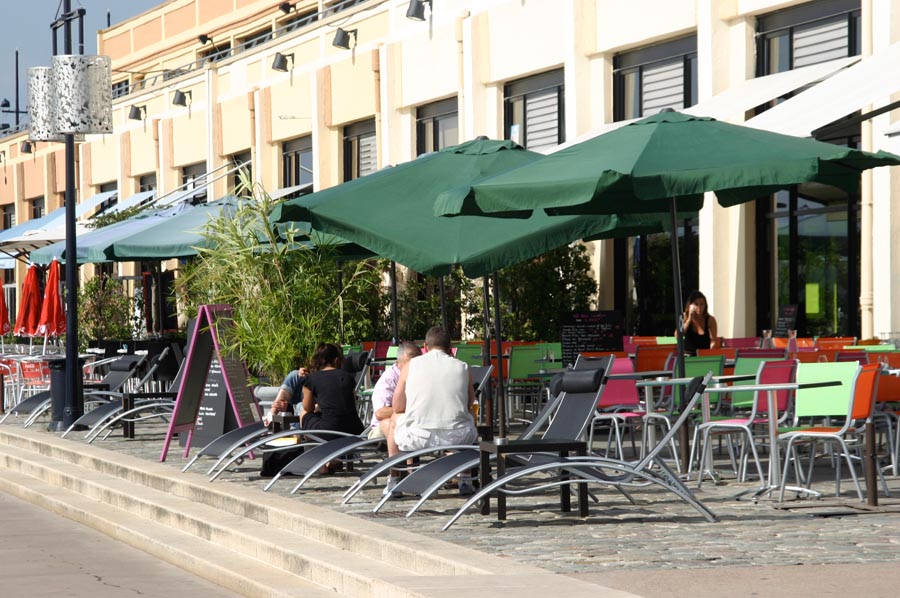
On either side of the esplanade are two sets of rectangular garden plots that have been named Gardens of Light, these being planted with low vegetation that does not interfere with the view of the urban façade. At street level the commercial spaces have taken on new life and activity with the widening of the pavement and new layout of terrace bars, parking and delivery zones. Almost half a kilometre downstream, the transformation of the Louis XVIII wharf into a large field called Prairie des Girondins permits the extension of the great esplanade of the Place des Quinconces right down to the river. Still further downstream, at the Chartrons wharf, the old wine merchant’s storehouses have been rehabilitated to be used for a range of activities that revitalise the river.
Assessment
Preceded by two judiciously conceived operations of enormous scope, moving an industrial zone and installing a public transport network, the recovery of the left bank of the Garonne could then only aim at making the most of a riverfront and its abundance of high-quality elements. The intervention has sidestepped the danger of adopting overly specific, excessively designed or picturesque solutions that might have detracted from the majesty of such urban features as the city’s urban façade, the Place de la Bourse or the Place des Quincones. Far from this, the project has managed to deploy a whole repertoire of simple, abstract elements of landscaping that have established a respectful dialogue with the pre-existing features of the area, bringing them into relation with the river. At the same time it has bestowed on them the versatility required for the citizens of Bordeaux to be able to use the different spaces in a wide variety of ways.
David Bravo Bordas, architect
[Last update: 26/05/2023]